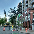
Cycling infrastructure in the Canadian city of Halifax, Nova Scotia includes most regular streets and roads, bike lanes, protected cycle tracks, local street bikeways, and multi-use pathways.
In recent years, the municipal government has been developing an "all ages and abilities bikeway network" (commonly called the "AAA network") in the urban core with the aim of increasing the proportion of trips that are made by bicycle.
Early bike lanes in Halifax include those on Bell Road, Brunswick Street, and South Park Street. The 1999 addition of a third lane to the Angus L. Macdonald Bridge also included the construction of a dedicated bikeway crossing Halifax Harbour. [1]
The city's first bicycle plan, Blueprint for a Bicycle Friendly HRM, was approved by council in 2002. It was superseded in 2006 by the Active Transportation Plan, which was updated in 2014 (see below). [2]
In 2014, the Halifax council approved the Making Connections: 2014-19 Halifax Active Transportation Priorities Plan. The plan was developed with extensive public participation. Among respondents, the most popular concept mentioned was the construction of a bicycle network in the regional centre (defined as the Halifax peninsula and the area of Dartmouth within the Circumferential Highway). The plan identified several goals including developing a connected bicycle network, doubling the modal share of bicycles by 2026, and improving bicycle infrastructure by introducing new types of facilities such as protected bike lanes. [2]
A 2016 survey found significant interest among Halifax residents in cycling more often, but respondents wished for greater separation from motor traffic. The city aims to capture this "latent demand" by improving cycling infrastructure and increasing the share of trips made by bicycle. [3]
Overall transportation improvements in Halifax are guided by the Integrated Mobility Plan (IMP), which was approved by council in December 2017. As part of the IMP, the city is currently building an "all ages and abilities bikeway network" in the regional centre, commonly called the "AAA network". [3] "All ages and ability" bicycle infrastructure is defined as facilities that are "comfortable for a wide range of cycling abilities and experience levels". Guidance on the design of this type of infrastructure is provided by organisations such as the National Association of City Transportation Officials (NACTO) and the Transportation Association of Canada (TAC). [3]
The AAA network comprises around 57 kilometres (35 mi) of routes intended to form a comprehensive cycling network in the regional centre. [4] About 10 kilometres (6.2 mi) of the routes already met "AAA" standard, such as the Macdonald Bridge bikeway. [3] In addition to new cycling infrastructure, the project will include the upgrading of some existing routes. For example, conventional bike lanes on Hollis, Lower Water, and South Park streets are being upgraded to protected bikeways.
In July 2019, the project received $25 million in funding from all three levels of government. It was expected to be completed by 2022. [5] However, as of 2022 it was only around 40 per cent complete. [6]
Bike lanes are painted lanes designated for use by cyclists. In Halifax, these typically do not offer physical protection to cyclists. They are not considered "all ages and abilities" bicycle infrastructure.
Cyclist advocates have criticized the fact that conventional Halifax bike lanes tend to end before reaching intersections. [7]
The first protected bike lane in Halifax opened as a pilot project on Rainnie Drive in 2015, as part of the redesign of the intersection at North Park Street and Cogswell Street. At that time, most of Rainnie Drive was converted to serve one-way car traffic only. The two-way bikeway is separated from the carriageway by a painted buffer and plastic bollards. [8]
Some existing bike lanes are being upgraded to become protected bikeways. The bike lanes on South Park Street between Inglis Street and Spring Garden Road were upgraded in 2019, with plans made to extend the bikeways to Sackville Street in 2020. [7] In 2020, the bike lanes on Hollis Street and Lower Water Street were similarly being upgraded.
Local street bikeways were introduced as part of the AAA bikeway network. These are quieter, local streets considered strategic links in the cycling network. In designating a local street bikeway, various design and regulatory changes are made to improve safety and comfort for cyclists. These include: [9]
The region's first local street bikeway was constructed on Vernon and Seymour streets, connecting the Quinpool District to Dalhousie University, and linking planned segregated cycling facilities on Windsor Street and University Avenue. Various streetscape changes were made, including the addition of traffic calming measures, curb extensions at intersections, and a bicycle lane at the Quinpool Road intersection. New pedestrian/bicyclist-actuated traffic signals were also installed at the Vernon-Seymour-Coburg intersection. [10] The first phase of this bikeway opened in 2019. [11]
Multi-use pathways are routes shared by cyclists and pedestrians, separated from car traffic.
Halifax has several non-profit organisations that promote cycling in the city, including the Halifax Cycling Coalition, Bike Again (a DIY bike shop), and the Ecology Action Centre. [12] [13]
Critical Mass events have been held regularly for many years. One such ride, held to highlight the need for safety improvements after a cyclist was struck by a motorist and seriously injured on Purcells Cove Road, attracted several hundred cyclists in July 2022. [14] Kidical Mass rides are also held regularly to promote safe and independent mobility for children. [15]
The city also has a "Bicycle Mayor", an unofficial advocate for cycling culture. The international bicycle mayor network is coordinated by BYCS, an Amsterdam-based social organisation. Halifax's first bicycle mayor, Jillian Banfield, served from 2019 to 2023. [16] [17] The incumbent bicycle mayor is Stephen MacKay, who took over the position in May 2023. [18]
A bike path or a cycle path is a bikeway separated from motorized traffic and dedicated to cycling or shared with pedestrians or other non-motorized users. In the US a bike path sometimes encompasses shared use paths, "multi-use path", or "Class III bikeway" is a paved path that has been designated for use by cyclists outside the right of way of a public road. It may or may not have a center divider or stripe to prevent head-on collisions. In the UK, a shared-use footway or multi-use path is for use by both cyclists and pedestrians.
Bike lanes (US) or cycle lanes (UK) are types of bikeways (cycleways) with lanes on the roadway for cyclists only. In the United Kingdom, an on-road cycle-lane can be firmly restricted to cycles or advisory. In the United States, a designated bicycle lane or class II bikeway (Caltrans) is always marked by a solid white stripe on the pavement and is for 'preferential use' by bicyclists. There is also a class III bicycle route, which has roadside signs suggesting a route for cyclists, and urging sharing the road. A class IV separated bike way (Caltrans) is a bike lane that is physically separate from motor traffic and restricted to bicyclists only.
John Forester was an English-American industrial engineer, specializing in bicycle transportation engineering. A cycling activist, he was known as "the father of vehicular cycling", for creating the Effective Cycling program of bicycle training along with its associated book of the same title, and for coining the phrase "the vehicular cycling principle" – "Cyclists fare best when they act and are treated as drivers of vehicles". His published works also included Bicycle Transportation: A Handbook for Cycling Transportation Engineers.
Vehicular cycling is the practice of riding bicycles on roads in a manner that is in accordance with the principles for driving in traffic, and in a way that places responsibility for safety on the individual.
Bicycle transportation planning and engineering are the disciplines related to transportation engineering and transportation planning concerning bicycles as a mode of transport and the concomitant study, design and implementation of cycling infrastructure. It includes the study and design of dedicated transport facilities for cyclists as well as mixed-mode environments and how both of these examples can be made to work safely. In jurisdictions such as the United States it is often practiced in conjunction with planning for pedestrians as a part of active transportation planning.
A bicycle boulevard, sometimes referred to as a neighborhood greenway, neighborway, neighborhood bikeway or neighborhood byway is a type of bikeway composed of a low-speed street which has been "optimized" for bicycle traffic. Bicycle boulevards discourage cut-through motor-vehicle traffic but allow local motor-vehicle traffic. They are designed to give priority to bicyclists as through-going traffic. They are intended as a low-cost, politically popular way to create a connected network of streets with good bicyclist comfort and/or safety.
A cycle track or cycleway (British) or bikeway, sometimes historically referred to as a sidepath, is a separate route for cycles and not motor vehicles. In some cases cycle tracks are also used by other users such as pedestrians and horse riders. A cycle track can be next to a normal road, and can either be a shared route with pedestrians or be made distinct from both the pavement and general roadway by vertical barriers or elevation differences.
Halifax Regional Municipality has a multi-modal transportation network.
Cycling in New York City is associated with mixed cycling conditions that include dense urban proximities, relatively flat terrain, congested roadways with stop-and-go traffic, and streets with heavy pedestrian activity. The city's large cycling population includes utility cyclists, such as delivery and messenger services; cycling clubs for recreational cyclists; and increasingly commuters. Cycling is increasingly popular in New York City; in 2018 there were approximately 510,000 daily bike trips, compared with 170,000 daily bike trips in 2005.
Toronto, Ontario, like many North American cities, has slowly been expanding its purpose-built cycling infrastructure. The number of cyclists in Toronto has been increasing progressively, particularly in the city's downtown core. As cycling conditions improve, a cycling culture has grown and alternatives such as automobiles are seen as less attractive. The politics of providing resources for cyclists, particularly dedicated bike lanes, has been contentious, particularly since the 2010s.
Cycling in Copenhagen is – as with most cycling in Denmark – an important mode of transportation and a dominating feature of the cityscape, often noticed by visitors. The city offers a variety of favourable cycling conditions — dense urban proximities, short distances and flat terrain — along with an extensive and well-designed system of cycle tracks. This has earned it a reputation as one of the most bicycle-friendly cities in the world. Every day 1.2 million kilometres are cycled in Copenhagen, with 62% of all citizens commuting to work, school, or university by bicycle; in fact, almost as many people commute by bicycle in greater Copenhagen as do those cycle to work in the entire United States. Cycling is generally perceived as a healthier, more environmentally friendly, cheaper, and often quicker way to get around town than by using an automobile.
Cycling in Canada is experienced in various ways across a geographically huge, economically and socially diverse country. Among the reasons for cycling in Canada are for practical reasons such as commuting to work or school, for sports such as road racing, BMX, mountain bike racing, freestyle BMX, as well as for pure recreation. The amount and quality of bicycle infrastructure varies widely across the country as do the laws pertaining to cyclists such as bicycle helmet laws which can differ by province.
Cycling infrastructure is all infrastructure cyclists are allowed to use. Bikeways include bike paths, bike lanes, cycle tracks, rail trails and, where permitted, sidewalks. Roads used by motorists are also cycling infrastructure, except where cyclists are barred such as many freeways/motorways. It includes amenities such as bike racks for parking, shelters, service centers and specialized traffic signs and signals. The more cycling infrastructure, the more people get about by bicycle.
The history of cycling infrastructure starts from shortly after the bike boom of the 1880s when the first short stretches of dedicated bicycle infrastructure were built, through to the rise of the automobile from the mid-20th century onwards and the concomitant decline of cycling as a means of transport, to cycling's comeback from the 1970s onwards.
A protected intersection or protected junction, also known as a Dutch-style junction, is a type of at-grade road junction in which cyclists and pedestrians are separated from cars. The primary aim of junction protection is to help pedestrians and cyclists be and feel safer at road junctions.
There is debate over the safety implications of cycling infrastructure. Recent studies generally affirm that segregated cycle tracks have a better safety record between intersections than cycling on major roads in traffic. Furthermore, cycling infrastructure tends to lead to more people cycling. A higher modal share of people cycling is correlated with lower incidences of cyclist fatalities, leading to a "safety in numbers" effect though some contributors caution against this hypothesis. On the contrary, older studies tended to come to negative conclusions about mid-block cycle track safety.
Controversies have surrounded dedicated cycling routes in cities. Some critics of bikeways argue that the focus should instead be placed on educating cyclists in road safety, and others that safety is better served by using the road space for parking. There is debate over whether cycle tracks are an effective factor to encourage cycling or whether other factors are at play.
The Vancouver Greenway Network is a collection of greenways across Vancouver, British Columbia, Canada. Greenways are streets where pedestrians and cyclists are prioritized over motorized vehicles, through structures such as road closures and road diverters to prevent or limit motor vehicle traffic, widened sidewalk-promenades, narrowed road space, speed restrictions, bike lanes, raised sidewalks and speed bumps. The City of Vancouver hopes to create and maintain the trend of constructing new greenways to establish a network where, potentially, every citizen could access a city greenway within a 25-minute walking or a 10-minute cycling distance of their home.
A bicycle highway, also known as a cycling superhighway, fast cycle route or bike freeway, is an informal name for a bicycle path that is meant for long-distance traffic. There is no official definition of a bicycle highway. The characteristics of a cycle motorway mentioned by authorities and traffic experts include an absence of single-level intersections with motorized traffic, a better road surface and the absence of traffic lights. Bicycle highways are mentioned in connection with traffic jam. Owing to higher average speeds than normal cycling infrastructure, they provide an alternative to the car in commuter traffic. Often a cycle motorway follows the route of a railway or other linear infrastructure.
Cycling is a popular mode of transport and recreational sport in the Philippines.