
The Cabot Trail is a highway and scenic roadway in northern Victoria County and Inverness County on Cape Breton Island in Nova Scotia, Canada.
The Ceilidh Trail is a scenic roadway in the Canadian province of Nova Scotia.

Lake Ainslie on Cape Breton Island is the largest natural freshwater lake in Nova Scotia. The Southwest Margaree River starts at the lake and empties into the Gulf of Saint Lawrence. The lake is approximately 20 km long and averages 5 km in width.

The Margaree River is a river on Cape Breton Island in Nova Scotia. The northeast branch of the river derives from the watershed of the Cape Breton Highlands, while the Southwest Margaree flows northeast from Lake Ainslie. The two branches join at Margaree Forks. The river then flows north to empty into the Gulf of Saint Lawrence at Margaree Harbour, Nova Scotia. The river is 120 km in length and drains an area of 1,375 km². The Margaree has been well known for a century for its trout and Atlantic salmon sport fishery, that draws anglers from near and far. Fishing is highly regulated now and is restricted to fly fishing only, with barbless hooks, in the main stem of the river. Famed American angler and Atlantic salmon conservationist Lee Wulff caught his first salmon on a fly on the Margaree in 1933.
Trunk 19 is part of the Canadian province of Nova Scotia's system of trunk highways. The road runs from Port Hastings to a junction with the Cabot Trail at Margaree Forks on Cape Breton Island, a distance of 107 kilometres (66 mi). Most of the route is known as the Ceilidh Trail.
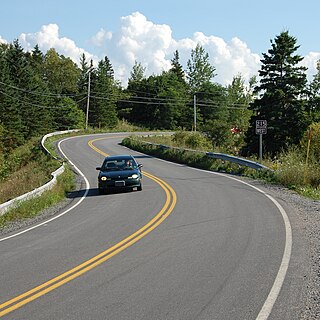
Nova Scotia Route 253 is a collector road in the Canadian province of Nova Scotia.

Route 333 is a collector road in the Canadian province of Nova Scotia.
Route 306 is a collector road in the Canadian province of Nova Scotia.
Route 212 is a collector road in the Canadian province of Nova Scotia.
Route 206 is a collector road in the Canadian province of Nova Scotia.
Route 215 is collector road in the Canadian province of Nova Scotia.
Route 219 is a collector road approximately 20.3 km long in the Canadian province of Nova Scotia.
Route 223 is a collector road in the Canadian province of Nova Scotia.

Lake Charlotte is a rural cottage community on the Eastern Shore of the Halifax Regional Municipality, Nova Scotia, Canada. The community is located on the junction of Trunk 7 and Clam Harbour Road, 58.23 kilometers from Downtown Halifax.
Margaree Valley is a small community in the Canadian province of Nova Scotia, located in Inverness County on Cape Breton Island.
Route 470, also known as La Poile Highway, is a highway on the West Coast of the Canadian province of Newfoundland and Labrador. It is the last provincial highway off Route 1 before approaching the Marine Atlantic Ferry to Nova Scotia, in Channel-Port aux Basques. The route is 42.8 kilometres (26.6 mi) in length. During much of the journey, there is plenty of barren land on both sides of the road, until arriving at its final community, Rose Blanche. Route 470 also carries the designation of Granite Coast Scenic Drive.

The Margaree Salmon Association is a wildlife conservation group that was established in 1982 in Margaree, Cape Breton Island, Nova Scotia, Canada. The association is a nonprofit organization, that dedicates itself to restoration ecology, through conservation, protection and enhancement of spawning and rearing habitat of the salmonid lineage; specific to the Atlantic salmon and trout species. The association engineers habitat enhancing structures into tributaries of the Margaree River watershed. The Margaree River is public domain, attracting yearly visits by anglers near and far. The Association was involved in the nomination and designation of the Margaree River-Lake Ainslie watershed; as a Canadian Heritage Rivers System. As well, the Association works in collaboration with the Inland Fisheries Division of the Nova Scotia Department of Fisheries and Aquaculture and Fisheries and Oceans Canada, to assist with scientific study in areas of broodstock collection, stock assessment and water quality sampling.