The Gulf of St. Lawrence is the outlet of the North American Great Lakes via the St. Lawrence River into the Atlantic Ocean. The gulf is a semi-enclosed sea, covering an area of about 226,000 square kilometres (87,000 sq mi) and containing about 34,500 cubic kilometres (8,300 cu mi) of water, at an average depth of 152 metres (500 ft).
Inverness County is an historical county and census division of Nova Scotia, Canada. Local government is provided by the Municipality of the County of Inverness, the town of Port Hawkesbury and the Whycocomagh 2 Waycobah First Nation reserve.

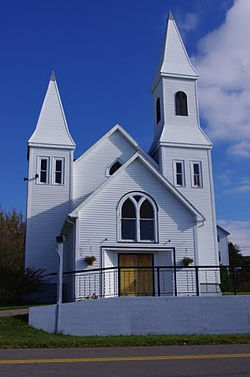
Port Hood is an unincorporated place in the Municipality of the County of Inverness, Nova Scotia, Canada. It is an administrative centre and a service centre for the surrounding area. It is also the site of a registered historic place, Peter Smyth House.
Havre Boucher is a community in Antigonish County, Nova Scotia, Canada.
Strait Regional School Board is a Canadian school board operating 25 schools in eastern Nova Scotia's counties of Richmond, Antigonish, Inverness, and Guysborough.
Aylesford, since its formation, has always been a farming community. It is situated in western Kings County in the Annapolis Valley of Nova Scotia, Canada. The settlement was named after the fourth Earl of Aylesford, Heneage Finch, who was Lord Of The Bedchamber to George III from 1772-1777. The community is located between the North and South Mountains, and is roughly a 15 minute to Canadian Forces Base Greenwood, and a 10 minute drive to its closest neighbour, the Town Of Berwick. Aylesford is located on the Evangeline Trail scenic tourist route, which was named after the epic 1847 H.W. Longfellow poem entitled Evangeline, A Tale of Acadie.
The Bras d'Or Lakes Scenic Drive is a scenic roadway on Nova Scotia's Cape Breton Island. It extends around the perimeter of Bras d'Or Lake.
Route 395 is a collector road in the Canadian province of Nova Scotia.
Route 223 is a collector road in the Canadian province of Nova Scotia.
Route 252 is a collector road in the Canadian province of Nova Scotia.
Arichat is an unincorporated place in the Municipality of the County of Richmond, Nova Scotia, Canada. It is the main village on Isle Madame on the southeastern tip of Cape Breton Island.
Dover is an unincorporated community within Guysborough County in Nova Scotia, Canada. It is 7 km (4.3 mi) southwest of Canso and approximately 210 km (130 mi) northeast of Halifax.
Port Hastings is a unincorporated settlement on Cape Breton Island, within the Municipality of the County of Inverness, Canada. The population in 2021 was 90.
Lake Charles is a small lake in Nova Scotia’s Halifax Regional Municipality between the communities of Dartmouth and Waverley. It is situated between Port Wallace in the south and Nova Scotia Highway 107 in the North, Nova Scotia Highway 118 in the west and Nova Scotia Route 318 to the east. It is the summit of the Shubenacadie Canal, where the level of the surface is 31 m above sea level. Located in the Shubenacadie watershed, it ultimately feeds into the Bay of Fundy. However, it also feeds into Halifax Harbour through the canal locks at Shubie Park.
Aulds Cove is a community in the Canadian province of Nova Scotia, located in both Antigonish County and Guysborough County.
Heatherton is a small community in the Canadian province of Nova Scotia, located in Antigonish County. It has a Community centre, post office, Catholic church. Local economy consists of farming, forestry and fishing. Many people work in the town of Antigonish. Also has a group home and a community centre with a bakery.
Linwood is a community in the Canadian province of Nova Scotia, located in Antigonish County. Linwood, Nova Scotia is a small coastal community located halfway between the town of Antigonish and the Canso Causeway. Located around Linwood Harbour, Linwood has two campgrounds, both with a view of the Harbour, along with a short hiking trail, picnic park, ice rink and a community centre.
There are various Black Lakes in Nova Scotia, Canada. They vary widely in size, depth and usability. Many counties, such as Cumberland, Halifax, Inverness, and Pictou Counties have more than one Black Lake so named, while other counties mentioned in this article have only one named Black Lake.

The Treaty of 1752 was a treaty signed between the Mi'kmaq people of Shubenacadie, Nova Scotia and the governor of Nova Scotia on 22 November 1752 during Father Le Loutre's War. The treaty was created by Edward Cornwallis and later signed by Jean-Baptiste Cope and Governor Peregrine Hopson. Cornwallis was at the signing at Cope's request.
Maritime Launch Services (MLS) is a Canadian space transport services company founded in 2016 and headquartered in Nova Scotia, Canada. MLS will rely on Ukrainian Cyclone-4M rockets by Pivdenne to launch polar and sun synchronous orbit from Canso, Nova Scotia. MLS is a joint venture of three U.S.-based firms.