
The Minas Basin is an inlet of the Bay of Fundy and a sub-basin of the Fundy Basin located in Nova Scotia, Canada. It is known for its extremely high tides.

Advocate Harbour is a Canadian rural community located in Cumberland County, Nova Scotia
Trunk 2 is part of the Canadian province of Nova Scotia's system of Trunk Highways. The route runs from Halifax to Fort Lawrence on the New Brunswick border. Until the 1960s, Trunk 2 was the Halifax area's most important highway link to other provinces, and was part of a longer Interprovincial Highway 2 which ended in Windsor, Ontario. The controlled access Highway 102 and Highway 104 now carry most arterial traffic in the area, while Trunk 2 serves regional and local traffic.
Trunk 8 is part of the Canadian province of Nova Scotia's system of Trunk Highways. The route runs from Liverpool to Annapolis Royal, a distance of 113 kilometres (70 mi). Trunk 8 is also known as the Kejimkujik Scenic Drive.
Route 318 is a collector road in the Canadian province of Nova Scotia.

Route 333 is a collector road in the Canadian province of Nova Scotia.
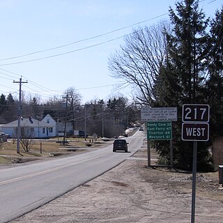
Route 217 is a collector road in the Canadian province of Nova Scotia.
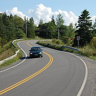
The Glooscap Trail is a scenic roadway in the Canadian province of Nova Scotia.

The Sunrise Trail is a scenic roadway in the Canadian province of Nova Scotia. It is located along the province's North Shore on the Northumberland Strait for 333 km (207 mi) from Amherst to the Canso Causeway.
The Fundy Shore Ecotour is a former scenic drive and network of tourist destinations in the Canadian province of Nova Scotia and encircles several sub-basins of the Bay of Fundy, which contains the highest tidal range on the planet.
Route 215 is collector road in the Canadian province of Nova Scotia.
Route 242 is a collector road in the Canadian province of Nova Scotia.
Route 366 is a collector road in the Canadian province of Nova Scotia.
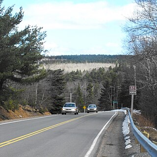
Route 321 is a collector road in the Canadian province of Nova Scotia.

Route 302 is a collector road in the Canadian province of Nova Scotia.
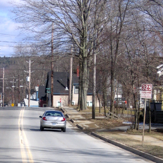
Route 325 is a collector road in the Canadian province of Nova Scotia. It is located in Lunenburg County and connects Colpton at Route 208 with Mahone Bay at Trunk 3.

Cape Chignecto Provincial Park is a Canadian provincial park located in Nova Scotia. A wilderness park, it derives its name from Cape Chignecto, a prominent headland which divides the Bay of Fundy with Chignecto Bay to the north and the Minas Channel leading to the Minas Basin to the east. The park, which opened in 1998, is the largest provincial park in Nova Scotia. It also anchors one end of the UNESCO Cliffs of Fundy Global Geopark.
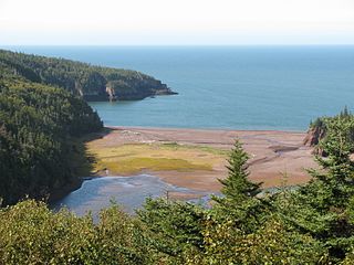
Eatonville is a former lumber and shipbuilding village in Cumberland County, Nova Scotia. It includes a large tidal harbour at the mouth of the Eatonville Brook beside several dramatic sea stacks known as the "Three Sisters". It was founded in 1826 and abandoned in the 1940s. The site of the village is now part of Cape Chignecto Provincial Park.

The Parrsboro Shore is an area of Cumberland County, Nova Scotia consisting of the shoreline communities west of the town of Parrsboro. The Parrsboro Shore is generally defined as stretching along the Bay of Fundy from the town of Parrsboro westward around Cape Chignecto as far as Apple River. It includes the communities of Diligent River, Fox River, Port Greville, Ward's Brook, Fraserville, Spencer's Island, Advocate, the ghost town of Eatonville. Linked by Nova Scotia's Route 209, the communities form part of the Fundy Shore Ecotour.
The Fundy Shore Scenic Drive is a scenic drive in the Canadian province of Nova Scotia. It located along the northeastern portion of the Bay of Fundy, following the Chignecto Peninsula which separates Chignecto Bay and Minas Basin, an area which contains the highest tidal range on the planet.

