
The Halifax Regional Municipality has a number of parks and recreation areas in urban and rural settings.

The Musquodoboit River is a Canadian river located in central Nova Scotia in the northeastern part of Halifax Regional Municipality. The river is approximately 97 kilometres (60 mi) in length with roughly 88 kilometres (55 mi) being traversable by paddle. It has a watershed area of 1,409 square kilometres (544 sq mi)
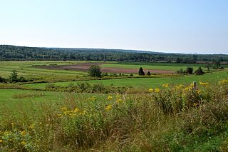
The Musquodoboit Valley is a valley and region in the Halifax Regional Municipality of Nova Scotia, Canada. It is administratively located in the municipality's Musquodoboit Valley & Dutch Settlement planning area and the western edge of the valley includes communities that are considered part of the commutershed for the urban area of the Halifax Regional Municipality. The picturesque Musquodoboit River flows through majority of the valley, passing by most of the communities in the valley. The river is approximately 97 kilometres (60 mi) long and originates in the extreme northeastern area of the valley. The three largest communities in the valley are Upper Musquodoboit, Middle Musquodoboit and Musquodoboit Harbour. The word "Musquodoboit" is derived from the Mi’kmaq language and means "rolling out in foam".

Route 357 is a collector road in the Canadian province of Nova Scotia. It is located in the Halifax Regional Municipality and connects Musquodoboit Harbour at Trunk 7 with Middle Musquodoboit at Route 224.
Dollar Lake Provincial Park is a seasonal provincial park located in the Musquodoboit Valley area of the Halifax Regional Municipality in Nova Scotia, Canada, in the community of Wyses Corner, 22 kilometres from the Halifax International Airport on the Old Guysborough Road.
Musquodoboit Harbour is a natural harbour in Canada on the Eastern Shore of Nova Scotia.

Middle Musquodoboit is a rural community in the Musquodoboit Valley region of Nova Scotia, Canada within the Halifax Regional Municipality, along the Musquodoboit River at the junction of Route 357 with Route 224, 78 kilometres (48 mi) from Dartmouth, Nova Scotia. The community's name comes from the First Nations' word Mooskoduboogwek, which means to suddenly widen out after a narrow entrance at a mouth. For a time after 1883, Middle Musquodoboit was called Laytonville, but at some point reverted to its former name.
Dean is a small farming & forestry community in the North Branch Musquodoboit in the Musquodoboit Valley along the Halifax Regional Municipality/Colchester County county line, in the Canadian province of Nova Scotia, along Route 336. Other communities in the North Branch include Elmsvale, Greenwood, Upper Musquodoboit, and Moose River Gold Mines, among others.

East Chezzetcook is a rural community on the Eastern Shore outside of the Halifax Regional Municipality, Nova Scotia on the East Chezzetcook Road off of Trunk 7. This small French fishing village is home to many descendant Acadians.
Wyses Corner is a farming community in the Musquodoboit Valley area of the Halifax Regional Municipality, Nova Scotia on Route 212.
Chaswood is a rural community in the Musquodoboit Valley northwest of Middle Musquodoboit, Nova Scotia in Nova Scotia, Canada. Chaswood is named in honour of Charles Carroll Wood.
Cooks Brook is a small community found in the Southwest Branch Musquodoboit of the Musquodoboit Valley in Nova Scotia, Canada. Cooks Brook is located along the Halifax Regional Municipality/Colchester County border.
Lake Egmont is a small rural community in the lower interior of the Musquodoboit Valley, in the Halifax Regional Municipality of Nova Scotia, Canada. Other communities in this area include Antrim and Wyses Corner, Nova Scotia. The community was named after John Perceval, 2nd Earl of Egmont.

Eastern Shore District High School is a public school in the Musquodoboit Harbour area east of Dartmouth, Nova Scotia, Canada. It is operated by the Halifax Regional Centre for Education (HRCE).

Upper Lakeville is a small cottage community on the Eastern Shore, which includes a blend of summer cottages and year-round homes. It is located on the Western shore of Lake Charlotte. Upper Lakeville is one of the many small rural communities that are included in the Halifax Regional Municipality Nova Scotia. Upper Lakeville road is located at its junction with Trunk 7, 55.3 km from Dartmouth, Nova Scotia, and 58.9 km from the City of Halifax, on the stretch of Marine Drive running between Musquodoboit Harbour and Sheet Harbour. It terminates at E & F Webber Lakeside Park campgrounds. The only public access to the lake in Upper Lakeville is at E & F Webber Lakeside Park campgrounds.
Pleasant Point, is a community of the Halifax Regional Municipality in the Canadian province of Nova Scotia.
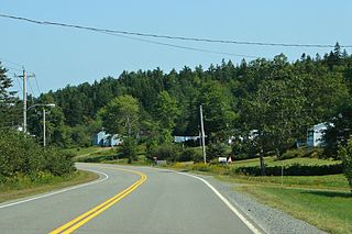
Gibraltar is a rural community of the Halifax Regional Municipality in the Canadian province of Nova Scotia on Nova Scotia Route 357, approximately 15 km north of Musquodoboit Harbour.
South Section is a community on the Eastern Shore of the Halifax Regional Municipality in the Canadian province of Nova Scotia in the Musquodoboit Valley.
The Musquodoboit Trailway is a 14.5-kilometre-long (9.0 mi) multiuse rail trail located in Halifax County, Nova Scotia, running the distance from Gibralter to Musquodoboit Harbour. The entire route is part of the Halifax spur of The Great Trail, and follows Nova Scotia Route 357 for its length.

The Eastern Shore is a tourism region of the province of Nova Scotia, Canada. It provides two percent of the revenue for the province's tourism economy. One of its key features is an archipelago known as the 100 Wild Islands area.
