Stormont II

Last updated

The Stormont II is a cable ferry operating in the Canadian province of Nova Scotia.

Cable ferry ship type

A cable ferry is a ferry that is guided across a river or large body of water by cables connected to both shores. Early cable ferries often used either rope or steel chains, with the latter resulting in the alternate name of chain ferry. Both of these were largely replaced by wire cable by the late 19th century.

Canada Country in North America

Canada is a country in the northern part of North America. Its ten provinces and three territories extend from the Atlantic to the Pacific and northward into the Arctic Ocean, covering 9.98 million square kilometres, making it the world's second-largest country by total area. Canada's southern border with the United States is the world's longest bi-national land border. Its capital is Ottawa, and its three largest metropolitan areas are Toronto, Montreal, and Vancouver. As a whole, Canada is sparsely populated, the majority of its land area being dominated by forest and tundra. Consequently, its population is highly urbanized, with over 80 percent of its inhabitants concentrated in large and medium-sized cities, many near the southern border. Canada's climate varies widely across its vast area, ranging from arctic weather in the north, to hot summers in the southern regions, with four distinct seasons.

Nova Scotia Province of Canada

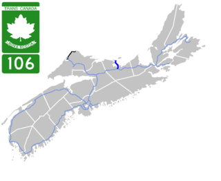
Nova Scotia is one of Canada's three Maritime Provinces, and one of the four provinces that form Atlantic Canada. Its provincial capital is Halifax. Nova Scotia is the second-smallest of Canada's ten provinces, with an area of 55,284 square kilometres (21,300 sq mi), including Cape Breton and another 3,800 coastal islands. As of 2016, the population was 923,598. Nova Scotia is Canada's second-most-densely populated province, after Prince Edward Island, with 17.4 inhabitants per square kilometre (45/sq mi).

Stormont II was built by Ferguson Industries Ltd. at Pictou in 1980. It is owned by the Minister of Transportation and Infrastructure Renewal.

Pictou Shipyard

The Pictou Shipyard is a Canadian shipbuilding site located in Pictou County, Nova Scotia, Canada and made famous by its use as an emergency shipbuilding facility in World War Two where it constructed twenty-four 4,700 ton Scandinavian class freighters. At its current site it was founded as The Pictou Iron Foundry in 1856 by William Henry Davies and through many business booms and busts as well as several changes of ownership it continues to operate today under the ownership of Aecon Atlantic Industrial Inc.

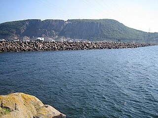
Stormont II currently operates on a 0.41 nmi (760 m) route across Country Harbour in Guysborough County where it connects Port Bickerton in the west with Isaac's Harbour North in the east, carrying traffic for Route 211.

Guysborough County, Nova Scotia County in Nova Scotia, Canada

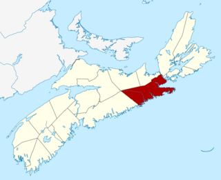
Guysborough County is a county in the Canadian province of Nova Scotia.

Port Bickerton, Nova Scotia human settlement in Canada

Port Bickerton is a small community in the Canadian province of Nova Scotia, located in the Municipality of the District of Saint Mary's in Guysborough County.

Isaacs Harbour North, Nova Scotia human settlement in Canada

Isaac's Harbour North is a community in the Canadian province of Nova Scotia, located in the Municipality of the District of Guysborough in Guysborough County.

The ferry has a capacity of 12 automobile-equivalent vehicles, measuring 24.72 m (81.1 ft) in length and 9.45 m (31.0 ft) in breadth while having a draught of 1.52 m (5.0 ft). It has a gross tonnage of 84 GT and is powered by a 74 kW (99 hp) diesel engine which pulls the ferry on a fixed cable at a speed of 5 kn (9.3 km/h).

Related Research Articles

Bay of Fundy A bay on the east coast of North America between New Brunswick and Nova Scotia

The Bay of Fundy is a bay between the Canadian provinces of New Brunswick and Nova Scotia, with a small portion touching the US state of Maine. It has an extremely high tidal range.

Canso Causeway

The Canso Causeway is a 1,385 m (4,544 ft) rock-fill causeway in Nova Scotia, Canada.

Havre Boucher Village in Nova Scotia, Canada

Havre Boucher is a village in Antigonish County, Nova Scotia, Canada.

Country Harbour, Nova Scotia human settlement in Canada

Country Harbour is a rural community in Guysborough County, Nova Scotia, Canada. The community is situated on a large deep natural harbour of the same name and is located along the province's Eastern Shore close to Canso, Nova Scotia.

Coastal Transport Limited

Coastal Transport Limited is a ferry company operating in eastern Canada on the Bay of Fundy with headquarters in Saint John, New Brunswick. The company began as a wholly owned subsidiary of Marine Atlantic Incorporated (MAI), and in April 1997 was sold to Murray O. Ryder, the former MAI Vice President of Operations.

Cape Breton and Central Nova Scotia Railway

The Cape Breton and Central Nova Scotia Railway is a short line railway operating in the Canadian province of Nova Scotia. CBNS operates of main line and associated spurs between Truro in the central part of the province to Point Tupper on Cape Breton Island.

Nova Scotia Highway 106 highway in Nova Scotia

Highway 106 is a 19 km (12 mi) 2-lane limited-access highway located within Pictou County, in the Canadian province of Nova Scotia.

Seal Island Bridge

The Seal Island Bridge is a Canadian bridge located in Victoria County, Nova Scotia. It is the third longest bridge span in the province.

Transportation in Halifax, Nova Scotia

Halifax, Nova Scotia, is a major multi-modal transportation centre for freight and passengers in Atlantic Canada.

<i>Sankaty</i>

Sankaty was a propeller-driven steamer that served as a ferry to Martha's Vineyard and Nantucket in Massachusetts; in Rockland, Maine; Stamford, Connecticut and Oyster Bay, Long Island in the United States from 1911 to 1940. During World War II, the ship was requisitioned by the Royal Canadian Navy for service as a minelayer and maintenance vessel along the Canadian Atlantic coast. Following the war the ship returned to a ferry, working the Wood Islands, Prince Edward Island and Caribou, Nova Scotia route in Canada from 1947 until 1964. While being towed to the breaker's yard, the ship sank off the coast of Nova Scotia on October 27, 1964.

Canso Canal Bridge bridge in Canada

The Canso Canal Bridge is a rotating swing bridge in Nova Scotia, Canada. It crosses the Canso Canal at the eastern end of the Canso Causeway. The bridge carries the 2 traffic lanes of Highway 104 as well as a single track railway line operated by the Cape Breton and Central Nova Scotia Railway (CBNS).

Lake Charles is a small lake in Nova Scotia’s Halifax Regional Municipality between the communities of Dartmouth and Waverley. It is situated between Port Wallace in the south and Nova Scotia Highway 107 in the North, Nova Scotia Highway 118 in the west and Nova Scotia Route 318 to the east. It is the summit of the Shubenacadie Canal, where the level of the surface is 31 m above sea level. Located in the Shubenacadie watershed, it ultimately feeds into the Bay of Fundy. However, it also feeds into Halifax Harbour through the canal locks at Shubie Park.

Pictou Landing, Nova Scotia human settlement in Canada

Pictou Landing is a community in the Canadian province of Nova Scotia, located in Pictou County.

Monastery, Nova Scotia human settlement in Canada

Monastery is a small community in the Canadian province of Nova Scotia, located in Antigonish County at the junction of Nova Scotia Trunk 16 and 4.

Cobequid Pass pass in Nova Scotia

The Cobequid Pass is the name given to a 45 km (28 mi) tolled section of Nova Scotia Highway 104 between Thomson Station, Cumberland County and Masstown, Colchester County in the Canadian province of Nova Scotia. The section is a public–private partnership; the highway is owned by the Highway 104 Western Alignment Corporation, a Crown corporation of the Government of Nova Scotia, with a toll plaza operated under contract by Atlantic Highway Management Corporation Limited, a subsidiary of Aecon Concessions. The toll plaza is located near the halfway point in Londonderry.

Stormont, Nova Scotia human settlement in Canada

Stormont is a community in the Canadian province of Nova Scotia, located in the Municipality of the District of Guysborough in Guysborough County.

The Department of Transportation and Infrastructure Renewal is a department within the Government of Nova Scotia and has responsibility for overseeing transportation, communications, construction, property, and accommodation needs of government departments and agencies in the province.

Lloyd P. Hines is a Canadian politician, who was elected to the Nova Scotia House of Assembly in the 2013 provincial election. A member of the Nova Scotia Liberal Party, he represents the electoral district of Guysborough–Eastern Shore–Tracadie.

East River Bridge (Sheet Harbour) bridge in Canada

The East River Bridge is a multi-span bridge in Sheet Harbour, Nova Scotia that carries Trunk 7 over the Northeast Arm of Sheet Harbour. The bridge is 183 m (600 ft) in length and was constructed from September 2014 to December 2015. It was opened on December 17, 2015 to pedestrians, with a bridge walk commemorating the closing of the old bridge and the opening of the new bridge. The bridge was opened to vehicles the day after. It replaced a green steel arch bridge bridge of the same name that was built in 1956 immediately north of the current bridge. It shared engineering ties with the Angus L. MacDonald Bridge in Halifax. Nova Scotia was considering repairs to the old bridge, but they ultimately elected to construct a new bridge instead. The current bridge was designed without overhead arches, unlike its predecessor, as the construction cost would have been doubled with the addition of overhead arches.

References

Coordinates: 45°10′18″N61°42′00″W / 45.171751°N 61.699905°W / 45.171751; -61.699905

Geographic coordinate system Coordinate system

A geographic coordinate system is a coordinate system that enables every location on Earth to be specified by a set of numbers, letters or symbols. The coordinates are often chosen such that one of the numbers represents a vertical position and two or three of the numbers represent a horizontal position; alternatively, a geographic position may be expressed in a combined three-dimensional Cartesian vector. A common choice of coordinates is latitude, longitude and elevation. To specify a location on a plane requires a map projection.