
Autoroute 35 (A-35) is an Autoroute in the region of Montérégie, Quebec, Canada. Constructed in the 1960s, the A-35 links Saint-Jean-sur-Richelieu with Montreal via the A-10. The A-35 is also the primary route for traffic between Montreal and Boston, although it ends 13.4 km (8.3 mi) short of the U.S. border. South of its current terminus in Saint-Sébastien, the A-35 continues as two-lane Route 133 to the border. An extension of A-35 to meet Interstate 89 at Saint-Armand will complete a nearly 500 km (310 mi) limited-access highway link between Montreal and Boston. It had been scheduled to open in 2017, but construction was on hold and now will be completed up to the Canada-US border by 2023.

Route 281 is a 75 km two-lane north/south highway in the Chaudière-Appalaches region in the province of Quebec, Canada. Its northern terminus is in St-Michel at the junction of Route 132 and its southern terminus is close to Saint-Camille-de-Lellis at the junction of Route 204.

Route 243 is a north/south highway on the south shore of the Saint Lawrence River. Its northern terminus is in Saint-Félix-de-Kingsey at the junction of Route 255 and its southern terminus is in the township of Potton where it crosses the Canada–US border at the North Troy–Highwater Border Crossing into Vermont and becomes Vermont Route 243. Route 243 is not a busy highway as it does not go through big towns.

Route 232 is a two-lane east/west provincial highway on the south shore of the St. Lawrence River in the Bas-Saint-Laurent region of Eastern Quebec, Canada. Its eastern terminus is in Rimouski at the junction of Route 132 and the western terminus is at the junction of Route 289 in Rivière-Bleue. The route temporarily becomes A-85 along a 3 kilometre section through Cabano.

Route 289 is a two-lane north/south highway on the south shore of the Saint Lawrence River in the Bas-Saint-Laurent region of eastern Quebec, Canada. Its northern terminus is in Saint-André-de-Kamouraska at the junction of Route 132 and the southern terminus is at the border of New Brunswick where it continues as Route 120.

Route 287 is a 42 km two-lane north/south highway on the south shore of the Saint Lawrence River in the Bas-Saint-Laurent region of Eastern Quebec, Canada. Its northern terminus is in Saint-Denis-De La Bouteillerie at the junction of Route 132 and the southern terminus is at Lac de l'Est, part of the municipality of Mont-Carmel. About 10 km after Mont-Carmel, the route becomes a gravel road until the lake.

Route 269 is a two-lane north-south highway on the south shore of the Saint Lawrence River, in Quebec, Canada. Its northern terminus is close to Saint-Gilles at the junction of Route 116, and the southern terminus is at the junction of Route 173 in Armstrong, part of Saint-Théophile. The stretch between Saint-Gilles and Kinnear's Mills is very scenic, rising and dipping in the Appalachians.

Route 108 is a two-lane east/west highway on the south shore of the Saint Lawrence River in the Eastern Townships and Chaudière-Appalaches regions of Quebec, Canada. Its eastern terminus is in Beauceville at the junction of Route 173, and the western terminus is at the junction of Route 112 in Magog.

Route 157 is a four-lane north–south highway on the north shore of the Saint Lawrence River in Quebec, Canada. Its northern terminus is in Shawinigan at the junction of Route 153, and the southern terminus is at the junction of Route 138 in Cap-de-la-Madeleine, now part of Trois-Rivières.

Provincial Highway 159 is a two-lane north/south highway on the north shore of the Saint Lawrence River in Quebec, Canada. Its northern terminus is in Saint-Roch-de-Mékinac at the junction of Route 155, and the southern terminus is at the junction of Route 138 in Sainte-Anne-de-la-Pérade.
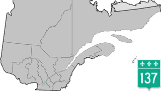
Route 137 is a north/south highway on the south shore of the Saint Lawrence River in Quebec, Canada. Its northern terminus is in Saint-Denis-sur-Richelieu, at the junction of Route 133, and the southern terminus is in Granby at the junction of Route 112.
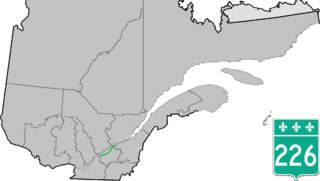
Route 226 is a two-lane east/west highway in Quebec, Canada. Its western terminus is at the junction of Route 132 in Pierreville and its eastern terminus is in Sainte-Croix at the junction of Route 271.

Route 344 is an east/west highway on the north shore of the Ottawa River in Quebec, Canada. Its western terminus is in Grenville-sur-la-Rouge at the junction of Autoroute 50, and its eastern terminus is in L'Assomption at the junction of Route 343. It follows the Ottawa River from Grenville-sur-la-Rouge to Saint-André-d'Argenteuil, where it follows the Lac des Deux Montagnes until Deux-Montagnes, where it follows the Rivière des Mille Îles until Repentigny, where it follows the Rivière l'Assomption until L'Assomption.

Route 230 is a two-lane east/west provincial highway on the south shore of the Saint Lawrence River in the Bas-Saint-Laurent region of Eastern Quebec, Canada. Its eastern terminus is in Saint-Alexandre-de-Kamouraska east of the junction of Route 289 and the western terminus is at the junction of Route 132 in La Pocatière.

Route 202 is an east/west 140-kilometre highway in the Monteregie and Estrie regions of the province of Quebec, Canada. Its western terminus is at the junction of Route 132 in Sainte-Barbe and its eastern terminus is in southern Cowansville at the junctions of Route 104 and Route 139. The highway runs a few kilometres north of the Canada–United States border for most of its length.

Route 111 is a north/south highway on the north shore of the Saint-Lawrence River in the Abitibi-Témiscamingue region of Quebec, Canada. Its northern terminus is in the municipality of Baie-James at the junction of Route 393, and its southern terminus is in Val-d'Or at the junction of Route 117.

Route 155 is a north/south highway on the north shore of the Saint Lawrence River in Quebec, Canada. Its northern terminus is in Chambord at the junction of Route 169, and the southern terminus is the Piles Bridge in Shawinigan. Previously the highway continued to Autoroute 20 but that section was decommissioned in 2006 when Autoroute 55 was completed.

Route 257 is a north–south highway on the south shore of the St. Lawrence River, in the Eastern Townships region of Quebec, Canada. Its northern terminus is in Saint-Adrien at a junction with Route 216, and its southern terminus is at the Pittsburg–Chartierville Border Crossing, where it becomes U.S. Route 3 as it enters Pittsburg, New Hampshire.

Route 309 is a provincial highway located in the Outaouais region in western Quebec. It starts at the junction of Autoroute 50 in the Buckingham sector, in the city of Gatineau's east end. It runs mostly parallel to the Du Lièvre River and ends north of Mont-Laurier in the town of Sainte-Anne-du-Lac in the Upper Laurentians.

Route 217 is a provincial highway located in the Montérégie region of Quebec south of Montreal. It runs from Montée Guay in Saint-Bernard-de-Lacolle and ends in La Prairie at the junctions of Route 104 and Autoroute 30. It serves in part as a service route for Autoroute 15 until Saint-Philippe and, where it runs along the Saint-Jacques River, and serves as a service route for Autoroute 30 until La Prairie and its northeastern terminus at Route 104.

