Dunham, Quebec

Last updated

Dunham
La Route des vins de Brome-Missisquoi.JPG
A vineyard in Dunham.
Dunham Quebec location diagram.PNG
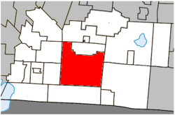
Location within Brome-Missisquoi RCM.
Canada Southern Quebec location map.png
Red pog.svg
Dunham
Location in southern Quebec.
Coordinates: 45°08′N72°48′W / 45.133°N 72.800°W / 45.133; -72.800 [1]
Country Canada
Province Quebec
Region Estrie
RCM Brome-Missisquoi
ConstitutedSeptember 25, 1971
Government
  MayorPierre Janecek
   Federal riding Brome—Missisquoi
   Prov. riding Brome-Missisquoi
Area
  Total
196.20 km2 (75.75 sq mi)
  Land195.18 km2 (75.36 sq mi)
Population
 (2011) [5]
  Total
3,471
  Density17.8/km2 (46/sq mi)
  Pop 2006-2011
Increase2.svg 2.2%
  Dwellings
1,709
Time zone UTC−5 (EST)
  Summer (DST) UTC−4 (EDT)
Postal code(s)
Area codes 450 and 579
HighwaysQc202.svg R-202
Qc213.svg R-213
Website www.ville.dunham.qc.ca

Dunham is a city in the Canadian province of Quebec, located in Brome-Missisquoi Regional County Municipality. The population as of the Canada 2011 Census was 3,471.

Contents

Dunham is located approximately 12 kilometres (7.5 mi) north of the United States border. It is bordered by Saint-Ignace-de-Stanbridge and Stanbridge East to the west, Farnham to the northwest, Brigham and Cowansville to the north, Brome Lake to the northeast, Sutton to the east and Frelighsburg to the south. Selby Lake is located entirely within Dunham.

Demographics

Historical Census Data - Dunham, Quebec [6]
YearPop.±%
1991 3,226    
1996 3,370+4.5%
2001 3,215−4.6%
2006 3,396+5.6%
2011 3,471+2.2%

In the 2021 Census of Population conducted by Statistics Canada, Dunham had a population of 3,599 living in 1,529 of its 1,758 total private dwellings, a change of 4.9% from its 2016 population of 3,432. With a land area of 193.86 km2 (74.85 sq mi), it had a population density of 18.6/km2 (48.1/sq mi) in 2021. [7]

Canada census – Dunham community profile
2021 2011
Population3,599 (+4.9% from 2016)3,471 (+2.2% from 2006)
Land area193.86 km2 (74.85 sq mi)195.18 km2 (75.36 sq mi)
Population density18.6/km2 (48/sq mi)17.8/km2 (46/sq mi)
Median age48.4 (M: 50.0, F: 47.2)46.4 (M: 46.7, F: 46.1)
Private dwellings1,758 (total)  1,529 (occupied)1,709 (total) 
Median household income$76,000$67,068
References: 2021 [8] 2011 [5]
Canada Census Mother Tongue - Dunham, Quebec [6]
CensusTotal
French
English
French & English
Other
YearResponsesCountTrendPop %CountTrendPop %CountTrendPop %CountTrendPop %
2011
3,455
2,625Increase2.svg 4.8%75.98%695Decrease2.svg 6.7%20.12%55Decrease2.svg 31.3%1.59%80Increase2.svg 128.6%2.31%
2006
3,365
2,505Increase2.svg 6.6%74.44%745Increase2.svg 3.5%22.14%80Increase2.svg 45.5%2.38%35Decrease2.svg 41.7%1.04%
2001
3,185
2,350Decrease2.svg 8.2%73.78%720Increase2.svg 7.5%22.61%55Increase2.svg 57.1%1.73%60Increase2.svg 20.0%1.88%
1996
3,315
2,560n/a77.22%670n/a20.21%35n/a1.06%50n/a1.51%

See also

References

  1. "Banque de noms de lieux du Québec: Reference number 19766". toponymie.gouv.qc.ca (in French). Commission de toponymie du Québec.
  2. 1 2 Ministère des Affaires municipales, des Régions et de l'Occupation du territoire: Dunham
  3. Parliament of Canada Federal Riding History: BROME--MISSISQUOI (Quebec)
  4. 2011 Statistics Canada Census Profile: Dunham, Quebec
  5. 1 2 "2011 Community Profiles". 2011 Canadian census . Statistics Canada. March 21, 2019. Retrieved 2014-03-13.
  6. 1 2 Statistics Canada: 1996, 2001, 2006, 2011 census
  7. "Population and dwelling counts: Canada, provinces and territories, and census subdivisions (municipalities), Quebec". Statistics Canada. February 9, 2022. Retrieved August 29, 2022.
  8. "2021 Community Profiles". 2021 Canadian census . Statistics Canada. February 4, 2022. Retrieved 2023-10-19.