The Saguenay River is a major river of Quebec, Canada. It drains Lac Saint-Jean in the Laurentian Highlands, leaving at Alma and running east; the city of Saguenay is located on the river. It drains into the Saint Lawrence River. Tadoussac, founded as a French colonial trading post in 1600, is located on the northeast bank at this site.
Tadoussac is a village in Quebec, Canada, at the confluence of the Saguenay and Saint Lawrence rivers. The indigenous Innu call the place Totouskak meaning "bosom", probably in reference to the two round and sandy hills located on the west side of the village. According to other interpretations, it could also mean "place of lobsters", or "place where the ice is broken". Although located in Innu territory, the post was also frequented by the Mi'kmaq people in the second half of the 16th century, who called it Gtatosag. Alternate spellings of Tadoussac over the centuries included Tadousac, Tadoussak, and Thadoyzeau (1550). Tadoussac was first visited by Europeans in 1535 and was established in 1599 when the first trading post in Canada was formed there, in addition to a permanent settlement being placed in the same area that the Grand Hotel is located today.

Route 138 is a major highway in the Canadian province of Quebec, following the entire north shore of the Saint Lawrence River past Montreal to the temporary eastern terminus in Kegashka on the Gulf of Saint Lawrence. The western terminus is in Elgin, at the border with New York State south-west of Montreal. Part of this highway is known as the Chemin du Roy, or King's Highway, which is one of the oldest highways in Canada.

Autoroute 73 is an autoroute in Quebec, Canada. Following a northwest-southeast axis perpendicular to the Saint Lawrence River, the A-73 provides an important freeway link with regions north and south of Quebec City, the capital of the province. It also intersects with Autoroute 20 and Autoroute 40 - one of only three Quebec autoroutes to do so. The A-73 begins less than 40 kilometres from the U.S. border in Quebec's Beauce region, traverses metropolitan Quebec City, and ends in the Laurentian Mountains. Civic, political, and business leaders in regions north and south of the A-73's termini have lobbied the Quebec government to extend the autoroute. While the four-laning of Route 175 to Saguenay has alleviated concerns in the north about safety and connectivity, Quebecers in the Beauce continue to advocate for extending the A-73 to the U.S. border, towards the Armstrong–Jackman Border Crossing and U.S. Route 201 within Maine.
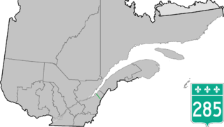
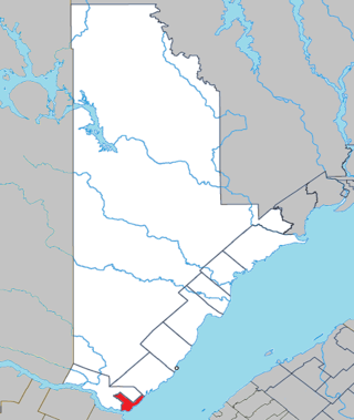
Route 285 is a 48 km two-lane north/south highway on the south shore of the Saint Lawrence River in the Chaudière-Appalaches region of Quebec, Canada. Its northern terminus is in L'Islet at the junction of Route 132 and the southern terminus is close to Saint-Adalbert at the junction of Route 204.
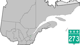
Route 273 is a short 21 km long, two-lane north–south highway on the south shore of the Saint Lawrence River in Quebec, Canada. Its northern terminus is in Saint-Antoine-de-Tilly at the junction of Route 132, and the southern terminus is at the junction of Route 269 near Saint-Gilles.

Provincial Highway 159 is a two-lane north/south highway on the north shore of the Saint Lawrence River in Quebec, Canada. Its northern terminus is in Saint-Roch-de-Mékinac at the junction of Route 155, and the southern terminus is at the junction of Route 138 in Sainte-Anne-de-la-Pérade.

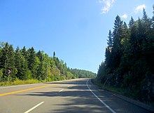
Route 175 is a major north–south highway on both sides of the St. Lawrence River in Quebec, Canada. Its southern terminus is in Saint-Lambert-de-Lauzon at the junction of Route 218 and its northern terminus is in Saguenay at the junction of Route 172, in the former city of Chicoutimi. Route 175 crosses the Saint Lawrence River on the Quebec Bridge, and a little further north of downtown Quebec City, it merges with Autoroute 73 for about 30 km before continuing through the Laurentides Wildlife Reserve as a two-lane divided highway in Stoneham.

Route 255 is a north/south highway on the south shore of the St. Lawrence River. Its northern terminus is in Baie-du-Febvre at the junction of Route 132 and its southern terminus is in Bury at the junction of Quebec Route 214.

Route 261 is a north/south highway on the south shore of the Saint Lawrence River in Quebec, Canada. Its northern terminus is in Bécancour at the junction of Route 132 and its southern terminus is in Saint-Valère at the junction of Route 161.

Route 170 is a major east/west highway on the north shore of the St. Lawrence River in Quebec, Canada, and it parallels the Saguenay River on the south side of it. The western terminus of Route 170 is in Métabetchouan–Lac-à-la-Croix at the junction of Route 169, at Lac Saint-Jean, and the eastern terminus is in Saint-Siméon, at the junction of Route 138, close to the Saint Lawrence River.
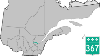
Route 367 is a 100 km two-lane north-south highway on the north shore of the Saint Lawrence River in Quebec, Canada. Although it is technically a north-south highway, long stretches of the road are east-west. Its northern/western terminus is close to Lac-aux-Sables at the junction of Route 363 and the southern/eastern terminus is in Saint-Augustin-de-Desmaures at the junction of Route 138. Route 367 used to end in Rivière-à-Pierre, but in the late 1990ss, thea stretch between Rivière-à-Pierre and the junction of Route 363 was added.

Route 241 is a north/south provincial highway on the south shore of the Saint Lawrence River in Quebec. Its northern terminus is in Roxton Falls at the junction of Route 139 and its southern terminus is close to Cowansville, at the junction of Route 139 once again. The highway overlaps both Route 112 and Route 243 in Waterloo located east of Granby and Bromont and just north of Autoroute 10.

Route 155 is a north/south highway on the north shore of the Saint Lawrence River in Quebec, Canada. Its northern terminus is in Chambord at the junction of Route 169, and the southern terminus is the Piles Bridge in Shawinigan. Previously the highway continued to Autoroute 20 but that section was decommissioned in 2006 when Autoroute 55 was completed.

Baie-Sainte-Catherine, Quebec is a town in Quebec, Canada. The municipal's territory extends along the Saguenay and Saint Lawrence rivers, whereas the town itself is on the small St. Catherine Bay, which is located at the confluence of these two rivers. Its elevation is 260 feet.

Route 381 is a provincial highway located in the Capitale-Nationale and Saguenay–Lac-Saint-Jean regions of Quebec. It runs from Baie-Saint-Paul at the junction of Route 138 and ends in the La Baie sector of the City of Saguenay at the junction of Route 170.
The ZEC Chauvin is a "zone d'exploitation contrôlée" of 619 square kilometres (239 sq mi), located partly in the unorganized territory of the Mont-Valin, in Le Fjord-du-Saguenay Regional County Municipality, in the administrative region Saguenay-Lac-Saint-Jean, in Quebec, in Canada.
The ZEC de la Rivière-Sainte-Marguerite is a "zone d'exploitation contrôlée" (ZEC) in the unorganized territory of the Mont-Valin, in Le Fjord-du-Saguenay Regional County Municipality, in the administrative region of Saguenay-Lac-Saint-Jean, Quebec, Canada.
The Rivière aux Outardes is a tributary of the Saguenay River, flowing in the municipality of Saint-Fulgence, in the Le Fjord-du-Saguenay Regional County Municipality, in the administrative region of Saguenay-Lac-Saint-Jean, in the province of Quebec, in Canada.
The rivière à la Loutre is a tributary of the Saguenay River, flowing in the municipality of Saint-Fulgence in the Le Fjord-du-Saguenay Regional County Municipality, in the administrative region of Saguenay-Lac-Saint-Jean, in Quebec, in Canada.