Quebec Route 136 (Montreal)

Last updated

Qc136.svg

Route 136

Autoroute Ville-Marie
Autoroute 720 (former)
A-720.png
Map of Greater Montreal with Route 136 highlighted in red
Route information
Maintained by Transports Québec
Length8.5 km [1] [2]  (5.3 mi)
Existed1972 [2] –present
RestrictionsHeight and HAZMAT restrictions in the Ville-Marie Tunnel
Major junctions
West endQuebec Autoroute 15.svgQuebec Autoroute 20.svg A-15  / A-20 in Montréal
Major intersectionsQuebec Autoroute 10.svg A-10 in Montréal
East end Rue Notre-Dame in Montréal
Location
Country Canada
Province Quebec
Major cities Montréal, Westmount
Highway system
Qc134.svg R-134 Qc136.svg R-136

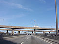
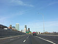
Route 136 (R-136), formerly Autoroute 720, known as the Ville-Marie Expressway (English) or Autoroute Ville-Marie (French) is an Autoroute highway in the Canadian province of Quebec that is a spur route of Autoroute 20 in Montreal. Its western terminus is located at the Turcot Interchange, a junction with Autoroute 15 and Autoroute 20, and its eastern terminus is near the Jacques Cartier Bridge (Route 134), where the highway merges with Notre-Dame Street. The Autoroute Ville-Marie designation is named after the downtown borough of Ville-Marie, through which the expressway is routed. It was designated Autoroute 720 until 2021 when it was renamed to Route 136.

Contents

Part of R-136 runs underground (below grade) through Downtown Montreal. This section begins from the west at Rue Guy (exit 4: Rue de la Montagne  / Rue Atwater) and remains underground almost all the way to its eastern end, except for a short section between Rue Saint-Urbain and Rue Hôtel-de-Ville. The tunnelled section west of this gap is known as the Ville-Marie Tunnel, and the section east of it is known as Viger Tunnel. However, locals regard both tunnels as one, and the term Ville-Marie Tunnel is often used to refer to both tunnels.

History

The Ville-Marie Expressway near Old Montreal Autoroute Ville-Marie.jpg
The Ville-Marie Expressway near Old Montreal

It was originally envisioned that Autoroute 20 would extend from the Turcot Interchange, along the route of the 720, to the Louis Hippolyte Lafontaine Bridge-Tunnel. Indeed, when the first section of the expressway was constructed and opened in the early 1970s, many Montrealers, anticipating that it would eventually replace the Metropolitan Expressway as the primary connector route to the Lafontaine Tunnel, and onward to Quebec City, dubbed the then-unnamed roadway the "Downtown Trans-Canada Highway". The provincial transport ministry (Le ministère des Transports du Québec, or MTQ) had planned to extend the Viger Tunnel east to Autoroute 25 at its Souligny Avenue interchange. The right-of-way has existed since the original layout of the A-720, and buildings along the extension were demolished at that time, even though the 720 was not completed due to cost constraints. The government of Montreal instead converted the portion of Rue Notre Dame east of the Jacques Cartier Bridge into a six-lane urban boulevard, rather than continue a sunken limited-access expressway. The final project was approved, and work began on Souligny Avenue to double the span of the travel lanes.

In 2007, working crews for Transports Québec discovered major cracks in a support pillar and closed several lanes of the expressway. Transports Quebec announced on August 10, 2007, major repair projects for a large section of the Expressway west of the Ville-Marie tunnel. [3]

On July 31, 2011, part of the roof of the Ville-Marie Tunnel collapsed, sending large chunks of concrete to the road below. This incident occurred at a time with little traffic and no vehicles were damaged. Several construction workers were on site at the time and were unharmed. [4] The tunnel had to be closed for repair of the roof and several other parts of the tunnel. Transport Minister Sam Hamad announced on Friday, August 5 that the tunnel would re-open the following day.

In 2021, the A-720 was renamed to Route 136 due to the highway having reduced lane sizes following the reconstruction of the Turcot Interchange. [5] [6] [7]

Quebec Autoroute 720.svg

Autoroute 720

Location Montreal
Length8.5 km (5.3 mi)
Existed1972–2021

Exit list

The entire route is located in Montréal. 

Locationkm [2] miExitDestinationsNotes
Montréal 0.000.00Quebec Autoroute 20.svgQuebec I-300-1.svg A-20 west (Autoroute du Souvenir) Aéroport P.-E.-Trudeau, Toronto Exit 68 on A-20
1SQuebec Autoroute 15.svgQuebec Autoroute 20.svg A-15 south / A-20 east (Pont Champlain) New York, Quebec Turcot Interchange
1NQuebec Autoroute 15.svgQuebec I-300-1.svg A-15 north (Autoroute Décarie) Laval, Aéroport Mirabel Exit 63 on A-15
Westmount 1.60.992 Rue Saint-Jacques Westbound exit and eastbound entrance
2.51.62 Avenue Atwater Eastbound exit only
Montréal 3.32.13 Rue Guy  Centre-Ville Montreal Eastbound exit and westbound entrance
3.62.24 Avenue Atwater Westbound exit only
4.32.74 Rue de la Montagne  / Rue Saint-Jacques Eastbound exit and westbound entrance
4.42.7West end of the Ville-Marie Tunnel
5.63.55Quebec Autoroute 10.svg A-10 east (Autoroute Bonaventure) Pont Champlain, Sherbrooke, Rue University Westbound exit and eastbound entrance; west end of A-10
6.54.06 Boulevard Saint-Laurent  / Rue Berri  Vieux-Montreal, Vieux-Port Eastbound exit and westbound entrance
7.54.7East end of the Ville-Marie Tunnel
7.64.77 Pont Jacques-Cartier  / Avenue Papineau  / Avenue de LorimierEastbound exit and westbound at-grade intersection
8.505.28 Rue Notre-Dame eastContinuation beyond De Lorimier Avenue
15.59.615S/15NAv. Souligny/ Quebec Autoroute 25.svgTrans-Canada Highway shield.svgQuebec Autoroute 20.svg A-25 (TCH) to A-20  Laval, Tunnel Louis-Hippolyte-Lafontaine Av. Souligny is a brief 2 km (1¼ mile) spur that was intended to link up with Route 136 had it been finished.
1.000 mi = 1.609 km; 1.000 km = 0.621 mi

Related Research Articles

<span class="mw-page-title-main">Autoroutes of Quebec</span>

The autoroute system is a network of freeways within the province of Quebec, Canada, operating under the same principle of controlled access as the Interstate Highway System in the United States and the 400-series highways in neighbouring Ontario. The Autoroutes are the backbone of Quebec's highway system, spanning almost 2,400 km (1,491 mi). The speed limit on the Autoroutes is generally 100 km/h (62 mph) in rural areas and 70–90 km/h (43–56 mph) in urban areas; most roads are made of asphalt concrete.

<span class="mw-page-title-main">Taschereau Boulevard</span>

Taschereau Boulevard is a major suburban boulevard located on the south shore of Montreal, Quebec, Canada. It is a section of Quebec Route 134 and runs from Longueuil to Candiac. It is named after the prominent Quebec family, which included former Premier Louis-Alexandre Taschereau. At 17.5 km (10.9 mi), it is one of the longest commercial arteries in Canada. It serves the heart of an area with an estimated population of 400,000.

Autoroute 5 is a short controlled-access Autoroute in the Outaouais region of western Quebec. It connects the central urban area of Gatineau with the recreational areas of Gatineau Park and the exurban rural areas of Chelsea and La Pêche. The southern terminus provides access to the Macdonald-Cartier Bridge, which continues into downtown Ottawa. The A-5 generally has four lanes of traffic with the exception of southernmost section across the Macdonald-Cartier Bridge where A-5 widens to six lanes.

Autoroute 20 is a Quebec Autoroute, following the Saint Lawrence River through one of the more densely populated parts of Canada, with its central section forming the main route of the Trans-Canada Highway from the A-25 interchange to the A-85 interchange. At 585 km (363.5 mi), it is the longest Autoroute in Quebec. It is one of two main links between Montreal and Quebec City; the other is the A-40.

Autoroute 40, officially known as Autoroute Félix-Leclerc outside Montreal and Metropolitan Autoroute/Autoroute Métropolitaine within Montreal, is an Autoroute on the north shore of the St. Lawrence River in the Canadian province of Quebec. It is one of the two major connections between Montreal and Quebec City, the other being Autoroute 20 on the south shore of the St. Lawrence. Autoroute 40 is currently 347 km (215.6 mi) long. Between the Ontario–Quebec boundary and the interchange with Autoroute 25, the route is signed as part of the Trans-Canada Highway.

Autoroute 15 is a highway in western Quebec, Canada. It was, until the extension of Autoroute 25 was opened in 2011, the only constructed north-south autoroute to go out of Montreal on both sides. A-15 begins at the end of Interstate 87 at the United States border at Saint-Bernard-de-Lacolle and extends via Montreal to Sainte-Agathe-des-Monts with an eventual continuation beyond Mont-Tremblant. The total length of A-15 is currently 164 km (101.9 mi), including a short concurrency with Autoroute 40 that connects the two main sections. This is one of the few autoroutes in Quebec that does not have any spinoff highways.

Autoroute 25 is an Autoroute in the Lanaudière region of Quebec. It is currently 49 km (30.4 mi) long and services the direct north of Montreal's Metropolitan Area. A-25 has one toll bridge, which is the first modern toll in the Montreal area and one of two overall in Quebec.

<span class="mw-page-title-main">Quebec Autoroute 50</span> Highway in Quebec

Autoroute 50 is an Autoroute in western Quebec, Canada. It links Canada's National Capital Region (Gatineau) and the Greater Montreal area (Mirabel).

<span class="mw-page-title-main">Le Sud-Ouest</span> Borough of Montreal in Quebec, Canada

Le Sud-Ouest is a borough (arrondissement) of the city of Montreal, Quebec, Canada.

Autoroute 10 (A-10) is an Autoroute of Quebec in Canada that links greater Montreal to key population centres in Montérégie and Estrie, including Brossard, Saint-Jean-sur-Richelieu, Granby, and Sherbrooke.

Autoroute 73 is an autoroute in Quebec, Canada. Following a northwest-southeast axis perpendicular to the Saint Lawrence River, the A-73 provides an important freeway link with regions north and south of Quebec City, the capital of the province. It also intersects with Autoroute 20 and Autoroute 40 - one of only three Quebec autoroutes to do so. The A-73 begins less than 40 kilometres from the U.S. border in Quebec's Beauce region, traverses metropolitan Quebec City, and ends in the Laurentian Mountains. Civic, political, and business leaders in regions north and south of the A-73's termini have lobbied the Quebec government to extend the autoroute. While the four-laning of Route 175 to Saguenay has alleviated concerns in the north about safety and connectivity, Quebecers in the Beauce continue to advocate for extending the A-73 to the U.S. border, towards the Armstrong–Jackman Border Crossing and U.S. Route 201 within Maine.

<span class="mw-page-title-main">Highway revolt</span> Protest against new highways & freeways

Highway revolts are organized protests against the planning or construction of highways, freeways, expressways, and other civil engineering projects that favor motor vehicles.

<span class="mw-page-title-main">Quebec Autoroute 19</span> Highway in Quebec

Autoroute 19, also known as Autoroute Papineau, is an autoroute in Quebec. It crosses the Rivière des Prairies via the Papineau-Leblanc Bridge, connecting the borough of Ahuntsic-Cartierville in Montreal and the Duvernay neighbourhood in Laval.

Autoroute 740 is a Quebec Autoroute in metropolitan Quebec City, Canada. A spur route of Autoroute 40, the A-740 runs for 7.3 km (4.5 mi) on a north-south axis through the boroughs of Sainte-Foy–Sillery–Cap-Rouge and Les Rivières, with interchanges at the A-440 at exit 4 and the A-40 at exit 9.

Autoroute 440 is a superhighway located in Quebec City. It includes two separate segments, respectively named Autoroute Charest and Autoroute Dufferin-Montmorency. Originally meant to be connected and form a single continuous highway via a tunnel under the city centre, these plans were shelved years ago and are not expected to be revived.

<span class="mw-page-title-main">Quebec Route 116</span> Highway in Quebec

Route 116 is an east/west highway on the south shore of the St. Lawrence River in Quebec, Canada. It runs between Route 134 in Longueuil and Route 132 in Lévis, connecting the south shore areas of Montreal and Quebec City; it also serves the administrative regions of Montérégie, Centre-du-Québec, Estrie and Chaudière-Appalaches. Until the mid-1970s it was known as Route 9 between Le Moyne and Saint-Simon; Route 32 between Saint-Simon and Richmond; and Route 5 between Richmond and Saint-Nicolas.

<span class="mw-page-title-main">Quebec Route 117</span> Highway in Quebec

Route 117, the Trans Canada Highway Northern Route, is a provincial highway within the Canadian province of Quebec, running between Montreal and the Quebec/Ontario border where it continues as Highway 66 east of McGarry, Ontario. It is an important road since it is the only direct route between southern Quebec and the Abitibi-Témiscamingue region.

<span class="mw-page-title-main">Turcot Interchange</span> Interchange in Montreal, Quebec

The Turcot Interchange is a three-level four-way freeway interchange within the city of Montreal, Quebec, Canada. Located southwest of downtown, the interchange links Autoroutes 15 and 20, and Route 136, and provides access to the Champlain Bridge via the Décarie South Expressway. It takes its name from the nearby Philippe-Turcot Street and Turcot village, which were in turn named after Philippe Turcot (1791-1861) who was a merchant owning land in Saint-Henri.

<span class="mw-page-title-main">Notre-Dame Street</span> Street in Montreal, Quebec

Notre-Dame Street is a historic east–west street located in Montreal, Quebec, Canada. It runs parallel to the Saint Lawrence River, from Lachine to the eastern tip of the island in Pointe-aux-Trembles, then continuing off the island into the Lanaudière region.

References

  1. Ministère des transports, "Distances routières", page (?), Les Publications du Québec, 2005
  2. 1 2 3 "Répertoire des autoroutes du Québec" (in French). Transports Québec. Archived from the original on 2010-01-11. Retrieved 2008-02-23.
  3. "Montreal commuters facing major expressway tie-ups". CBC News . 2007-08-10. Archived from the original on 2022-11-08.
  4. "Huge concrete slab falls in Montreal expressway tunnel". CBC.ca. Retrieved Aug 1, 2011.
  5. Turcot Project Archived March 6, 2016, at the Wayback Machine (in French)
  6. "CityNews".
  7. "De A720 à R136%%: les numéros de route". www.transports.gouv.qc.ca. Retrieved 2022-01-29.
Template:Attached KML/Quebec Autoroute 720
KML is from Wikidata