
Outremont is an affluent residential borough (arrondissement) of the city of Montreal, Quebec, Canada. It consists entirely of the former city on the Island of Montreal in southwestern Quebec. The neighbourhood is inhabited largely by Francophones, and is also home to a Hasidic Jewish community. Since the 1950s, Outremont has been mostly residential, but some streets such as Van Horne, Bernard and Laurier have many commercial buildings.

Ville-Marie is the name of a borough (arrondissement) in the centre of Montreal, Quebec. The borough is named after Fort Ville-Marie, the French settlement that would later become Montreal, which was located within the present-day borough. Old Montreal is a National Historic Site of Canada.

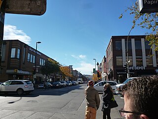
Saint Laurent Boulevard, also known as Saint Lawrence Boulevard, is a major street in Montreal, Quebec, Canada. A commercial artery and cultural heritage site, the street runs north–south through the near-centre of city and is nicknamed The Main, which is the abbreviation for "Main Street".

Sainte-Catherine Street is the primary commercial artery of Downtown Montreal, Quebec, Canada. It crosses the central business district from west to east, beginning at the corner of Claremont Avenue and de Maisonneuve Boulevard in Westmount, and ending at the Grace Dart Extended Care Centre by Assomption metro station, where it folds back into Notre-Dame Street. It also traverses Ville-Marie, passing just east of Viau in Mercier–Hochelaga-Maisonneuve. The street is 11.2 km long, and considered the backbone of Downtown Montreal.

Le Plateau-Mont-Royal is a borough (arrondissement) of the city of Montreal, Quebec, Canada.

Saint Denis Street is a major north–south thoroughfare in Montreal, Quebec.

Mile End is a neighbourhood and municipal electoral district in the city of Montreal, Quebec, Canada. It is located in the city’s Plateau-Mont-Royal borough.

Route 335 is a north-south regional route located on the north shore of the St. Lawrence River. from Montreal It serves the administrative regions of Montreal, Laval, Laurentides, and Lanaudière. It is the only secondary road whose route crosses the Island of Montreal. Between Autoroute 440 in Laval and Côte-Saint-Louis Road in Terrebonne, Route 335 is located in the right-of-way of the future Autoroute 19.

Park Extension is a neighbourhood in the city of Montréal, Québec. It is located in the borough of Villeray–Saint-Michel–Parc-Extension and has a population of 33,800 and an area of 1.6 km2. The name derives from the fact that it is situated at the north end of Park Avenue and is literally an "extension" of the artery. The area is known by locals as "Park Ex."

Park Avenue is one of central Montreal's major north-south streets. It derives its name from Mount Royal Park, by which it runs. Between Mount Royal Avenue and Pine Avenue, the street separates the eastern side of the mountain park and the smaller Jeanne Mance Park.

Sherbrooke Street is a major east–west artery and at 31.3 kilometres (19.4 mi) in length, is the second longest street on the Island of Montreal, Canada. The street begins in the town of Montreal West and ends on the extreme tip of the island in Pointe-aux-Trembles, intersecting Gouin Boulevard and joining up with Notre-Dame Street. East of Cavendish Boulevard this road is part of Quebec Route 138.

Peel Street (officially in French: rue Peel) is a major north–south street located in downtown Montreal, Quebec, Canada. The Street links Pine Avenue, near Mount Royal, in the north and Smith Street, in the Southwest borough, in the south. The street's southern end is at the Peel Basin of the Lachine Canal. The street runs through Montreal's shopping district. The Peel Metro station is named for the street.

De Maisonneuve Boulevard is a major westbound boulevard located in downtown Montreal, Quebec, Canada. It is named after the founder of Montreal, Paul Chomedey de Maisonneuve. It is a one-way street westbound.
Saint Joseph Boulevard is a major boulevard located east of Mount Royal in Montreal, Quebec, Canada. Although it is mainly residential, it is a major east–west artery in the Plateau Mont-Royal and the Rosemont–La Petite-Patrie boroughs. Its intersection with D'Iberville Street is known as the infamous Tunnel de la mort. Laurier metro station is located on the boulevard. It also intersects Route 335.
Pine Avenue is an east–west street in Montreal, Quebec, Canada. This street serves as the dividing line between the downtown Ville-Marie borough and borough of Le Plateau-Mont-Royal, and also serves as the northern border of the Golden Square Mile historic district, further west.
Papineau Avenue is the longest north–south street in Montreal, Quebec, Canada. The part of the street between Henri Bourassa Boulevard and Quebec Autoroute 40 is the Montreal portion of Quebec Autoroute 19, commonly referred to as Autoroute Papineau. North of Henri Bourassa Boulevard, it becomes a true autoroute before crossing the Rivière des Prairies on the Papineau-Leblanc Bridge. In the south, the avenue ends at Notre-Dame Street.

Christophe Colomb Avenue is a major north–south street in Montreal, Quebec, Canada. It has a length of 8.5 kilometres, and crosses the boroughs of Le Plateau-Mont-Royal, Rosemont-La Petite-Patrie, Villeray-Saint-Michel-Parc-Extension and Ahuntsic-Cartierville. The street is predominantly residential south of Villeray Street and is a large urban boulevard to the north. It is served primarily by the weekday only 13 Christophe Colomb route.

Laurier Avenue is a commercial and residential street in Montreal, Quebec, Canada. It crosses the boroughs of Outremont, Le Plateau-Mont-Royal and Rosemont–La Petite-Patrie. It is known for its cafés, restaurants and specialty stores, especially near Park Avenue and east of Sir Wilfrid Laurier Park.

D'Iberville Street is a north-south thoroughfare of Montreal.

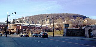
Côte-Sainte-Catherine Road is a street in Montreal, Quebec, Canada. It begins at the Décarie Expressway in Snowdon, part of the borough of Côte-des-Neiges–Notre-Dame-de-Grâce, and runs east and southeast along the periphery of Mount Royal to Park Avenue in the Plateau, terminating near Mount Royal Avenue. In between, it crosses Outremont completely and is one of the oldest streets in the borough, having been present at the time Outremont was incorporated in 1875. Outremont's borough hall is located on this street, as is Beaubien Park. Further west in Côte-des-Neiges, it houses the Jewish General Hospital, the CHU Sainte-Justine hospital, Collège Jean-de-Brébeuf, the Montreal Holocaust Museum, and the Segal Centre for Performing Arts.

