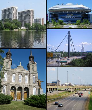
Laval is a city in Quebec, Canada. It is in the southwest of the province, north of Montreal. It is the largest suburb of Montreal, the third-largest city in the province after Montreal and Quebec City, and the thirteenth largest city in Canada, with a population of 443,192 in 2021.

Henri-Bourassa station is a Montreal Metro station in the borough of Ahuntsic-Cartierville in Montreal, Quebec, Canada. It is operated by the Société de transport de Montréal (STM) and serves the Orange Line. It is located in the Ahuntsic district. The station opened October 14, 1966, as part of the original network of the Metro. It was the eastern terminal of the Orange Line until 2007, when the line expanded to Montmorency station in Laval.
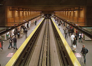
Cartier station is a Montreal Metro station in Laval, Quebec, Canada. It is operated by the Société de transport de Montréal (STM) and serves the Orange Line. Located in the Pont-Viau district, it is part of an extension into Laval, and opened on April 28, 2007.
Autoroute 25 is an Autoroute in the Lanaudière region of Quebec. It is currently 49 km (30.4 mi) long and services the direct north of Montreal's Metropolitan Area. A-25 has one toll bridge, which is the first modern toll in the Montreal area and one of two overall in Quebec.
Pont-Viau, Quebec is a district in the southern part of Laval, Quebec, Canada. It was a town before August 6, 1965. It was named after Viau Bridge, which links it to Ahuntsic-Cartierville in Montreal, Quebec.

Ahuntsic-Cartierville is a borough (arrondissement) of the city of Montreal, Quebec, Canada. The borough was created following the 2002 municipal reorganization of Montreal. It comprises two main neighbourhoods, Ahuntsic, a former village annexed to Montreal in 1910 and Cartierville, a town annexed to Montreal in 1916.

Montreal North is a borough within the city of Montreal, Canada. It consists entirely of the former city of Montreal North on the Island of Montreal in southwestern Quebec. It was amalgamated into the City of Montreal on January 1, 2002.

Autoroute 19, also known as Autoroute Papineau, is an autoroute in Quebec. It crosses the Rivière des Prairies via the Papineau-Leblanc Bridge, connecting the borough of Ahuntsic-Cartierville in Montreal and the Duvernay neighbourhood in Laval.

Route 335 is a north-south regional route located on the north shore of the St. Lawrence River. from Montreal It serves the administrative regions of Montreal, Laval, Laurentides, and Lanaudière. It is the only secondary road whose route crosses the Island of Montreal. Between Autoroute 440 in Laval and Côte-Saint-Louis Road in Terrebonne, Route 335 is located in the right-of-way of the future Autoroute 19.
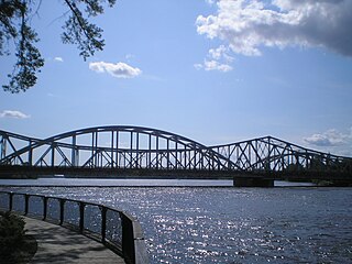
'Lachapelle Bridge', in French Pont Lachapelle, Also known as Cartierville Bridge.

The Bordeaux Railway Bridge is a railway bridge on the Canadian Pacific Railway line across the Rivière des Prairies between Ahuntsic-Cartierville, on Montreal Island, and Laval-des-Rapides, Laval, Quebec, Canada. This bridge is used by freight trains of the Canadian Pacific Railway (CPR), the Chemins de Fer Québec-Gatineau (CFQG) and by passenger suburban trains of Exo's Saint-Jerome line.

The Papineau-Leblanc Bridge was one of the first cable-stayed spans in North America. It is part of Quebec Autoroute 19 and is one of the connections between Laval and Montreal, Quebec, Canada, spanning Rivière des Prairies. It was fabricated from weathering steel and has an orthotropic deck. The freeway ends abruptly at the southern end of the bridge at the intersection of Henri Bourassa Boulevard, where Autoroute 19 follows Avenue Papineau down to Quebec Autoroute 40.
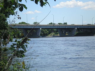
Médéric Martin Bridge is a viaduct-type bridge in Quebec, Canada that spans Rivière des Prairies between Montreal and Laval. It carries 8 lanes of Quebec Autoroute 15, including 1 reserved bus and carpooling lanes.
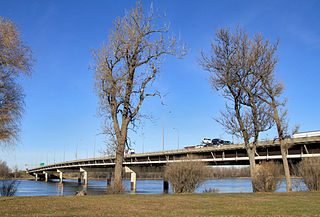
Louis Bisson Bridge spans the Rivière des Prairies between the eastern tip of Montreal's Pierrefonds-Roxboro borough and the district of Chomedey in Laval, Quebec, Canada. It carries 7 lanes of Quebec Highway 13, including one reversible lane at the centre. That lane is an example of a permanent zipper lane.
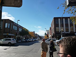
Papineau Avenue is the longest north–south street in Montreal, Quebec, Canada. The part of the street between Henri Bourassa Boulevard and Quebec Autoroute 40 is the Montreal portion of Quebec Autoroute 19, commonly referred to as Autoroute Papineau. North of Henri Bourassa Boulevard, it becomes a true autoroute before crossing the Rivière des Prairies on the Papineau-Leblanc Bridge. In the south, the avenue ends at Notre-Dame Street.

The Olivier Charbonneau Bridge is a toll bridge over the Rivière des Prairies, between Laval's St. François district and Montreal's Rivière-des-Prairies–Pointe-aux-Trembles borough. Along with the Serge-Marcil Bridge, it is one of two toll bridges in Quebec.
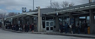
Henri Bourassa Boulevard is a major east–west street located in Montreal, Quebec, Canada. Located in the north of the island of Montreal, it runs parallel to Gouin Boulevard. Spanning 29 kilometres in length, it links the borough of Rivière-des-Prairies–Pointe-aux-Trembles in the east to a junction with Autoroute 13 and Alfred Nobel Boulevard in Saint-Laurent in the west. West of here, the street continues into the West Island as Hymus Boulevard, a main thoroughfare in Dorval, Pointe-Claire, and Kirkland.
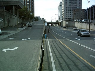
Berri Street is a major north–south street located in Montreal, Quebec, Canada. Berri Street links De la Commune Street in the south and Somerville Street in the north. The street is interrupted between Rosemont Boulevard and Jean Talon Street.
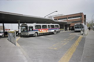
Terminus Henri-Bourassa is a Société de transport de Montréal bus terminus located at 590 Henri Bourassa Boulevard East next to the Henri-Bourassa Metro station.


