You can help expand this article with text translated from the corresponding article in French. (August 2025)Click [show] for important translation instructions.
Machine translation, like DeepL or Google Translate, is a useful starting point for translations, but translators must revise errors as necessary and confirm that the translation is accurate, rather than simply copy-pasting machine-translated text into the English Wikipedia.
Do not translate text that appears unreliable or low-quality. If possible, verify the text with references provided in the foreign-language article.
You must provide copyright attribution in the edit summary accompanying your translation by providing an interlanguage link to the source of your translation. A model attribution edit summary is Content in this edit is translated from the existing French Wikipedia article at [[:fr:Route 138 (Québec)]]; see its history for attribution.
You may also add the template {{Translated|fr|Route 138 (Québec)}} to the talk page.
From Tadoussac to Blanc-Sablon,[4] at the beginning of the 20th century, the first routes of what would become Route 138 (formerly Route 15) were laid in the vicinity of Sept-Îles. In 1961, a section was added from the Franquelin region to the tip of the Moisie River, some 20 kilometres east of Sept-Îles.
On the north shore of the Gulf of St. Lawrence, until 1976, there was no continuous route to go further east than the Moisie River. Only bits of paths here and there connect a few coastal villages to each other, Natashquan connects to Aguanish by a dirt road (1959).
Route 138, from Tadoussac to Havre-Saint-Pierre, opened in the spring of 1976, from there access to the islands of the Mingan Archipelago by sea.
In 1984, to commemorate the 450th anniversary of Jacques Cartier's arrival in New France, the Commission de toponymie gave this name to the part of Route 138 located east of the Saguenay River, that is, the part that extends from Tadoussac to Havre-Saint-Pierre.[5][6]
The Whale route - Route Jacques-Cartier - Route 138 East 1976
Since 2013, motorists can reach the small village of Kegaska, the westernmost village of the Lower North Shore.
Until the mid-1990s, the highway's eastern terminus was Havre-Saint-Pierre, but in 1996 the extension to Natashquan was completed. A 40km gravel section between Natashquan and Kegaska opened on September 26, 2013, with the inauguration of a bridge across the Natashquan River.[8][9]
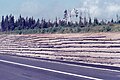
When planning Route 138, from Havre-Saint-Pierre to the Pashashibou River, the Quebec Ministry of Transport planned the installation of lookouts. Visual openness, proximity to an exceptional landscape, educational potential, as well as a tourist vocation play a determining role in the choice of sites.
The arrangement of lookouts invites travelers to stop in safe observation places, close to the road, preferably elevated and exposed to the winds to avoid the presence of insects.[10]
A second segment of about 17km extends from Tête-à-la-Baleine's airport, east through Tête-à-la-Baleine, to the ferry terminal southeast of Tête-à-la-Baleine. There is also a 10.7km roadway, la route Mecatina, from Mutton Bay to a ferry terminal in La Tabatière and continuing beyond.
A gap remains between Kegaska and Old Fort, through isolated communities accessible only by coastal ferry. On August 25, 2006, the Quebec government announced a 10-year project to connect the two segments by building 425km of highway along the Lower North Shore. In 2011, the Quebec government announced an additional $122 million investment for the project over five years as part of the Plan Nord.[13] However, by 2013 difficulties ensued between the Quebec Ministry of Transport and the Pakatan Corporation, who was previously responsible for managing the funding for this project, leading to the termination of agreement between the two. By this time only 12km of this road had been built, plus some additional engineering work and deforestation.[14] The construction of two segments of the highway (Kegaska–La Romaine and Tête-à-la-Baleine–La Tabatière) was set to begin in 2019. A total of $232 million will be contributed to this project.[15] In 2024 the province awarded contracts for engineering and construction of the route and bridges for the road segment between Kegaska and La Romaine.[16][17]
↑Ministère des transports, "Distances routières", page 66-69, Les Publications du Québec, 2005
12"Chemin du Roy, tourist route". Quebec Gouvernement. Bonjour Québec. 2024. Retrieved 15 June 2024. Route 138 runs along much of the Chemin du Roy, which starts from Repentigny, east of Montréal, and goes towards the city of Québec.
↑"Chemin du Roy, map tourist information"(PDF). Regions of Lanaudière, Mauricie and Capitale-Nationale (in French). 23 March 2021. Archived from the original(PDF) on 1 July 2024. Retrieved 15 June 2024. Downtime...so many attractions!
123"Come see the whales". Côte-Nord, between nature and excess. North Shore Tourism. 2024. Retrieved 4 June 2024. The tide, the underwater relief and the currents generate phenomenal concentrations of fish and plankton. No wonder the St. Lawrence is one of the best places in the world for whale watching: it's a real open-air buffet!
↑The Ages of Exploration. "Jacques Cartier". The Mariners' Museum and ParK. Retrieved 2024-01-13. Jacques Cartier is credited with discovering and claiming the land now known as Canada for France.
↑Pierre Frenette (2009). "North Shore, a land of convergence"(PDF) (in French). Les Éditions Histoire Québec. p.8. Retrieved 14 January 2024. Logger-farmers swapped axes, harrows, and horses for saws, truck steering wheels, and bulldozer levers
↑- Quebec Gouvernement (2024). "Rivière au Bouleau". Ministry of Transport and Sustainable Mobility (in French). Inventory and inspection of structures. Retrieved 24 May 2024. Bridge 14468 - Type: Steel girder bridge
↑"Rest areas of Quebec by region and by road". Ministry of Transport and Sustainable Mobility Quebec. 2024. Retrieved 16 July 2024. Lookouts Rest Areas with or without services. They include a parking area and typically offer an exceptional view of the surrounding landscape.
↑Fabien Lecours, landscape architect, project manager; Yves Bédard, biologist; Robert Langlois, urban planner; François Morneau, geomorphologist; Denis Roy, archaeologist (March 1989). "Sites proposed for the establishment of lookouts, Route 138 – Havre-Saint-Pierre at the Pashashibou River"(PDF) (in French). Ministry of Transport Quebec, Environmental Service. Retrieved 16 July 2024. ,,, the presence of several exceptional attractions in edge of this road encourages observation{{cite web}}: CS1 maint: multiple names: authors list (link)
This page is based on this Wikipedia article Text is available under the CC BY-SA 4.0 license; additional terms may apply. Images, videos and audio are available under their respective licenses.