Anjou, Quebec

Last updated • 2 min readFrom Wikipedia, The Free Encyclopedia

Anjou
Anjou.jpg
Logoanjou.png
Carte localisation Montreal - Anjou.svg
Anjou's location in Montreal
Coordinates: 45°36′24″N73°33′20″W / 45.60667°N 73.55556°W / 45.60667; -73.55556
CountryFlag of Canada (Pantone).svg  Canada
Province Flag of Quebec.svg  Quebec
City Montreal
Region Montréal
EstablishedFebruary 23, 1956
Merged into
Montreal
January 1, 2002
Electoral Districts
Federal

Honoré-Mercier
Provincial Anjou–Louis-Riel
Government
  TypeBorough
  Mayor Luis Miranda
  Federal MP(s) Pablo Rodríguez (LPC)
  Quebec MNA(s) Karine Boivin Roy (CAQ)
Area
  Land13.7 km2 (5.3 sq mi)
Population
 (2016) [4]
  Total
42,796
  Density3,128.4/km2 (8,103/sq mi)
  Dwellings
18,810
Time zone UTC−5 (Eastern (EST))
  Summer (DST) UTC−4 (EDT)
Postal code(s)
Area codes (514) and (438)
Access Routes [5] Quebec Autoroute 25.svgTrans-Canada Highway shield.svg A-25 (TCH)
Quebec Autoroute 40.svgTrans-Canada Highway shield.svg A-40 (TCH)
Website www.ville.montreal.qc.ca/anjou

Anjou (French pronunciation: [ɑ̃ʒu] ) is a borough ( arrondissement ) of the Canadian city of Montreal. Prior to its 2002 merger it was an independent city. Although it is no longer an independent city, it is still commonly known as known as Ville d'Anjou. Anjou has a predominantly Francophone population. [6]

Contents

Geography

The borough is located in the eastern end of the island of Montreal. The borough largely retained its former municipality logo, although the borough's logo is used on fleet vehicles without Montreal's logo. On fleet vehicles, the text reads "Ville de Montréal, arrondissement Anjou."

The borough is bordered to the north and east by Rivière-des-Prairies–Pointe-aux-Trembles, to the south by Mercier—Hochelaga-Maisonneuve and Montréal-Est, to the west by Saint-Léonard, and at the northwestern corner by Montréal-Nord.

It has an area of 13.7 km2 and a population of nearly 42,796.

Features

The borough is traversed by Autoroute 40 (Metropolitan Aut.) exits 80 and 82 located within its borders. Exits 6,7,8, (9 and 10 Northbound only) of Autoroute 25 (Louis-Hippolyte La Fontaine Aut.) are also located in Anjou. Among other attractions, it contains the large Les Galeries d'Anjou shopping mall which is one of the few mega malls located within the city of Montreal. The Blue line extension of the Montreal Metro which is expected to be completed in 2029 will have one new station located in Anjou with two entrances located on both sides of Autoroute 25. [7]

Federal and provincial elections

The entire borough is located within the federal riding of Honoré-Mercier, and within the provincial electoral district of Anjou–Louis-Riel. It is represented in the House of Commons by Pablo Rodriguez of the Liberal Party and in the National Assembly by Karine Boivin Roy of Coalition Avenir Québec.

Borough council

Following the 2021 Montreal municipal election, the current borough council consists of the following councilors: [8]

DistrictPositionName Party
Borough mayor
City councillor
Luis Miranda  Équipe Anjou
City councillor Andrée Hénault  Équipe Anjou
CentreBorough councillorKristine Marsolais Équipe Anjou
EastBorough councillorRichard Leblanc Équipe Anjou
WestBorough councillorMarie Josée Dubé Équipe Anjou

Demographics

Historical populations
YearPop.±%
196622,477    
197133,885+50.8%
197636,596+8.0%
198137,346+2.0%
198636,916−1.2%
199137,210+0.8%
1996 37,308+0.3%
2001 38,015+1.9%
2006 40,891+7.6%
2011 41,928+2.5%
2016 42,796+2.1%
Home language (2016) [4]
LanguagePopulationPercentage (%)
French 28,82576%
English 2,9058%
Other languages6,28016%
Mother tongue (2016) [4]
LanguagePopulationPercentage (%)
French 25,55563%
English 1,6304%
Other languages13,22033%
Visible Minorities (2016) [4]
EthnicityPopulationPercentage (%)
Not a visible minority28,41068.1%
Visible minorities 13,30031.9%

Education

Jean Corbeil Library Bibliotheque Jean-Corbeil 01.jpg
Jean Corbeil Library

The Centre de Service Scolaire de la Pointe-de-l'Île operates French-language public schools. The secondary school is the École secondaire d'Anjou . [9]

Primary schools [10]

The English Montreal School Board operates Anglophone public schools:

The borough has two libraries of the Montreal Public Libraries Network: Haut-Anjou and Jean-Corbeil. [12]

See also

Related Research Articles

<span class="mw-page-title-main">Honoré-Mercier (electoral district)</span> Federal electoral district in Quebec, Canada

Honoré-Mercier is a federal electoral district in Montreal, Quebec, Canada, that has been represented in the House of Commons of Canada since 1988.

<span class="mw-page-title-main">Mercier (federal electoral district)</span> Federal electoral district in Quebec, Canada

Mercier was a federal electoral district in Quebec, Canada, that was represented in the House of Commons of Canada from 1935 to 2004. In 2003, the district was abolished and split into the La Pointe-de-l'Île and Honoré-Mercier ridings. A provincial electoral district still exists under the same name but is located in Plateau Mont-Royal borough.

<span class="mw-page-title-main">LaSalle, Quebec</span> Borough of Montreal in Quebec, Canada

LaSalle is the most southerly borough (arrondissement) of the city of Montreal, Quebec, Canada. It is located in the south-west portion of the Island of Montreal, along the Saint Lawrence River. Prior to 2002, it was a separate municipality that had been incorporated in 1912.

<span class="mw-page-title-main">Saint-Leonard, Quebec</span> Borough of Montreal in Quebec, Canada

Saint-Leonard is a borough (arrondissement) of Montreal, Quebec, Canada. Formerly a separate city, it was amalgamated into the city of Montreal in 2002. The former city was originally called Saint-Leonard de Port Maurice after Leonard of Port Maurice, an Italian saint. The borough is home to Montreal's Via Italia.

<span class="mw-page-title-main">Verdun, Quebec</span> Borough of Montreal in Quebec, Canada

Verdun is a borough (arrondissement) of the city of Montreal, Quebec, located in the southeastern part of the island.

<span class="mw-page-title-main">Ville-Marie, Montreal</span> Borough in Quebec, Canada

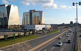
Ville-Marie is the name of a borough (arrondissement) in the centre of Montreal, Quebec. The borough is named after Fort Ville-Marie, the French settlement that would later become Montreal, which was located within the present-day borough. Old Montreal is a National Historic Site of Canada.

<span class="mw-page-title-main">Mercier–Hochelaga-Maisonneuve</span> Borough of Montreal in Quebec, Canada

Mercier–Hochelaga-Maisonneuve is a borough of Montreal, Quebec, Canada located in the southeastern end of the island.

<span class="mw-page-title-main">Le Sud-Ouest</span> Borough of Montreal in Quebec, Canada

Le Sud-Ouest is a borough (arrondissement) of the city of Montreal, Quebec, Canada.

<span class="mw-page-title-main">Ahuntsic-Cartierville</span> Borough of Montreal in Quebec, Canada

Ahuntsic-Cartierville is a borough (arrondissement) of the city of Montreal, Quebec, Canada. The borough was created following the 2002 municipal reorganization of Montreal. It comprises two main neighbourhoods, Ahuntsic, a former village annexed to Montreal in 1910 and Cartierville, a town annexed to Montreal in 1916.

<span class="mw-page-title-main">Montréal-Nord</span> Borough of Montreal North in Quebec, Canada

Montreal North is a borough within the city of Montreal, Canada. It consists entirely of the former city of Montreal North on the Island of Montreal in southwestern Quebec. It was amalgamated into the City of Montreal on January 1, 2002.

<span class="mw-page-title-main">L'Île-Bizard–Sainte-Geneviève</span> Borough of Montreal in Quebec, Canada

L'Île-Bizard–Sainte-Geneviève is a borough (arrondissement) of the city of Montreal.

<span class="mw-page-title-main">Pierrefonds-Roxboro</span> Borough of Montreal in Quebec, Canada

Pierrefonds-Roxboro is a borough of the city of Montreal. It was created January 1, 2006, following the demerger of parts of the city.

<span class="mw-page-title-main">Rivière-des-Prairies–Pointe-aux-Trembles</span> Borough of Montreal in Quebec, Canada

Rivière-des-Prairies–Pointe-aux-Trembles is a suburban borough (arrondissement) on the eastern tip of the city of Montreal, Quebec, Canada. It is located at the eastern end of the Island of Montreal.

<span class="mw-page-title-main">Mercier, Montreal</span> Neighbourhood in Montreal, Quebec, Canada

Mercier denotes the eastern portion of the Mercier–Hochelaga-Maisonneuve borough of the city of Montreal, Quebec. It consists of two neighbourhoods Mercier-Ouest (Longue-Pointe) and Mercier-Est (Tétreaultville).

<span class="mw-page-title-main">Pointe-aux-Trembles</span> Neighbourhood in Montreal, Quebec, Canada

Pointe-aux-Trembles was a municipality, founded in 1674, that was annexed by Montreal, Quebec, Canada, in 1982. This was the last city to be merged into Montreal until the 2002 municipal reorganization. On January 1, 2002 this neighbourhood at the far east end of the Island of Montreal became part of the borough of Rivière-des-Prairies–Pointe-aux-Trembles–Montréal-Est. On January 1, 2006 Montreal East demerged, and the borough became Rivière-des-Prairies–Pointe-aux-Trembles.

Rivière-des-Prairies was a municipality that was annexed by Montreal, Canada in 1963. On January 1, 2002, it became part of the borough of Rivière-des-Prairies–Pointe-aux-Trembles–Montréal-Est. On January 1, 2006 Montreal East demerged, and the borough became Rivière-des-Prairies–Pointe-aux-Trembles.

The Centre de services scolaire de la Pointe-de-l'Île (CSSPÎ) is an autonomous school service centre in Montreal, Quebec, Canada, based primarily in the city's east end, appointed by the Ministry of Education.

The Commission scolaire Jérôme-Le Royer was a Catholic school board located on the Island of Montreal in Quebec, Canada. It oversaw French and English schools in the former independent municipalities of Anjou, Saint-Leonard, and Montreal-Est as well as the city of Montreal's borough of Pointe-aux-Trembles

École secondaire d'Anjou is a francophone public co-educational secondary school located in most part in Mercier-Hochelaga-Maisonneuve borough and in small part in Anjou borough in Montreal. Part of the Commission scolaire de la Pointe-de-l'Île, it was originally in the catholic School board Commission scolaire Jérôme-Le Royer before the 1998 reorganization of School boards from religious communities into linguistic communities in Quebec. École secondaire d'Anjou offers regular and special education programs, welcoming classes, professional programs and adults programs. This school hosts actually 1,337 students and 67 teachers.

The Commission scolaire de la Pointe-de-l'Île (CSPÎ) was a francophone school board in Montreal, Quebec, Canada, based primarily in the city's east end. It served Montréal-Nord, Saint-Léonard, Anjou, and Rivière-des-Prairies–Pointe-aux-Trembles. It also served Montréal-Est, a municipality outside of the Montreal city limits. Its headquarters is in the Pointe-aux-Trembles area of Montreal.

References

  1. "Ministère des Affaires Municipales et Régions: Anjou". Archived from the original on 2013-01-06. Retrieved 2012-03-14.
  2. Parliament of Canada Federal Riding History: HONORÉ-MERCIER (Quebec)
  3. Chief Electoral Officer of Québec - 40th General Election Riding Results: ANJOU [ permanent dead link ]
  4. 1 2 3 4 "Arrondissement d'Anjou" (PDF). Sociodemographic Profile 2016 Census (in French). City of Montreal. May 2018. Archived from the original (PDF) on July 25, 2023.
  5. Official Transport Quebec Road Map
  6. Wellington, T. A. (2015-07-13). "My Montreal: Anjou & Other Quebec Curios". montrealrampage.com. Retrieved 2023-07-01.
  7. "Blue line extension". Société de transport de Montréal. Retrieved 2023-01-02.
  8. "Résultats détaillés pour chacun des postes électifs". Élections Montréal. November 8, 2011. Retrieved November 8, 2021.
  9. "Secondaire Archived 2015-03-31 at archive.today ." Commission scolaire de la Pointe-de-l'Île . Retrieved on December 8, 2014.
  10. "Primaire Archived 2015-03-31 at archive.today ." Commission scolaire de la Pointe-de-l'Île . Retrieved on December 8, 2014.
  11. "Dalkeith".
  12. "Les bibliothèques par arrondissement." Montreal Public Libraries Network. Retrieved on December 7, 2014.

45°36′N73°33′W / 45.600°N 73.550°W / 45.600; -73.550