Saint-Henri, Montreal

Last updated
Saint-Henri
Caserne St-Henri.jpg
Art deco 23 fire hall, Saint-Henri
Montreal-blank.png
Red pog.svg
Saint-Henri
Location of Saint-Henri in Montreal
Coordinates: 45°28′38″N73°35′11″W / 45.47716°N 73.58651°W / 45.47716; -73.58651
Country Canada
Province Quebec
City Montreal
Borough Le Sud-Ouest
Established1685
Population
 (2011) [1]
  Total15,800
Postal Code
H4C
Area code(s) 514, 438

Saint-Henri is a neighbourhood in southwestern Montreal, Quebec, Canada, in the borough of Le Sud-Ouest.

Contents

Saint-Henri is bounded to the east by Atwater Avenue, to the west by the town of Montreal West, to the north by Autoroute Ville-Marie (Route 136), and to the south by the Lachine Canal. [2]

Description

Saint-Henri is well known as a historically French-Canadian, Irish and black working class neighbourhood. Often contrasted with wealthy Westmount or NDG looking down over the Falaise Saint-Jacques, in recent years it has been strongly affected by gentrification.

The area—historically known as Les Tanneries because of the artisans' shops where leather tanning took place—was named for St. Henry via the Église Saint-Henri, which at one time formed Place Saint-Henri along with the community's fire and police station. The bustle of a nearby passenger rail station was immortalized in the song "Place St. Henri" (1964) by Oscar Peterson. [3]

Saint-Henri is part of the municipal district of Saint-Henri–Petite-Bourgogne–Pointe-Saint-Charles. The borough hall for Le Sud-Ouest is located in a converted factory in Saint-Henri, bearing witness to the borough's industrial heritage.

Also located in the neighbourhood is Solin Hall, a student residence of McGill University. The former chocolate factory is home to nearly 300 students, [4] and is the University's only off-campus residence.

There are two metro stations in Saint-Henri; Lionel-Groulx and Place-Saint-Henri.

History

Saint-Henri's Les Tanneries, 1859. Saint-Henri Montreal 1859.jpg
Saint-Henri's Les Tanneries, 1859.

Église Saint-Henri was so named to commemorate Fr. Henri-Auguste Roux (1798–1831), the superior of Saint-Sulpice Seminary. The municipality of Saint-Henri was formed in 1875, joining the village of Saint-Henri and the surrounding settlements of Turcot, Brodie, Saint-Agustin and Sainte-Marguerite into one administrative unit. [5] The municipality was incorporated into the City of Montreal in 1905. [5]

Well-known people from Saint-Henri include strongman Louis Cyr, who served as a police officer there; the Place des Hommes-Forts and the Parc Louis-Cyr are named for him. Celebrated jazz pianist Oscar Peterson grew up in Little Burgundy which is the neighbourhood adjacent to Saint-Henri. Stand-up comedian Yvon Deschamps has described the daily struggle of Saint-Henri's citizens with humorous melancholy.

Saint-Henri and Little Burgundy are divided by Atwater Avenue. Historically, Saint-Henri was occupied predominantly by French-Canadian blue-collar workers while Little Burgundy was occupied primarily by African-Canadians who worked on the railroads. Today both neighbourhoods have a population of varied ethnicity and social class, especially in the recent housing developments that have sprouted along the Lachine Canal. A great number of teenagers from neighbouring districts attend Polyvalente Saint-Henri and James Lyng High School (English Montreal School Board).

St-Henri housed the Victor Talking Machine Company's first factory space located in Canada where they produced flat discs, gramophones, radios, and military equipment for the Second World War. [6] Though the space has changed much over the years and the building is no longer in use as a factory of RCA Victor, there is a museum located in the old RCA building called le Musée des Ondes Emile Berliner. [7] The museum covers the life of Emile Berliner, inventor of the gramophone, as well as details the history of his inventions, as well as his company even after his family was no longer affiliated with it. The museum is a technology museum and explores the nature and science behind sound waves.

Many of the district's notable Art deco buildings, including Atwater Market and the historic No. 23 fire hall, were designed by Ludger Lemieux. [8] [9] [10]

The neighbourhood is served by the Lionel-Groulx and Place-Saint-Henri Metro stations.

Gentrification

Introduction

St-Henri is located in Le Sud-Ouest Borough, and became a part of the City of Montreal in 1905. Its proximity to the Lachine Canal shaped the neighbourhood with a large industrial working class. Industry lasted from the canal's opening in 1825, until its closure in 1970. [11] Its closure meant the predominantly working-class neighbourhood began to lose their jobs, creating thousands of unemployed labourers. [12] Saint-Henri became associated with poverty, marginality and squalor. [13] This deindustrialization rendered the neighbourhood an opportune site for gentrification. Sitting on valuable land bordered by the Lachine Canal and both the downtown and Old Montreal, St Henri became primed for redevelopment of old industrial buildings into parks, mixed use developments, condos, shops and restaurants. [14] This transformation began taking form when the Canal was reopened in 2002 with the presence of open park space and pedestrian and cyclist paths, bringing more residents and tourists to the area. [15] St Henri is seen by some as a victim of gentrification, characterized by the arrival of younger residents and the revitalization of the neighborhood with parks and commercial spaces. Once described as a working-class neighbourhood with factories, its contemporary form is a “lively and surprising borough” ranked as Montreal's second best neighbourhood for its livability and atmosphere. [16]

Evidence of gentrification in St. Henri

Changes to the demographic composition of a neighbourhood are an indicator of gentrification. Particularly, increased proportions of college educated residents and residents aged 25 to 34 years old have been found to signal gentrification. [17] This cohort's role in gentrification has been in part attributed to amenities in downtown areas which draw this "creative class" to neighbourhoods perceived as undervalued. [18]

In St. Henri, between 2001 and 2011, the proportion of residents aged 25–34 rose by seven percentage points : from 20.1% to 27.1%. [19] [20] By comparison, Montreal's share of residents aged 25–34 only increased from 16.3% [19] to 17.0%. [20] This overrepresentation of the 25-34-year-old age group reflects the gentrification of St. Henri. The progression of neighbourhood residents that are college graduates is less indicative of gentrification than the previous measure. However, during this period, the St. Henri neighbourhood goes from being below the city's average to above it with its share of residents having graduated from college increasing from 25.9% in 2001 (26.4% in Montreal) [19] to 43.1% in 2011 (41.5% in Montreal). [20]

Gentrification is most often associated with an increase in average neighbourhood income [21] . Contrasting the average household income of St. Henri residents with that of Montreal residents shows that the neighbourhood's revenues has comparatively increased. In 2001 the average household income in St.Henri was 29% lower than in Montreal. [19] In 2011, the average income in the neighbourhood decreased to about 17% lower than that of Montreal. [20]

The changes in availability of services is also telling of gentrification. From 1996 to 2011 rue Notre-Dame, a street which runs through the whole neighbourhood, has seen a considerable increase in the number of entrepreneurial services such as coffee shops and boutiques accompanied by a smaller increase in the number of corporate chains. [11] Conversely street-level vacant lots on this rue Notre-Dame decreased from 26.2% to 13.5%. [11]  

Everyday Politics and Resistance in St. Henri

In St. Henri, up-scale condominiums, boutique shops and other signs of gentrification have displaced, marginalized and stressed those of lower socio-economic status (SES). In response to gentrifying practices, inhabitants within the historically low-income neighbourhood have taken up various forms of everyday politics. The power on display in St. Henri can be understood as the increasingly prevalent neo-liberal order, resulting in a free market focus for urban planning initiatives (Rose, 2017). In St. Henri, everyday politics is a mode of resistance to the aforementioned powers by opposing oppressive and unjust treatment from powerful actors and broad social forces. [22] How subordinate inhabitants of St. Henri engage in this resistance can vary from informal behaviour to formally organized and confrontational acts, the former being everyday resistance. [22] Through the gentrification of St. Henri, everyday resistance must precede overt forms of resistance, suggesting that the neighbourhood has harboured this resistance, leading to more consistent resistance. Gentrification as a physical and social force, allows for everyday resistance to manifest into organized resistance, [22] garnering the attention of media outlets.

In 2016, a boutique grocery store known as ‘3734’ was vandalized by masked individuals, displaying anti-capitalist rhetoric and displeasure for the arrival of condos in St. Henri. [23] During a Halloween demonstration, the ‘Collective for an Autonomous Space’ rallied and marched for housing rights and alternatives to commercializing vacant properties. [24] With a surge of expensive condos being built in recent years replacing low-income options, dozens marched on Tenant's Day in 2016 organized by a coalition of actors, ending in front of the Quebec Minister of Economic Development office. [25] These organized forms of resistance, ranging from violent to peaceful, proceed with gentrification in St. Henri. In St. Henri, as gentrification proliferates, the inhabitants of the neighbourhood look toward more organized and targeted political activism to resist the powers of neo-liberal urban planning agendas. Resistance in St.Henri can be seen as collective action and people-led solutions to neighbourhood challenges. These solutions call upon formal authorities, resulting in programs affordable housing development initiatives and requirements by the Quebec government. [26]

Indirect displacements by gentrification

Concerning Twigge-Molecey [11] and the St Henri neighbourhood, inhabitants form social ties to others within their same neighbourhood. However, this is particularly true amongst low-income groups, as these people often do not have the opportunity to build a social network outside their living area. In a situation where their houses are repossessed, such people struggle to find new houses within the same neighbourhood and fail to remain socially integrated. As a result, they are forced to live elsewhere, where there is distance between them and their social circle in the previous neighbourhood. This particular scenario embodies a form of social displacement.

Moreover, the notion of “sense of place” is threatened by newcomers whose presence would change the character and cultural shape of the place. [27] Regarding gentrification in St Henri, conflicts emerged between lifelong low-income residents and incoming condominium dwellers, the latter denying their belonging to St Henri neighbourhood. Existing residents and newcomers also display forms of condescension and snobbery that create social separation between inhabitants of the same neighbourhood. Those behaviours underline the shifting of senses of place and highlight a cultural displacement. This type of displacement results “when the tastes, norms and desires of newcomers supplant and replace those of incumbent residents”. [28]

Finally, the cultural displacement is another indirect consequence caused by gentrification. In 2006 a new IGA supermarket opened in St Henri. Previously, residents relied on familial small-scale grocery stores, "depanneurs". Thus, low-income renters feel rejected from the neighbourhood by the presence of a grocery store. This feeling is also seen in the new renovated Louis Cyr park in St Henri. Since it has been rebuilt with the addition of two play areas for children, a soccer field, and a fenced in area for dogs located in the back of the park at the train tracks, it became attractive for dog-sitters who could now leave their dogs off leashes. As a result, it discouraged parents from letting their children play in those areas by fear of the aggressive dogs. [11] Overall, it appears that low-income residents suffer more from changes associated with gentrification through socioeconomic and cultural displacements.  

Depictions in literature and film

Gabrielle Roy in 1945 with boys from Saint-Henri, the working-class neighbourhood of Montreal where The Tin Flute takes place. Feature. St. Henri - Gabrielle Roy and Boys of St. Henri BAnQ P48S1P11917.jpg
Gabrielle Roy in 1945 with boys from Saint-Henri, the working-class neighbourhood of Montreal where The Tin Flute takes place.
Place Saint-Henri Place Saint-Henri 01.jpg
Place Saint-Henri

The district's working-class character was most memorably recorded by Gabrielle Roy in her novel The Tin Flute (Bonheur d'occasion).

Saint-Henri has been the subject of two National Film Board of Canada (NFB) documentaries, each capturing one day in the life of the district. In 1962 Hubert Aquin directed À St-Henri le cinq septembre (September Five at Saint-Henri). In 2010, director Shannon Walsh and producer Sarah Spring oversaw a crew of sixteen videographers as they followed area residents during one summer's day to make À St-Henri le 26 août, an NFB/Parabola Films co-production inspired by Aquin's cinéma-vérité classic. [29]

Notable people from Saint-Henri

See also

Related Research Articles

<span class="mw-page-title-main">Notre-Dame-de-Grâce</span> Neighbourhood in Montreal, Quebec, Canada

Notre-Dame-de-Grâce, also nicknamed NDG, is a residential neighbourhood of Montreal in the city's West End, with a population of 166,520 (2016). An independent municipality until annexed by the City of Montreal in 1910, NDG is today one half of the borough of Côte-des-Neiges–Notre-Dame-de-Grâce. It comprises two wards, Loyola to the west and Notre-Dame-de-Grâce to the east. NDG is bordered by four independent enclaves; its eastern border is shared with the City of Westmount, Quebec, to the north and west it is bordered by the cities of Montreal West, Hampstead and Côte-Saint-Luc. NDG plays a pivotal role in serving as the commercial and cultural hub for Montreal's predominantly English-speaking West End, with Sherbrooke Street West running the length of the community as the main commercial artery. The community is roughly bounded by Claremont Avenue to the east, Côte-Saint-Luc Road to the north, Brock Avenue in the west, and Highway 20 and the Saint-Jacques Escarpment to the south.

<span class="mw-page-title-main">Lachine Canal</span> Canal in southwestern Montreal, Canada

The Lachine Canal is a canal passing through the southwestern part of the Island of Montreal, Quebec, Canada, running 14.5 kilometres from the Old Port of Montreal to Lake Saint-Louis, through the boroughs of Lachine, Lasalle and Sud-Ouest.

<span class="mw-page-title-main">Verdun, Quebec</span> Borough of Montreal in Quebec, Canada

Verdun is a borough (arrondissement) of the city of Montreal, Quebec, located in the southeastern part of the island.

Pointe-Saint-Charles is a neighbourhood in the borough of Le Sud-Ouest in the city of Montreal, Quebec, Canada. Historically a working-class area, the creation of many new housing units, the recycling of industrial buildings into business incubators, lofts, and condos, the 2002 re-opening of the canal as a recreation and tourism area, the improvement of public spaces, and heritage enhancement have all helped transform the neighbourhood and attract new residents. Community groups continue to be pro-active in areas related to the fight against poverty and the improvement of living conditions.

<span class="mw-page-title-main">Griffintown</span> Neighbourhood in Montreal, Quebec, Canada

Griffintown is a historic neighbourhood of Montreal, Quebec, southwest of downtown. The area existed as a functional neighbourhood from the 1820s until the 1960s and was mainly populated by Irish immigrants and their descendants. Mostly depopulated since then, the neighbourhood has been undergoing redevelopment since the early 2010s.

<span class="mw-page-title-main">Ville-Marie, Montreal</span> Borough of Montreal in Quebec, Canada

Ville-Marie is the name of a borough (arrondissement) in the centre of Montreal, Quebec. The borough is named after Fort Ville-Marie, the French settlement that would later become Montreal, which was located within the present-day borough. Old Montreal is a National Historic Site of Canada.

<span class="mw-page-title-main">Le Sud-Ouest</span> Borough of Montreal in Quebec, Canada

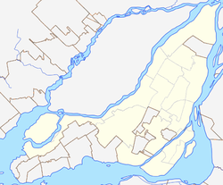
Le Sud-Ouest is a borough (arrondissement) of the city of Montreal, Quebec, Canada.

<span class="mw-page-title-main">Saint Jacques Street</span> Street in Montreal, Canada

Saint Jacques Street, or St. James Street, is a major street in Montreal, Quebec, Canada, running from Old Montreal westward to Lachine.

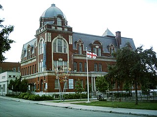
Ville-Émard is a neighbourhood located in the Sud-Ouest borough of Montreal, Quebec, Canada.

<span class="mw-page-title-main">Downtown Montreal</span> Neighbourhood, central business district of Montreal in Quebec, Canada

Downtown Montreal is the central business district of Montreal, Quebec, Canada.

<span class="mw-page-title-main">Atwater Market</span> Building in Atwater Street, Montreal

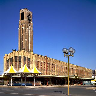
Atwater Market is a market hall located in the Saint-Henri area of Montreal, Quebec, Canada. It opened in 1933. The interior market is home to many butchers and the Première Moisson bakery and restaurant. The outside market has many farmers' stalls, which sell both local and imported produce, as well as two cheese stores, a wine store and a fish store.

<span class="mw-page-title-main">Little Burgundy</span> Neighbourhood in Montreal, Quebec, Canada

Little Burgundy is a neighbourhood in the South West borough of the city of Montreal, Quebec, Canada.

<span class="mw-page-title-main">Atwater Avenue</span>

Atwater Avenue is a major north–south street located in Montreal, Quebec, Canada. It links Doctor Penfield Avenue in the Ville-Marie borough to the north, and Henri Duhamel Street in the Verdun borough to the south. It is named for Edwin Atwater. The street runs through the Atwater Tunnel near the Atwater Market in Saint-Henri, before climbing and straddling the border of the city of Westmount.

The Canal de l'Aqueduc is an open-air aqueduct canal on the Island of Montreal in Quebec, Canada, serving part of the drinking water needs of the city of Montreal.

<span class="mw-page-title-main">Centre-Sud</span> Neighbourhood in Montreal, Quebec, Canada

The Centre-Sud is a neighbourhood located in the easternmost edge of the Ville-Marie borough of the city of Montreal.

<span class="mw-page-title-main">Côte-Saint-Paul</span> Neighbourhood in Montreal, Quebec, Canada

Côte-Saint-Paul is a neighbourhood located in the Southwest Borough of Montreal, Quebec, Canada.

<span class="mw-page-title-main">Benoit Dorais</span> Canadian politician

Benoit Dorais is a city councillor from Montreal, Quebec, Canada. He has served as the borough mayor of Le Sud-Ouest since 2009. From his first election to 2013, Dorais was a member of Vision Montreal, before joining Coalition Montréal in 2013 and Projet Montréal before the 2017 municipal election.

Jacqueline Montpetit is a politician in Montreal, Quebec, Canada. She served on the Montreal city council from 2001 to 2009 and was borough mayor of Le Sud-Ouest. Montpetit has also served as a school commissioner.
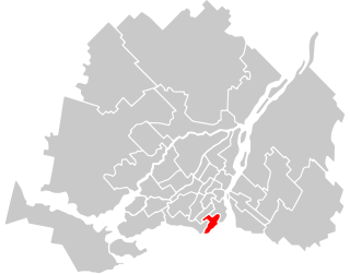
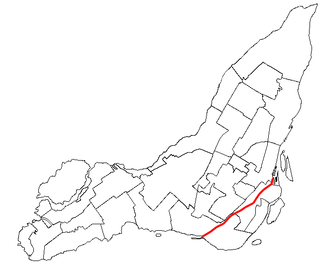
<span class="mw-page-title-main">Saint Patrick Street</span> Thoroughfare in Montreal, Canada

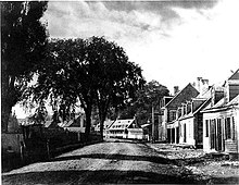
Saint Patrick Street is a street in Montreal, Quebec, Canada.

References

  1. 2011 Canadian census tracts 4620079 - 4620084
  2. http://ville.montreal.qc.ca/pls/portal/docs/page/lib_arr_fr/media/documents/carte_arr_sou.pdf [ bare URL PDF ]
  3. Place St. Henri. Retrieved 2015-08-23.
  4. "Solin Hall - Student Housing". McGill University. 12 February 2018.
  5. 1 2 "Industrial Architecture of Montreal: Saint-Henri". Canadian Architecture Collection, McGill University Library. Archived from the original on 13 June 2019. Retrieved 15 April 2024.
  6. "RCA Victor building". Héritage Montréal. Retrieved 2022-08-25.
  7. "Information". Musée des ondes Emile Berliner. Retrieved 2022-08-25.
  8. "Saint-Henri Fire Station". Images Montreal. Retrieved 2009-11-16.
  9. "Montreal Insites". Heritage Montreal. Retrieved 2009-11-15.
  10. "Trois architectes, trois quartiers : Ludger Lemieux (St. Henri), Ernest Cormier (Cité universitaire), Ernest Isbell Barott (St. Antoine)". Montreal: Canadian Centre for Architecture . Retrieved 2020-05-29.
  11. 1 2 3 4 5 Twigge-Molecey, A (2014). "Exploring Resident Experiences of Indirect Displacement in a Neighbourhood Undergoing Gentrification: The Case of Saint-Henri in Montréal". Canadian Journal of Urban Research. 23 (1): 1–22.
  12. Conrad; et al. (2015). History of the Canadian Peoples. Vol. 1, Beginnings to 1867. Pearson Canada Inc. pp. 275–300.
  13. García-Lamarca, Melissa. "Tensions amidst Saint-Henri, Montréal's development boom" . Retrieved 9 February 2024.
  14. "Canal de Lachine et son corridor industriel". Encyclopédie du patrimoine culturel de l'amérique française. Archived from the original on 2 December 2021. Retrieved 15 April 2024.
  15. "20 years of recreational navigation on the Lachine Canal: a retrospective on a colossal project". Parks Canada. Archived from the original on 16 March 2023. Retrieved 15 April 2024.
  16. "Saint-Henri". Les Quartiers du Canal. Retrieved 2020-07-26.
  17. Glaeser, Edward L.; Kim, Hyunjin; Luca, Michael (2018-05-01). "Nowcasting Gentrification: Using Yelp Data to Quantify Neighborhood Change". AEA Papers and Proceedings. 108: 77–82. doi: 10.1257/pandp.20181034 . ISSN   2574-0768.
  18. Glaeser, Edward L.; Shapiro, Jesse M. (2003). "Urban Growth in the 1990s: Is City Living Back?". Journal of Regional Science. 43 (1): 139–165. doi:10.1111/1467-9787.00293. ISSN   1467-9787. S2CID   154814351.
  19. 1 2 3 4 Ville de Montreal (2010). "Montréal en statistiques, Division des Affaires économiques et institutionnelles, Direction du développement économique et urbain. Profile de quartier: Saint-Henri, arrondissement du Sud-Ouest".
  20. 1 2 3 4 Ville de Montréal. (2014). Montréal en statistiques, Division de la planification urbaine, Direction de l’urbanisme . Profile de quartier : Saint-Henri, arrondissement du Sud-Ouest.
  21. Kayzar, Brenda; Derickson, Kate (2017-03-06), "Gentrification", in Richardson, Douglas; Castree, Noel; Goodchild, Michael F.; Kobayashi, Audrey (eds.), International Encyclopedia of Geography: People, the Earth, Environment and Technology, Oxford, UK: John Wiley & Sons, pp. 1–5, doi:10.1002/9781118786352.wbieg0317, ISBN   978-0-470-65963-2
  22. 1 2 3 Kerkvliet, Benedict J. Tria (2005-01-01). The Power of Everyday Politics. Cornell University Press. doi:10.7591/9781501722011. ISBN   978-1-5017-2201-1.
  23. Shingler. (2016). St-Henri looting puts spotlight on Montreal neighbourhood's  gentrification, CBC New. Retrieved from https://www.cbc.ca/news/canada/montreal/st-henri-montreal-looting-gentrification-1.3606859
  24. Parrillo. (2016). Saint-Henri demonstration denounces gentrification, Global News. Retrieved from https://globalnews.ca/news/3033689/saint-henri-demonstration-denounces-gentrification/
  25. CTV Montreal. (2016). Dozens protest in St. Henri in support of affordable apartments. Retrieved from https://montreal.ctvnews.ca/dozens-protest-in-st-henri-in-support-of-affordable-apartments-1.2872692
  26. Bemma, Adam. (2012). Montréal, tales of gentrification in a bohemian city. Retrieved from https://www.youtube.com/watch?v=va0JCg0j3fY
  27. Lippai, C. (2016). Space, Place and Politics. In Weberman D. & Moroni S. (Eds.), Space and Pluralism: Can Contemporary Cities Be Places of Tolerance? Budapest; New York: Central European University Press, 15-34. Retrieved from www.jstor.org/stable/10.7829/j.ctt1d4txn3.5
  28. Richardson, J. Mitchell, B. and Franco, J. (2019). Shifting Neighborhoods: Gentrification And Cultural Displacement In American Cities » NCRC. NCRC. Retrieved from https://ncrc.org/gentrification/
  29. Fraser, Malcolm (19 May 2011). "St-Henri revisited". Montreal Mirror . Archived from the original on 22 May 2011. Retrieved 21 May 2011.
  30. CBC Digital Archives. Retrieved 2019-12-28.