Jacques Cartier was a French-Breton maritime explorer for France. Jacques Cartier was the first European to describe and map the Gulf of Saint Lawrence and the shores of the Saint Lawrence River, which he named "The Country of Canadas" after the Iroquoian names for the two big settlements he saw at Stadacona and at Hochelaga.
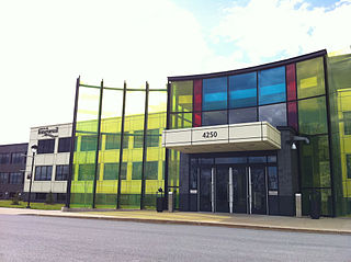
Longueuil is a city in the province of Quebec, Canada. It is the seat of the Montérégie administrative region and the central city of the urban agglomeration of Longueuil. It sits on the south shore of the Saint Lawrence River directly across from Montreal. The population as of the Canada 2021 Census totalled 254,483, making it Montreal's second largest suburb, the fifth most populous city in Quebec and twentieth largest in Canada.
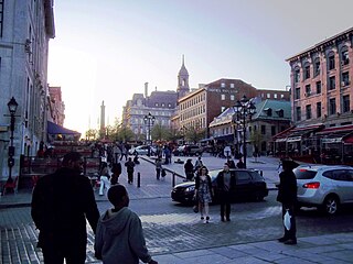
Place Jacques-Cartier is a square located in Old Montreal, Quebec, Canada. It is an entrance to the Old Port of Montreal.

Place-Saint-Henri station is a Montreal Metro station in the borough of Le Sud-Ouest in Montreal, Quebec, Canada. It is operated by the Société de transport de Montréal (STM) and serves the Orange Line. It is located in the Saint-Henri neighbourhood.

Ville-Marie is the name of a borough (arrondissement) in the centre of Montreal, Quebec. The borough is named after Fort Ville-Marie, the French settlement that would later become Montreal, which was located within the present-day borough. Old Montreal is a National Historic Site of Canada.

Le Sud-Ouest is a borough (arrondissement) of the city of Montreal, Quebec, Canada.

Ahuntsic-Cartierville is a borough (arrondissement) of the city of Montreal, Quebec, Canada. The borough was created following the 2002 municipal reorganization of Montreal. It comprises two main neighbourhoods, Ahuntsic, a former village annexed to Montreal in 1910 and Cartierville, a town annexed to Montreal in 1916.
Jules Lasalle is a Canadian sculptor living and working in Montreal. He has made many commemorative monuments that can be seen in Montreal, Longueuil, Quebec City, and other places.

La Fontaine Park is a 34 ha urban park located in the borough of Le Plateau-Mont-Royal in Montreal, Quebec, Canada. Named in honour of Louis-Hippolyte Lafontaine, The park's features include two linked ponds with a fountain and waterfalls, the Théâtre de Verdure open-air venue, the Calixa-Lavallée cultural centre, a monument to Adam Dollard des Ormeaux, playing fields and tennis courts.

Place Émilie-Gamelin is a city square in central Montreal, Quebec, Canada. It was created to mark the 350th anniversary of the city. Bordered by Berri Street, Saint Hubert Street, Sainte Catherine Street, and De Maisonneuve Boulevard, the square is adjacent to the entrances of transportation hubs Berri-UQAM Metro Station and the former Station centrale d'autobus, as well as the Université du Québec à Montréal and the Grande Bibliothèque du Québec.
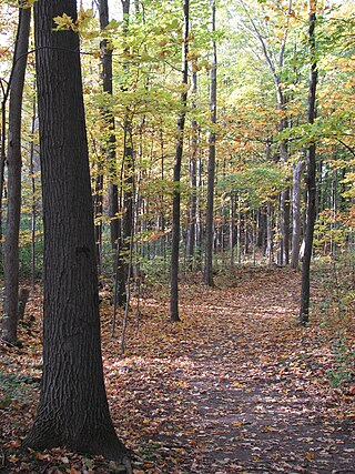
Cap-Saint-Jacques Nature Park is a large nature park in the Pierrefonds-Roxboro borough of Montreal, Quebec, Canada.

Saint Antoine Street, formerly known as Craig Street, is a street located in Montreal, Quebec, Canada. It runs to the south of Downtown Montreal and north of Old Montreal and Griffintown and Saint-Henri. It crosses the Quartier international de Montréal. Between Atwater Avenue and Greene Avenue, the north side of the street is in Westmount.

Nelson's Column is a monument, designed by Scottish architect Robert Mitchell and erected in 1809 in Place Jacques-Cartier, Montreal, Quebec, Canada, which is dedicated to the memory of Admiral Horatio Nelson, following his death at the Battle of Trafalgar. Subsequent to the destruction of Nelson's Pillar in Dublin (1808–1966), Montreal's pillar now stands as the second-oldest "Nelson's Column" in the world, after the Nelson Monument in Glasgow. It is also the city's oldest monument and is the oldest war monument in Canada.

The Sir George-Étienne Cartier Monument is a monument by sculptor George William Hill (1862–1934), with depiction of George-Étienne Cartier, located in Mount Royal Park in Montreal, Quebec, Canada.
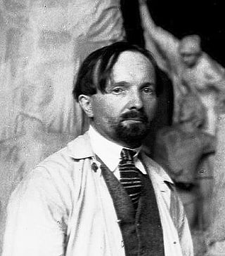
Alfred Laliberté was a French-Canadian sculptor and painter based in Montreal. His output includes more than 900 sculptures in bronze, marble, wood, and plaster. Many of his sculptures depict national figures and events in Canada and France such as Louis Hébert, François-Xavier-Antoine Labelle, Adam Dollard des Ormeaux, and the Lower Canada Rebellion. Although he produced hundreds of paintings as well, he is chiefly remembered for his work as a sculptor.

Parliament Hill is located in Quebec City in the borough of La Cité-Limoilou, specifically in districts of Vieux-Québec—Cap-Blanc—colline Parlementaire and Saint-Jean-Baptiste. In addition to the Parliament Building of Quebec, the Hill has a few shopping streets and residential areas and public green spaces. The hill on which it is located is the promontory of Quebec.
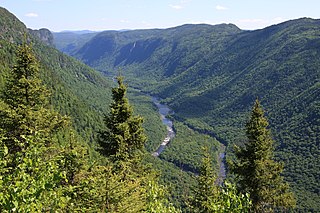
Réserve faunique des Laurentides, also known by its former name of parc des Laurentides, is a wildlife reserve in Quebec, Canada, located between Quebec City and the Saguenay–Lac-Saint-Jean region. This reserve is part of the network of wildlife reserves of Quebec (Canada) managed by the Ministry of Energy and Natural Resources (Quebec) and the Société des établissements de plein air du Québec. It is located halfway between Saguenay and Quebec.

