
Route 104 is an east/west highway on the south shore of the St. Lawrence River. Its eastern terminus is in Knowlton at the junction of Route 243 and its western terminus is in La Prairie at the junction of Route 134.

Route 243 is a north/south highway on the south shore of the Saint Lawrence River. Its northern terminus is in Saint-Félix-de-Kingsey at the junction of Route 255 and its southern terminus is in the township of Potton where it crosses the Canada–US border at the North Troy–Highwater Border Crossing into Vermont and becomes Vermont Route 243. Route 243 is not a busy highway as it does not go through big towns.

Route 232 is a two-lane east/west provincial highway on the south shore of the St. Lawrence River in the Bas-Saint-Laurent region of Eastern Quebec, Canada. Its eastern terminus is in Rimouski at the junction of Route 132 and the western terminus is at the junction of Route 289 in Rivière-Bleue. The route temporarily becomes A-85 along a 3 kilometre section through Cabano.

Route 289 is a two-lane north/south highway on the south shore of the Saint Lawrence River in the Bas-Saint-Laurent region of eastern Quebec, Canada. Its northern terminus is in Saint-André-de-Kamouraska at the junction of Route 132 and the southern terminus is at the border of New Brunswick where it continues as Route 120.

Route 287 is a 42 km two-lane north/south highway on the south shore of the Saint Lawrence River in the Bas-Saint-Laurent region of Eastern Quebec, Canada. Its northern terminus is in Saint-Denis-De La Bouteillerie at the junction of Route 132 and the southern terminus is at Lac de l'Est, part of the municipality of Mont-Carmel. About 10 km after Mont-Carmel, the route becomes a gravel road until the lake.

Route 204 is a finite two-lane east–west highway on the south shore of the Saint Lawrence River in Quebec. It is one of the longest secondary highways in the province. Its eastern terminus is in Saint-Jean-Port-Joli at the junction of Route 132 and the western terminus is in Lac-Mégantic at the junction of Route 161. Although it is numbered as an east–west highway, the road follows a north–south course from Saint-Jean-Port-Joli to Saint-Pamphile, where it then follows a mostly southwest–northeast course until Saint-Georges, where after crossing the Chaudière River, follows it in a north–south course until the source of the Chaudiere in Megantic Lake, in Lac-Mégantic.
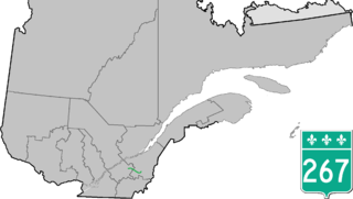
Route 267 is a two-lane north/south highway on the south shore of the Saint Lawrence River in Quebec, Canada. Its northern terminus is in Plessisville at the junction of Route 265, and the southern terminus is at the junction of Route 269 in Adstock.
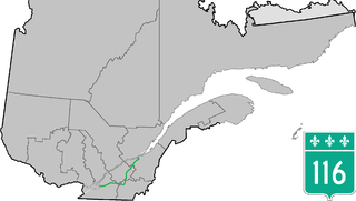
Route 116 is an east/west highway on the south shore of the St. Lawrence River in Quebec, Canada. It runs between Route 134 in Longueuil and Route 132 in Lévis, connecting the south shore areas of Montreal and Quebec City; it also serves the administrative regions of Montérégie, Centre-du-Québec, Estrie and Chaudière-Appalaches. Until the mid-1970s it was known as Route 9 between Le Moyne and Saint-Simon; Route 32 between Saint-Simon and Richmond; and Route 5 between Richmond and Saint-Nicolas.

Route 112 is a busy east–west highway on the south shore of the Saint Lawrence River in Quebec, Canada. Its eastern terminus is in Frampton at the junction of Route 275, and the western terminus is in Downtown Montreal, after crossing the Victoria Bridge. The stretch between Vallée-Jonction and Sherbrooke is a very busy highway as it is the main link between the southern regions of Quebec, in particular the Beauce region and the Eastern Townships. Between Sherbrooke and Marieville there is less traffic, since Autoroute 10 is in close proximity to the highway. From Marieville to Montreal it is a very busy highway, in most parts a four-lane separated highway, upgraded to freeway standards in certain places.

Route 165 is a 68 km north–south highway on the south shore of the Saint Lawrence River in Quebec, Canada. Its southern terminus is in Black Lake, now part of Thetford Mines, at the junction of Route 112 and its northern terminus is in Saint-Louis-de-Blandford at the junction of Autoroute 20. The stretch between Plessisville and Black Lake used to be Route 265 but it was re-numbered Route 165 in the 1990s.

Route 139 is a north/south highway on the south shore of the Saint Lawrence River. Its northern terminus is in Saint-Nicéphore, now part of Drummondville, at the junction of Route 143, and the southern terminus is in Abercorn at the border with Richford, Vermont at the Richford–Abercorn Border Crossing.

Route 137 is a north/south highway on the south shore of the Saint Lawrence River in Quebec, Canada. Its northern terminus is in Saint-Denis-sur-Richelieu, at the junction of Route 133, and the southern terminus is in Granby at the junction of Route 112.

Route 133 is a historic and heritage road of the Estrie and Montérégie regions in the province of Quebec, with north–south orientation and located on the eastern shore of the Richelieu River. Its northern terminus is in Sorel-Tracy, on the south shore of the Saint Lawrence River. The southern terminus is in Saint-Armand at the United States border with Vermont, close to Highgate Springs, where it continues southward past the Highgate Springs–St. Armand/Philipsburg Border Crossing as Interstate 89. Prior to the 1970s, the portion between the international border and Saint-Jean-sur-Richelieu was known as Route 7, which served as a continuation of US 7.
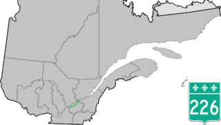
Route 226 is a two-lane east/west highway in Quebec, Canada. Its western terminus is at the junction of Route 132 in Pierreville and its eastern terminus is in Sainte-Croix at the junction of Route 271.

Route 344 is an east/west highway on the north shore of the Ottawa River in Quebec, Canada. Its western terminus is in Grenville-sur-la-Rouge at the junction of Autoroute 50, and its eastern terminus is in L'Assomption at the junction of Route 343. It follows the Ottawa River from Grenville-sur-la-Rouge to Saint-André-d'Argenteuil, where it follows the Lac des Deux Montagnes until Deux-Montagnes, where it follows the Rivière des Mille Îles until Repentigny, where it follows the Rivière l'Assomption until L'Assomption.

Route 230 is a two-lane east/west provincial highway on the south shore of the Saint Lawrence River in the Bas-Saint-Laurent region of Eastern Quebec, Canada. Its eastern terminus is in Saint-Alexandre-de-Kamouraska east of the junction of Route 289 and the western terminus is at the junction of Route 132 in La Pocatière.
Autoroute 85 is a Quebec Autoroute and the route of the Trans-Canada Highway in the province's Bas-Saint-Laurent region, also known as Autoroute Claude-Béchard. It is currently under construction with committed Federal and Provincial funding for its completion, with an estimated completion date of 2026. Once this upgrade is completed, it will close the last gap in the nearly continuous freeway section of the Trans-Canada between Arnprior, Ontario, and Antigonish, Nova Scotia, and for an even longer interprovincial freeway route between Windsor, Ontario and Halifax, Nova Scotia. Running between Rivière-du-Loup and a junction with New Brunswick Route 2 at the Quebec-New Brunswick border, A-85 when complete will be the only controlled access highway link between the Maritime Provinces and the rest of the country. A-85 is projected to be approximately 100 km (60 mi) long when construction is complete and is intended to replace Route 185, which has been called one of the deadliest highways in Canada.

Route 223 is a 128.6 km north/south highway on the south shore of the Richelieu River in Quebec. Its northern terminus is in Sorel-Tracy at the junction of Route 132 and its southern terminus is close to Lacolle, where it crosses the U.S. border at the Rouses Point–Lacolle 223 Border Crossing and continues into New York state as U.S. Route 11.

Deschaillons-sur-Saint-Laurent is a province of Québec municipality in Canada that is part of the regional county municipalities of Bécancour and the administrative region of Centre-du-Québec.
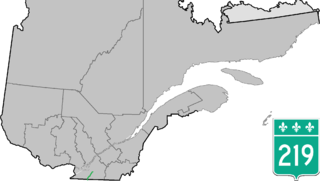
Route 219 is a provincial highway located in the Montérégie region of Quebec south of Montreal. It starts at the Mooers-Hemmingford Border Crossing south of Hemmingford and ends in Saint-Jean-sur-Richelieu.


