Route 243 is a north/south highway on the south shore of the Saint Lawrence River. Its northern terminus is in Saint-Félix-de-Kingsey at the junction of Route 255 and its southern terminus is in the township of Potton where it crosses the Canada–US border at the North Troy–Highwater Border Crossing into Vermont and becomes Vermont Route 243. Route 243 is not a busy highway as it does not go through big towns.

Route 287 is a 42 km two-lane north/south highway on the south shore of the Saint Lawrence River in the Bas-Saint-Laurent region of Eastern Quebec, Canada. Its northern terminus is in Saint-Denis at the junction of Route 132 and the southern terminus is at Lac de l'Est, part of the municipality of Mont-Carmel. About 10 km after Mont-Carmel, the route becomes a gravel road until the lake.

Route 204 is a finite two-lane east/west highway on the south shore of the Saint Lawrence River in Quebec. It is one of the longest secondary highways in the province. Its eastern terminus is in Saint-Jean-Port-Joli at the junction of Route 132 and the western terminus is in Lac-Mégantic at the junction of Route 161. Although it is numbered as an east/west highway, the road follows a north/south course from Saint-Jean-Port-Joli to Saint-Pamphile, where it then follows a mostly southwest/northeast course until Saint-Georges, where after crossing the Chaudière River, follows it in a north/south course until the source of the Chaudiere in Megantic Lake, in Lac-Mégantic.
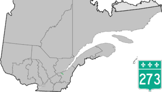
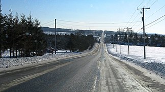
Route 273 is a short 21 km long, two-lane north/south highway on the south shore of the Saint Lawrence River in Quebec, Canada. Its northern terminus is in Saint-Antoine-de-Tilly at the junction of Route 132, and the southern terminus is at the junction of Route 269 near Saint-Gilles.

Route 108 is a two-lane east/west highway on the south shore of the Saint Lawrence River in the Eastern Townships and Chaudière-Appalaches regions of Quebec, Canada. Its eastern terminus is in Beauceville at the junction of Route 173, and the western terminus is at the junction of Route 112 in Magog.

Route 112 is a busy east/west highway on the south shore of the Saint Lawrence River in Quebec, Canada. Its eastern terminus is in Frampton at the junction of Route 275, and the western terminus is in Downtown Montreal, after crossing the Victoria Bridge. The stretch between Vallée-Jonction and Sherbrooke is a very busy highway as it is the main link between the southern regions of Quebec, in particular the Beauce region and the Eastern Townships. Between Sherbrooke and Marieville there is less traffic, since Autoroute 10 is in close proximity to the highway. From Marieville to Montreal it is a very busy highway, in most parts a four-lane separated highway, upgraded to freeway standards in certain places.

Route 143 is a north/south highway on the south shore of the Saint Lawrence River. Until the mid-1970s when the province decided to renumber all highways other than autoroutes, it was known as Route/Highway 5. Its northern terminus is in Saint-François-du-Lac, at the junction of Route 132, and the southern terminus is in Stanstead at the border with Vermont where the road continues past the Derby Line–Stanstead Border Crossing as U.S. Route 5 through Derby Line to New Haven, Connecticut.

Route 141 is a north/south highway in Quebec on the south shore of the Saint Lawrence River. Its northern terminus is in Magog at the junction of Route 112 and Autoroute 10, and the southern terminus is in Saint-Herménégilde at the United States border in Canaan, Vermont.
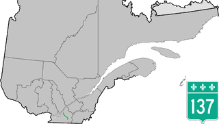
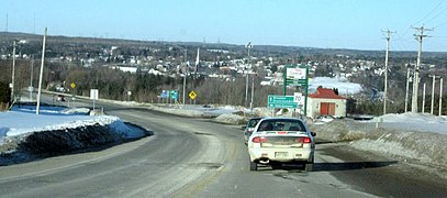
Route 137 is a north/south highway on the south shore of the Saint Lawrence River in Quebec, Canada. Its northern terminus is in Saint-Denis-sur-Richelieu, at the junction of Route 133, and the southern terminus is in Granby at the junction of Route 112.

Route 133 is a historic and heritage road of the Montérégie region in the province of Quebec, with north/south orientation and located on the eastern shore of the Richelieu River. Its northern terminus is in Sorel-Tracy, on the south shore of the Saint Lawrence River. The southern terminus is in Saint-Armand at the United States border with Vermont, close to Highgate Springs, where it continues southward past the Highgate Springs–St. Armand/Philipsburg Border Crossing as Interstate 89. Prior to the 1970s, the portion between the international border and Saint-Jean-sur-Richelieu was known as Route 7, which served as a continuation of US 7.

Route 255 is a north/south highway on the south shore of the St. Lawrence River. Its northern terminus is in Baie-du-Febvre at the junction of Route 132 and its southern terminus is in Bury at the junction of Quebec Route 214.

Route 230 is a two-lane east/west provincial highway on the south shore of the Saint Lawrence River in the Bas-Saint-Laurent region of Eastern Quebec, Canada. Its eastern terminus is in Saint-Alexandre-de-Kamouraska east of the junction of Route 289 and the western terminus is at the junction of Route 132 in La Pocatière.

Route 247 is a north/south highway on the south shore of the Saint Lawrence River in the Estrie region of Quebec. Its northern terminus is in Magog at the junction of Route 112 and its southern terminus is in Stanstead, at the junction of Autoroute 55 less than 1 kilometre north of the Canada–United States border.

Route 111 is a north/south highway on the north shore of the Saint-Lawrence River in the Abitibi-Témiscamingue region of Quebec, Canada. Its northern terminus is in the municipality of Baie-James at the junction of Route 393, and its southern terminus is in Val-d'Or at the junction of Route 117.

Route 155 is a north/south highway on the north shore of the Saint Lawrence River in Quebec, Canada. Its northern terminus is in Chambord at the junction of Route 169, and the southern terminus is the Piles Bridge in Shawinigan. Previously the highway continued to Autoroute 20 but that section was decommissioned in 2006 when Autoroute 55 was completed.

Cable Axion is a cable television distributor and Internet service provider based at Magog, Quebec.

Route 309 is a provincial highway located in the Outaouais region in western Quebec. It starts at the junction of Autoroute 50 in the Buckingham sector, in the city of Gatineau's east end. It runs mostly parallel to the Du Lièvre River and ends north of Mont-Laurier in the town of Sainte-Anne-du-Lac in the Upper Laurentians.
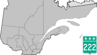
Route 222 is a provincial highway located in the Estrie region of Quebec, Canada. The 61 km (38 mi) highway runs from the junction of Route 139 in Roxton Falls and ends at the junction of Route 143 in Sherbrooke just east of Autoroute 55. It also has a brief concurrency with Route 243 in Racine.
The Centre de services scolaire des Sommets is a French-language, school board operating in the province of Quebec, Canada. The school board, based in Magog, covers towns in the Eastern Townships of Quebec, specifically the towns of Magog, Asbestos, Windsor in an area around the city of Sherbrooke.

The rivière au Saumon is a tributary of the Saint-François River, on the South Shore of the Saint Lawrence River, in the province of Quebec, Canada. The river has a basin of 291 km2 (112 sq mi) and has its source in lake Brompton.