
Maskinongé is a regional county municipality in the Mauricie region of Quebec, Canada. The seat is Louiseville. It is located adjacent on the west of Trois-Rivières on the Saint Lawrence River.

Route 138 is a major highway in the Canadian province of Quebec, following the entire north shore of the Saint Lawrence River past Montreal to the temporary eastern terminus in Kegashka on the Gulf of Saint Lawrence. The western terminus is in Elgin, at the border with New York State south-west of Montreal. Part of this highway is known as the Chemin du Roy, or King's Highway, which is one of the oldest highways in Canada.

Route 243 is a north/south highway on the south shore of the Saint Lawrence River. Its northern terminus is in Saint-Félix-de-Kingsey at the junction of Route 255 and its southern terminus is in the township of Potton where it crosses the Canada–US border at the North Troy–Highwater Border Crossing into Vermont and becomes Vermont Route 243. Route 243 is not a busy highway as it does not go through big towns.

Route 216 is a two-lane east/west highway in Quebec, Canada, which starts in Sainte-Catherine-de-Hatley in the Estrie region at the junction of Route 108 and ends in Sainte-Perpétue in Chaudière-Appalaches at the junction of Route 204.
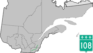
Route 108 is a two-lane east/west highway on the south shore of the Saint Lawrence River in the Eastern Townships and Chaudière-Appalaches regions of Quebec, Canada. Its eastern terminus is in Beauceville at the junction of Route 173, and the western terminus is at the junction of Route 112 in Magog.

Route 112 is a busy east/west highway on the south shore of the Saint Lawrence River in Quebec, Canada. Its eastern terminus is in Frampton at the junction of Route 275, and the western terminus is in Downtown Montreal, after crossing the Victoria Bridge. The stretch between Vallée-Jonction and Sherbrooke is a very busy highway as it is the main link between the southern regions of Quebec, in particular the Beauce region and the Eastern Townships. Between Sherbrooke and Marieville there is less traffic, since Autoroute 10 is in close proximity to the highway. From Marieville to Montreal it is a very busy highway, in most parts a four-lane separated highway, upgraded to freeway standards in certain places.
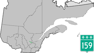
Provincial Highway 159 is a two-lane north/south highway on the north shore of the Saint Lawrence River in Quebec, Canada. Its northern terminus is in Saint-Roch-de-Mékinac at the junction of Route 155, and the southern terminus is at the junction of Route 138 in Sainte-Anne-de-la-Pérade.

Route 143 is a north/south highway on the south shore of the Saint Lawrence River. Until the mid-1970s when the province decided to renumber all highways other than autoroutes, it was known as Route/Highway 5. Its northern terminus is in Saint-François-du-Lac, at the junction of Route 132, and the southern terminus is in Stanstead at the border with Vermont where the road continues past the Derby Line–Stanstead Border Crossing as U.S. Route 5 through Derby Line to New Haven, Connecticut.
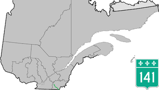
Route 141 is a north/south highway in Quebec on the south shore of the Saint Lawrence River. Its northern terminus is in Magog at the junction of Route 112 and Autoroute 10, and the southern terminus is in Saint-Herménégilde at the United States border in Canaan, Vermont.

Route 117 is a provincial highway within the Canadian province of Quebec, running between Montreal and the Quebec/Ontario border where it continues as Highway 66 east of Kearns, Ontario. It is an important road as it is the only direct route between southern Quebec and the Abitibi-Témiscamingue region.
Saint-François is a provincial electoral district in the Estrie region of Quebec, Canada that elects members to the National Assembly of Quebec. It includes the Brompton, Fleurimont and Lennoxville boroughs of the city of Sherbrooke, as well as also various other municipalities.
Brome-Missisquoi is a provincial electoral district in the Montérégie region of Quebec, Canada that elects members to the National Assembly of Quebec. It includes the municipalities of Bromont, Cowansville, Frelighsburg, Sutton, Saint-Armand and Farnham.

Route 309 is a provincial highway located in the Outaouais region in western Quebec. It starts at the junction of Autoroute 50 in the Buckingham sector, in the city of Gatineau's east end. It runs mostly parallel to the Du Lièvre River and ends north of Mont-Laurier in the town of Sainte-Anne-du-Lac in the Upper Laurentians.
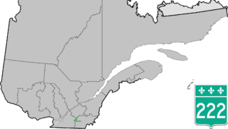
Route 222 is a provincial highway located in the Estrie region of Quebec, Canada. The 61 km (38 mi) highway runs from the junction of Route 139 in Roxton Falls and ends at the junction of Route 143 in Sherbrooke just east of Autoroute 55. It also has a brief concurrency with Route 243 in Racine.

Route 225 is a provincial highway located in the Montérégie region of Quebec. The route starts at the Canada-United States border at the Alburgh–Noyan Border Crossing in Noyan and runs north along the eastern shores of the Richelieu River, ending in Sainte-Anne-de-Sabrevois at the junction of Route 133.
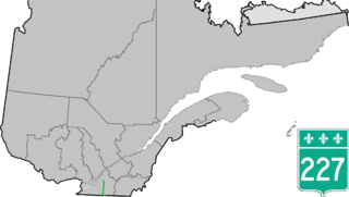
Route 227 is a provincial highway located in the Montérégie region of Quebec. The highway runs from Venise-en-Québec at the junction of Route 202 in the northwestern shores of Lake Champlain and ends at the junction of Autoroute 20 in Sainte-Marie-Madeleine, near Mont-Saint-Hilaire. It briefly overlaps Route 229 in Saint-Jean-Baptiste.

Route 333 is a short provincial highway located in the Laurentides region of Quebec. It runs for 16 kilometers from Saint-Jérôme at the junction of Route 117 to Saint-Hippolyte and serves mainly several large lakes located between Sainte-Adèle and Saint-Jérôme.

Route 347 is a provincial highway located in the Lanaudière region of Quebec. The 97-kilometer highway runs from Sainte-Geneviève-de-Berthier at the junction of Route 158 north of Autoroute 40 and ends in Notre-Dame-de-la-Merci at the junction of Route 125. In Saint-Gabriel-de-Brandon, it overlaps Route 348 while between north of Saint-Jean-de-Matha and Saint-Émélie-de-L'Énergie it overlaps Route 131.
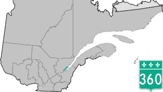
Route 360 is a provincial highway located in the Capitale-Nationale region in the south central part of the province of Quebec. The highway runs from Quebec City's Beauport sector and ends at the junction of Route 138 northeast of Saint-Tite-des-Caps in the Charlevoix region. For a large portion of its length it runs right beside Route 138, overlapping it briefly near Beaupré. The road also travels through significant portions of the Charlevoix touristic area and also crosses Mont-Sainte-Anne ski resort and the Montmorency Falls located at the Montmorency River which connects the Saint Lawrence River nearby.

Sainte-Anne-de-la-Rochelle is a community in Quebec, Canada, situated within the Regional County Municipality of Le Val-Saint-François in the administrative region of Estrie.


