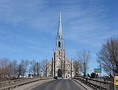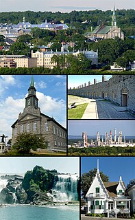
Lévis is a city in eastern Quebec, Canada, located on the south shore of the St. Lawrence River, opposite Quebec City. A ferry links Old Quebec with Old Lévis, and two bridges, the Quebec and the Pierre-Laporte, connect western Lévis with Quebec City.

Beauce is a federal electoral district in Quebec, Canada, that has been represented in the House of Commons of Canada since 1867. In 2006, it had a population of 103,617 people, of whom 82,123 were eligible voters.
Bellechasse was a federal electoral district in Quebec, Canada, that was represented in the House of Commons of Canada from 1867 until the 1997 election, when it became Bellechasse—Etchemins—Montmagny—L'Islet. After redistribution prior to the 2004 election, that riding became Lévis—Bellechasse. Currently, the only riding which includes the name "Bellechasse" is Bellechasse—Les Etchemins—Lévis.

Bellechasse—Les Etchemins—Lévis is a federal electoral district in Quebec, Canada, that has been represented in the House of Commons of Canada since 2004. It was created in 2003 from Lévis-et-Chutes-de-la-Chaudière and Bellechasse—Etchemins—Montmagny—L'Islet ridings.

Lévis—Lotbinière is a federal electoral district in the province of Quebec, Canada, that has been represented in the House of Commons of Canada since 2004.
Lévis was a federal electoral district in Quebec, Canada, that was represented in the House of Commons of Canada from 1867 to 2004. It was created by the British North America Act, 1867. From 1998 to 2003, it was known as Lévis-et-Chutes-de-la-Chaudière. It was abolished in 2003 when it was redistributed into Lévis—Bellechasse and Lotbinière—Chutes-de-la-Chaudière ridings.
Lotbinière was a federal electoral district in Quebec, Canada, that was represented in the House of Commons of Canada from 1867 to 2004.

Autoroute 20 is a Quebec Autoroute, following the Saint Lawrence River through one of the more densely populated parts of Canada, with its central section forming the main route of the Trans-Canada Highway from the A-25 interchange to the A-85 interchange. At 585 km (363.5 mi), it is the longest Autoroute in Quebec. It is one of two main links between Montreal and Quebec City; the other is the A-40.
Nicolet—Yamaska was a federal electoral district in Quebec, Canada, that was represented in the House of Commons of Canada from 1935 to 1968.

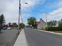
Route 173 (Route-du-Président-Kennedy) is a major north/south highway on the south shore of the St. Lawrence River in Quebec, Canada, named after the assassinated American president, John F. Kennedy. Its southern terminus is at the Armstrong-Jackman Border Crossing in Saint-Théophile in the hamlet of Armstrong, at the border with Maine, and its northern terminus is in Lévis at the junction of Route 132. Route 173 follows the Chaudière River for most of its course, from Saint-Georges, up to Scott, where the route takes a more northeastern route towards Lévis, crossing the Etchemin River in the municipality of Saint-Henri-de-Lévis.

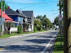
Saint-Henri is a municipality of 4,784 people, 20 km south of Lévis, in the Bellechasse Regional County Municipality. It is sometimes known as Saint-Henri-de-Lévis, and was historically known as Saint-Henri-de-Lauzon.

Route 271 is a two-lane north/south highway on the south shore of the Saint Lawrence River in Quebec, Canada. Its northern terminus is in Sainte-Croix at the junction of Route 132, and the southern terminus is at the junction of Route 173 in Saint-Georges.
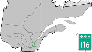
Route 116 is an east/west highway on the south shore of the Saint Lawrence River in Quebec, Canada. Until the mid-1970s it was known as Route 9. Its eastern terminus is in Lévis at the junction of Route 132, and the western terminus is at the junction of Route 134 in Lemoyne part of a concurrency with Route 112 until Saint-Hubert just south of the Saint-Hubert Municipal Airport. The stretch between Lévis and Plessisville does not have much traffic, since Autoroute 20 is not that far from the highway. Between Plessisville and Richmond traffic is heavier as it passes bigger towns, and it is further away from Autoroute 20. From Richmond to Autoroute 20, it is quiet again, before reaching Saint-Hyacinthe, where it becomes a busy four-lane separated highway, going through the growing "South Shore" suburbs of Montreal. From the junction of Autoroute 30 to its western terminus, it is a controlled-access Autoroute-grade expressway. This portion was once envisioned to be part of Autoroute 16. An unofficial extension of Route 116 as thought of by locals, from the western terminus follows the Route 134 limited access expressway to the Jacques Cartier Bridge.

Route 171 is a north/south highway on the south shore of the St. Lawrence River in Quebec, Canada. Its southern terminus is in Scott at the junction of Route 173 and its northern terminus is in Lévis at the junction of Route 132. Route 171 follows the Chaudière River for most of its course, from the former town of Saint-Étienne-de-Lauzon up to Scott.

Route 175 is a major north–south highway on both sides of the St. Lawrence River in Quebec, Canada. Its southern terminus is in Saint-Lambert-de-Lauzon at the junction of Route 218 and its northern terminus is in Saguenay at the junction of Route 172, in the former city of Chicoutimi. Route 175 crosses the Saint Lawrence River on the Quebec Bridge, and a little further north of downtown Quebec City, it merges with Autoroute 73 for about 30 km before continuing through the Laurentides Wildlife Reserve as a two-lane divided highway in Stoneham.

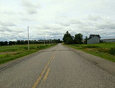
Route 277 is a two-lane north/south highway in the Chaudière-Appalaches region in the province of Quebec, Canada. Its northern terminus is in Saint-Henri at the junction of Route 173 and its southern terminus is in Sainte-Aurélie at the junction of Route 275.
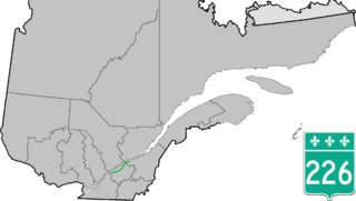
Route 226 is a two-lane east/west highway in Quebec, Canada. Its western terminus is at the junction of Route 132 in Pierreville and its eastern terminus is in Sainte-Croix at the junction of Route 271.

Cable Axion is a cable television distributor and Internet service provider based at Magog, Quebec.
Ligue Interzone de hockey mineur BC Rive Nord is an ice hockey league Based in the Quebec Metropolitan Area. It regroups many levels of hockey from Atom to Junior. It has two junior levels, Junior "A" and Junior "B".
The Rivière aux Pins is a tributary of the Beaurivage River which is a tributary of the west bank of the Chaudière River. It flows in the municipalities of Saint-Agapit and Saint-Gilles in the Lotbinière Regional County Municipality, in the administrative region of Chaudière-Appalaches, in Quebec, in Canada.