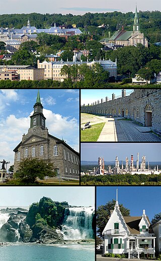
Lévis is a city in eastern Quebec, Canada, located on the south shore of the St. Lawrence River, opposite Quebec City. A ferry links Old Quebec with Old Lévis, and two bridges, the Quebec and the Pierre-Laporte, connect western Lévis with Quebec City.

Route 281 is a 75 km two-lane north/south highway in the Chaudière-Appalaches region in the province of Quebec, Canada. Its northern terminus is in St-Michel at the junction of Route 132 and its southern terminus is close to Saint-Camille-de-Lellis at the junction of Route 204.
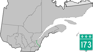
Route 173 (Route-du-Président-Kennedy) is a major north/south highway on the south shore of the St. Lawrence River in Quebec, Canada, named after the assassinated American president, John F. Kennedy. Its southern terminus is at the Armstrong-Jackman Border Crossing in Saint-Théophile in the hamlet of Armstrong, at the border with Maine, and its northern terminus is in Lévis at the junction of Route 132. Route 173 follows the Chaudière River for most of its course, from Saint-Georges, down to Scott, where the route takes a more northeastern route towards Lévis, crossing the Etchemin River in the municipality of Saint-Henri-de-Lévis.
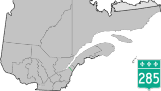
Route 285 is a 48 km two-lane north/south highway on the south shore of the Saint Lawrence River in the Chaudière-Appalaches region of Quebec, Canada. Its northern terminus is in L'Islet at the junction of Route 132 and the southern terminus is close to Saint-Adalbert at the junction of Route 204.

Route 204 is a finite two-lane east/west highway on the south shore of the Saint Lawrence River in Quebec. It is one of the longest secondary highways in the province. Its eastern terminus is in Saint-Jean-Port-Joli at the junction of Route 132 and the western terminus is in Lac-Mégantic at the junction of Route 161. Although it is numbered as an east/west highway, the road follows a north/south course from Saint-Jean-Port-Joli to Saint-Pamphile, where it then follows a mostly southwest/northeast course until Saint-Georges, where after crossing the Chaudière River, follows it in a north/south course until the source of the Chaudiere in Megantic Lake, in Lac-Mégantic.
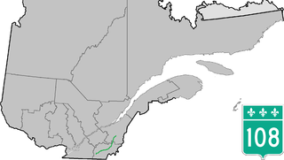
Route 108 is a two-lane east/west highway on the south shore of the Saint Lawrence River in the Eastern Townships and Chaudière-Appalaches regions of Quebec, Canada. Its eastern terminus is in Beauceville at the junction of Route 173, and the western terminus is at the junction of Route 112 in Magog.
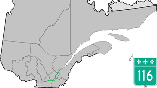
Route 116 is an east/west highway on the south shore of the St. Lawrence River in Quebec, Canada. It runs between Route 134 in Longueuil and Route 132 in Lévis, connecting the south shore areas of Montreal and Quebec City; it also serves the administrative regions of Montérégie, Centre-du-Québec, Estrie and Chaudière-Appalaches. Until the mid-1970s it was known as Route 9 between Le Moyne and Saint-Simon; Route 32 between Saint-Simon and Richmond; and Route 5 between Richmond and Saint-Nicolas.

Route 112 is a busy east/west highway on the south shore of the Saint Lawrence River in Quebec, Canada. Its eastern terminus is in Frampton at the junction of Route 275, and the western terminus is in Downtown Montreal, after crossing the Victoria Bridge. The stretch between Vallée-Jonction and Sherbrooke is a very busy highway as it is the main link between the southern regions of Quebec, in particular the Beauce region and the Eastern Townships. Between Sherbrooke and Marieville there is less traffic, since Autoroute 10 is in close proximity to the highway. From Marieville to Montreal it is a very busy highway, in most parts a four-lane separated highway, upgraded to freeway standards in certain places.
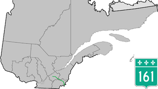
Route 161 is a north/south highway south of the St. Lawrence River in Quebec, Canada. Its current northern terminus is east of the junction of Autoroute 55 in Saint-Wenceslas, and its southern terminus is at the border of Maine in the USA, where it continues as Maine State Route 27.
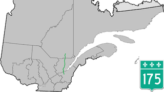
Route 175 is a major north–south highway on both sides of the St. Lawrence River in Quebec, Canada. Its southern terminus is in Saint-Lambert-de-Lauzon at the junction of Route 218 and its northern terminus is in Saguenay at the junction of Route 172, in the former city of Chicoutimi. Route 175 crosses the Saint Lawrence River on the Quebec Bridge, and a little further north of downtown Quebec City, it merges with Autoroute 73 for about 30 km before continuing through the Laurentides Wildlife Reserve as a two-lane divided highway in Stoneham.

Route 275 is a two-lane north/south highway in the Chaudière-Appalaches region in the province of Quebec. Its northern terminus is in Saint-Romuald, now part of Lévis at the junction of Route 132 and its southern terminus is in Saint-Côme–Linière at the junction of Route 173.
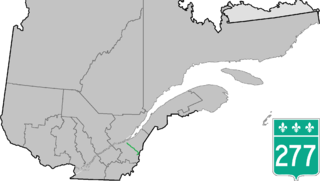
Route 277 is a two-lane north/south highway in the Chaudière-Appalaches region in the province of Quebec, Canada. Its northern terminus is in Saint-Henri at the junction of Route 173 and its southern terminus is in Sainte-Aurélie at the junction of Route 275.
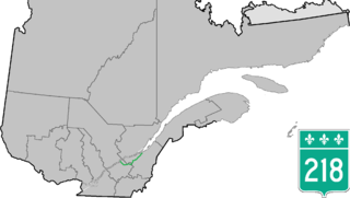
Route 218 is a two-lane east/west highway in Quebec, Canada. Its western terminus is at the junction of Route 132 in Saint-Pierre-les-Becquets and its eastern terminus is in Saint-Michel-de-Bellechasse at the junction of Route 281.

Route 276 is a 42 km two-lane east/west highway on the south shore of the Saint Lawrence River in the Chaudière-Appalaches region of Quebec, Canada. Its eastern terminus is close to Lac-Etchemin at the junction of Route 277, and the western terminus is at the junction of Route 112 in Saint-Frédéric.

The Beaurivage River is a tributary of the Chaudière River which in turn flows into the St. Lawrence River.
The Aulneuse River is a tributary of the south shore of the St. Lawrence River. This river flows through the municipalities of Saint-Apollinaire and the town of Lévis, in the administrative region of Chaudière-Appalaches, in Quebec, in Canada.
The Rivière Rouge is a tributary of the west shore of Beaurivage River which is a tributary of the west bank of the Chaudière River. It flows in the municipalities of Saint-Agapit and Saint-Apollinaire in the Lotbinière Regional County Municipality, in the administrative region of Chaudière-Appalaches, in Quebec, in Canada.
The rivière Noire is a tributary of the Beaurivage River which is a tributary of the east bank of the Chaudière River, in the administrative region of Chaudière-Appalaches, in Quebec, in Canada. It flows in the municipalities of Saint-Flavien, Saint-Agapit, Saint-Gilles and in the city of Lévis.
The Bras d'Henri is a tributary of the Beaurivage River which is a tributary of the west bank of the Chaudière River. It flows in the municipality of Saint-Elzéar, Saint-Bernard, Saint-Narcisse-de-Beaurivage, in the Saint-Étienne-de-Lauzon sector of the city of Lévis and Saint-Gilles, in the Lotbinière Regional County Municipality, in the administrative region of Chaudière-Appalaches, in Quebec, in Canada.
The Cugnet river is a tributary of the Beaurivage River which is a tributary of the west bank of the Chaudière River. It flows in the municipality of Saint-Lambert-de-Lauzon of the Lotbinière Regional County Municipality and in the Saint-Étienne-de-Lauzon of the city of Lévis, in the administrative region of Chaudière-Appalaches, in Quebec, in Canada.


