
Mékinac is a regional county municipality (RCM) of 5,607 km2 located in the administrative region of Mauricie, along the Saint-Maurice River, which also crosses the RCM from one end to the other, and the Matawin River, a tributary of the Saint-Maurice. Located in the province of Quebec, Canada.

The Saint-Maurice River, or the Saint-Maurice River, is one of the main tributaries of the St. Lawrence River, after the Ottawa and the Saguenay Rivers and drains an area of 42,735 km2. It touches the Lake Saint John watershed to the north; the Nottaway River watershed, a major tributary of James Bay, to the northwest; and the southwestern tributaries of the Ottawa River. The Saint-Maurice River is located on the north shore of the St. Lawrence River in Quebec, Canada.

Route 138 is a major highway in the Canadian province of Quebec, following the entire north shore of the St. Lawrence River past Montreal to the temporary eastern terminus in Kegashka on the Gulf of St. Lawrence. The western terminus is in Elgin, at the border with New York State south-west of Montreal. Part of this highway is known as the Chemin du Roy, or King's Highway, which is one of the oldest highways in Canada.

Route 359 is a 32 km north–south regional road in Quebec, Canada, going from Champlain to Grand-Mère. It is one of the direct roads linking Autoroute 40 to the Shawinigan-Grand-Mère area.

Route 243 is a north/south highway on the south shore of the Saint Lawrence River. Its northern terminus is in Saint-Félix-de-Kingsey at the junction of Route 255 and its southern terminus is in the township of Potton where it crosses the Canada–US border at the North Troy–Highwater Border Crossing into Vermont and becomes Vermont Route 243. Route 243 is not a busy highway as it does not go through big towns.

Route 153 is a two-lane north–south highway in Quebec, Canada, which starts in Yamachiche at the junction of Autoroute 40 and ends in Lac-aux-Sables at the junction of Route 363.

Route 289 is a two-lane north/south highway on the south shore of the Saint Lawrence River in the Bas-Saint-Laurent region of eastern Quebec, Canada. Its northern terminus is in Saint-André-de-Kamouraska at the junction of Route 132 and the southern terminus is at the border of New Brunswick where it continues as Route 120.

Route 112 is a busy east–west highway on the south shore of the Saint Lawrence River in Quebec, Canada. Its eastern terminus is in Frampton at the junction of Route 275, and the western terminus is in Downtown Montreal, after crossing the Victoria Bridge. The stretch between Vallée-Jonction and Sherbrooke is a very busy highway as it is the main link between the southern regions of Quebec, in particular the Beauce region and the Eastern Townships. Between Sherbrooke and Marieville there is less traffic, since Autoroute 10 is in close proximity to the highway. From Marieville to Montreal it is a very busy highway, in most parts a four-lane separated highway, upgraded to freeway standards in certain places.
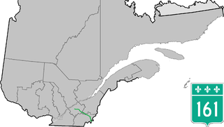
Route 161 is a north/south highway south of the St. Lawrence River in the regions of Centre-du-Québec, Chaudière-Appalaches and Estrie in the province of Quebec, Canada. Its current northern terminus is at Autoroute 20 in Sainte-Eulalie, just east of the junction of Autoroute 55, while its southern terminus is at the border of Maine in the USA, where it continues as Maine State Route 27. Previously the highway continued to Route 155 in Saint-Célestin, but that section was decommissioned in 2006 when Autoroute 55 was completed.

Route 157 is a four-lane north–south highway on the north shore of the Saint Lawrence River in Quebec, Canada. Its northern terminus is in Shawinigan at the junction of Route 153, and the southern terminus is at the junction of Route 138 in Cap-de-la-Madeleine, now part of Trois-Rivières.

Provincial Highway 159 is a two-lane highway on the north shore of the Saint Lawrence River in Quebec, Canada. Its northern terminus is in Saint-Roch-de-Mékinac at the junction of Route 155, and the southern terminus is at the junction of Route 138 in Sainte-Anne-de-la-Pérade.

Route 143 is a north/south highway on the south shore of the Saint Lawrence River, in the Centre-du-Québec and Estrie regions of Quebec. Until the mid-1970s when the province decided to renumber all highways other than autoroutes, it was known as Route/Highway 5. Its northern terminus is in Saint-François-du-Lac, at the junction of Route 132, and the southern terminus is in Stanstead, at the border with Vermont where the road continues past the Derby Line–Stanstead Border Crossing as U.S. Route 5 through Derby Line to New Haven, Connecticut.

Route 175 is a major north–south highway on both sides of the St. Lawrence River in Quebec, Canada. Its southern terminus is in Saint-Lambert-de-Lauzon at the junction of Route 218 and its northern terminus is in Saguenay at the junction of Route 172, in the former city of Chicoutimi. Route 175 crosses the Saint Lawrence River on the Quebec Bridge, and a little further north of downtown Quebec City, it merges with Autoroute 73 for about 30 km before continuing through the Laurentides Wildlife Reserve as a two-lane divided highway in Stoneham.

Route 344 is an east/west highway on the north shore of the Ottawa River in Quebec, Canada. Its western terminus is in Grenville-sur-la-Rouge at the junction of Autoroute 50, and its eastern terminus is in L'Assomption at the junction of Route 343. It follows the Ottawa River from Grenville-sur-la-Rouge to Saint-André-d'Argenteuil, where it follows the Lac des Deux Montagnes until Deux-Montagnes, where it follows the Rivière des Mille Îles until Repentigny, where it follows the Rivière l'Assomption until L'Assomption.

Route 247 is a north/south highway on the south shore of the Saint Lawrence River in the Estrie region of Quebec. Its northern terminus is in Magog at the junction of Route 112 and its southern terminus is in Stanstead, at the junction of Autoroute 55 less than 1 kilometre north of the Canada–United States border.

Route 201 is a north/south provincial highway within the Canadian province of Quebec, running between Route 202 in Franklin and Route 342 in Rigaud. Its total length is approximately 70 kilometres.
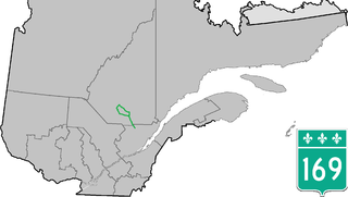
Route 169 begins south of Lac Saint-Jean, Quebec, Canada, at Route 175. It proceeds north to Lac Saint-Jean at Alma and encircles the lake, returning to Alma and its terminus in Hebertville.

Route 309 is a provincial highway located in the Outaouais region in western Quebec. It starts at the junction of Autoroute 50 in the Buckingham sector, in the city of Gatineau's east end. It runs mostly parallel to the Du Lièvre River and ends north of Mont-Laurier in the town of Sainte-Anne-du-Lac in the Upper Laurentians.

Route 351 is a Quebec provincial highway located in the Mauricie region. It runs from the junction of Route 153 in Saint-Barnabé and ends in Shawinigan also at a junction with Route 153 just south of the Autoroute 55 and Route 155 interchange. It also has a concurrency in Charette with Route 350.

The rivière Shawinigan flows in the rural area to the north of Shawinigan, then through the town of Shawinigan, in Mauricie, in Quebec, in Canada. The Shawinigan is a tributary of the right bank of the Saint-Maurice.


