Autoroute 5 is a short controlled-access Autoroute in the Outaouais region of western Quebec. It connects the central urban area of Gatineau with the recreational areas of Gatineau Park and the exurban rural areas of Chelsea and La Pêche. The southern terminus provides access to the Macdonald-Cartier Bridge, which continues into downtown Ottawa. The A-5 generally has four lanes of traffic with the exception of southernmost section across the Macdonald-Cartier Bridge where A-5 widens to six lanes.
Autoroute 20 is a Quebec Autoroute, following the Saint Lawrence River through one of the more densely populated parts of Canada, with its central section forming the main route of the Trans-Canada Highway from the A-25 interchange to the A-85 interchange. At 585 km (363.5 mi), it is the longest Autoroute in Quebec. It is one of two main links between Montreal and Quebec City; the other is the A-40.
Autoroute 40, officially known as Autoroute Félix-Leclerc outside Montreal and Metropolitan Autoroute/Autoroute Métropolitaine within Montreal, is an Autoroute on the north shore of the St. Lawrence River in the Canadian province of Quebec. It is one of the two major connections between Montreal and Quebec City, the other being Autoroute 20 on the south shore of the St. Lawrence. Autoroute 40 is currently 347 km (215.6 mi) long. Between the Ontario–Quebec boundary and the interchange with Autoroute 25, the route is signed as part of the Trans-Canada Highway.
Autoroute 15 is a highway in western Quebec, Canada. It is also called the Décarie Expressway (English) or Autoroute Décarie (French) between the Turcot and Décarie Interchanges in Montreal and the Laurentian Autoroute (English) or Autoroute des Laurentides (French) north of Autoroute 40. It was, until the extension of Autoroute 25 was opened in 2011, the only constructed north-south autoroute to go out of Montreal on both sides. A-15 begins at the end of Interstate 87 at the United States border at Saint-Bernard-de-Lacolle and extends via Montreal to Sainte-Agathe-des-Monts with an eventual continuation beyond Mont-Tremblant. The total length of A-15 is 164 km (101.9 mi), including a short concurrency with Autoroute 40 that connects the two main sections. It is one of the few autoroutes in Quebec that does not have any spinoff highways.

Route 132 is the longest highway in Quebec. It follows the south shore of the Saint Lawrence River from the border with the state of New York in the hamlet of Dundee, west of Montreal to the Gulf of Saint Lawrence and circles the Gaspé Peninsula. This highway is known as the Navigator's Route. It passes through the Montérégie, Centre-du-Québec, Chaudière-Appalaches, Bas-Saint-Laurent and Gaspésie regions of the province.
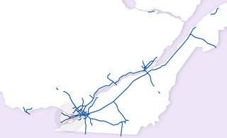
Autoroute 73 is an autoroute in Quebec, Canada. Following a northwest-southeast axis perpendicular to the St. Lawrence River, the A-73 provides an important freeway link with regions north and south of Quebec City, the capital of the province. It also intersects with Autoroute 20 and Autoroute 40 - one of only three Quebec autoroutes to do so. The A-73 begins less than 40 kilometres from the U.S. border in Quebec's Beauce region, traverses metropolitan Quebec City, and ends in the Laurentian Mountains. Civic, political, and business leaders in regions north and south of the A-73's termini have lobbied the Quebec government to extend the autoroute. While the four-laning of Route 175 to Saguenay has alleviated concerns in the north about safety and connectivity, Quebecers in the Beauce continue to advocate for extending the A-73 to the U.S. border, towards the Armstrong–Jackman Border Crossing and U.S. Route 201 within Maine.
Autoroute 55 is an important north–south Autoroute and the only one running in that direction in central Quebec. It is the longest north-south Autoroute, beginning as the continuation of I-91 at the Canada–United States border near Stanstead and continuing to Shawinigan, where it downgrades to Route 155. The total length of A-55 is currently 247 km (153.5 mi) long, including concurrencies with Autoroute 10, Autoroute 20 and Autoroute 40.
Autoroute 30 (A-30), or the Autoroute de l'Acier is an Autoroute in Quebec, Canada. Construction of the A-30 dates back to the early days of autoroute construction in the 1960s. Originally called Highway 3, the A-30 was designed to replace Route 132 as the main artery linking the communities along the South Shore of the St. Lawrence River. The A-30 was originally intended to begin at the U.S. border near Dundee and end at Saint-Pierre-les-Becquets. In the late 1970s an eight-year moratorium on new autoroute construction in favour of public transport by the Parti Québécois prevented implementation of that plan.
Autoroute 440 is a provincial highway that runs across the city of Laval, Quebec from Autoroute 13 to Autoroute 25. It is currently 18.2 km (11.3 mi) long and proceeds across Île Jésus on an east–west axis. It links every highway or expressway that connects Montreal to the North Shore.

Autoroute 13, is a freeway in the urban region of Montreal, Quebec, Canada. Its southern end is at the junction of A-20 on the Island of Montreal near Pierre Elliott Trudeau International Airport. Its northern terminus is at the junction of A-640 near Boisbriand. The road traverses Laval. A-13 is mostly six-laned and tolls were removed.

Autoroute 19, also known as Autoroute Papineau, is an autoroute in Quebec. It crosses the Rivière des Prairies via the Papineau-Leblanc Bridge, connecting the borough of Ahuntsic-Cartierville in Montreal and the Duvernay neighbourhood in Laval.
Autoroute 740 is a Quebec Autoroute in metropolitan Quebec City, Canada. A spur route of Autoroute 40, the A-740 runs for 7.3 km (4.5 mi) on a north-south axis through the boroughs of Sainte-Foy–Sillery–Cap-Rouge and Les Rivières, with interchanges at the A-440 at exit 4 and the A-40 at exit 9.
Autoroute 31 (A-31) is an Autoroute in the region of Lanaudière in Quebec. Constructed in 1966, A-31 primarily links Joliette with A-40 and in turn to Montreal, Trois-Rivières, and other points served by Quebec's autoroute system. A-31 is only 14 km (8.7 mi) long, making it one of the shortest autoroutes in the province. It is multiplexed with Route 131 for its entire length.
Autoroute 440 is a superhighway located in Quebec City. It includes two separate segments, respectively named Autoroute Charest and Autoroute Dufferin-Montmorency. Originally meant to be connected and form a single continuous highway via a tunnel under the city centre, these plans were shelved years ago and are not expected to be revived.
Autoroute 640 is a Quebec autoroute that runs across the North Shore Region from Route 344 in the Oka area to Route 138, where it ends as a four-lane expressway in Charlemagne. The road was designed to be northern bypass of the city of Montréal and was originally intended to cross the Lake of Two Mountains to connect to Autoroute 40 near Vaudreuil. It is currently 54.8 km (34.1 mi) long.
Autoroute 955 is a short 14.7-kilometre (9.1 mi) two-lane highway which links Autoroute 20 in Sainte-Eulalie with Saint-Albert.
Autoroute 85 is a Quebec Autoroute and the route of the Trans-Canada Highway in the province's Bas-Saint-Laurent region, also known as Autoroute Claude-Béchard. It is currently under construction with committed Federal and Provincial funding for its completion, with an projected completion date of 2026. Once this upgrade is completed, it will close the last gap in the nearly continuous freeway section of the Trans-Canada between Arnprior, Ontario, and Antigonish, Nova Scotia, and for an even longer interprovincial freeway route between Windsor, Ontario and Halifax, Nova Scotia. Running between Rivière-du-Loup and a junction with New Brunswick Route 2 at the Quebec-New Brunswick border, A-85 when complete will be the only controlled access highway link between the Maritime Provinces and the rest of the country. A-85 is projected to be approximately 100 km (60 mi) long when construction is complete and will replace Route 185, which has been called one of the deadliest highways in Canada.
Autoroute 520 or the Côte-de-Liesse Expressway is an expressway that connects Montreal's Pierre Elliott Trudeau International Airport with Autoroute 20 at the expressway's western terminus and Autoroute 40 at the expressway's eastern terminus. This route serves as a link to the airport to residents living in the east of Montreal and the West Island as well as the city of Dorval.
Autoroute 540 (Vaudreuil-Dorion) was a short spur route that connected Autoroute 20 to Autoroute 40, providing a direct freeway link from Windsor, Ontario to Quebec City, Rivière-du-Loup, and points east through A-40, as A-20 currently has several at-grade intersections in Vaudreuil-Dorion as a multi-lane divided road. A-540 was the shortest numbered Autoroute.
Autoroute 610 (A-610), also known as Autoroute Louis Bilodeau, is a short spur autoroute serving the eastern and northern suburbs of Sherbrooke, Quebec, Canada. It bypasses Sherbrooke's city centre to the north and connects the A-55 and A-10 to Route 112, a primary regional link to East Angus, Thetford Mines, and Lac-Mégantic.

