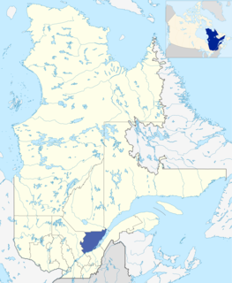
Capitale-Nationale is one of the 17 administrative regions of Quebec. It is anchored by the provincial capital, Quebec City, and is largely coextensive with that city's metropolitan area. It has a land area of 18,797.45 km2. It reported a total resident population of 729,997 as of the Canada 2016 Census, with Quebec City having 73.7 percent of the total.

The Réseau de transport de la Capitale (RTC), brand name for Société de transport de Québec, provides urban public transit services in the Quebec City area. It was founded in 2001, continuing the operations of the former Société de transport de la communauté urbaine de Québec, as the latter was merged into the new Quebec City.
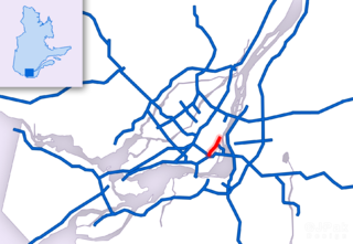
Route 136 (R-136), formerly Autoroute 720, known as the Ville-Marie Expressway (English) or Autoroute Ville-Marie (French) is an Autoroute highway in the Canadian province of Quebec that is a spur route of Autoroute 20 in Montreal. Its western terminus is located at the Turcot Interchange, a junction with Autoroute 15 and Autoroute 20, and its eastern terminus is near the Jacques Cartier Bridge, where the highway merges with Notre-Dame Street. The Autoroute Ville-Marie designation is named after the downtown borough of Ville-Marie, through which the expressway is routed. It was designated Autoroute 720 until 2021 when it was renamed to Route 136.

Autoroute 19, also known as Autoroute Papineau, is an autoroute in Quebec. It crosses the Rivière des Prairies via the Papineau-Leblanc Bridge, connecting the borough of Ahuntsic-Cartierville in Montreal and the Duvernay neighbourhood in Laval.
Autoroute 740 is a Quebec Autoroute in metropolitan Quebec City, Canada. A spur route of Autoroute 40, the A-740 runs for 7.3 km (4.5 mi) on a north-south axis through the boroughs of Sainte-Foy–Sillery–Cap-Rouge and Les Rivières, with interchanges at the A-440 at exit 4 and the A-40 at exit 9.

Route 368 is a 72 km two-lane east/west highway in Quebec, Canada, which is located on Île d'Orléans and includes the Pont de l'Île which connects the island to the mainland. It starts at the junction of Autoroute 40 at exit 325 in Beauport, now part of Quebec City, crosses the bridge and it follows around the island's perimeter, passing through all 6 villages on the island.

Route 116 is an east/west highway on the south shore of the Saint Lawrence River in Quebec, Canada. Until the mid-1970s it was known as Route 9. Its eastern terminus is in Lévis at the junction of Route 132, and the western terminus is at the junction of Route 134 in Lemoyne part of a concurrency with Route 112 until Saint-Hubert just south of the Saint-Hubert Municipal Airport. The stretch between Lévis and Plessisville does not have much traffic, since Autoroute 20 is not that far from the highway. Between Plessisville and Richmond traffic is heavier as it passes bigger towns, and it is further away from Autoroute 20. From Richmond to Autoroute 20, it is quiet again, before reaching Saint-Hyacinthe, where it becomes a busy four-lane separated highway, going through the growing "South Shore" suburbs of Montreal. From the junction of Autoroute 30 to its western terminus, it is a controlled-access Autoroute-grade expressway. This portion was once envisioned to be part of Autoroute 16. An unofficial extension of Route 116 as thought of by locals, from the western terminus follows the Route 134 limited access expressway to the Jacques Cartier Bridge.

Route 117, the Trans Canada Highway Northern Route, is a provincial highway within the Canadian province of Quebec, running between Montreal and the Quebec/Ontario border where it continues as Highway 66 east of McGarry, Ontario. It is an important road since it is the only direct route between southern Quebec and the Abitibi-Témiscamingue region.

Route 158 is an east-west arterial road running between Lachute and Berthierville, north of the Ottawa and Saint Lawrence rivers, in the Laurentides region.

Route 230 is a two-lane east/west provincial highway on the south shore of the Saint Lawrence River in the Bas-Saint-Laurent region of Eastern Quebec, Canada. Its eastern terminus is in Saint-Alexandre-de-Kamouraska east of the junction of Route 289 and the western terminus is at the junction of Route 132 in La Pocatière.
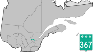
Route 367 is a 100 km two-lane north/south highway on the north shore of the Saint Lawrence River in Quebec, Canada. Although technically a north/south highway, long stretches of the road are east/west. Its northern/western terminus is close to Lac-aux-Sables at the junction of Route 363 and the southern/eastern terminus is in Saint-Augustin-de-Desmaures at the junction of Route 138. Route 367 used to stop in Rivière-à-Pierre, but in the late 1990s they have added the stretch between Rivière-à-Pierre and the junction of Route 363.

Route 169 begins south of Lac Saint-Jean, Quebec, Canada, at Route 175. It proceeds north to Lac Saint-Jean at Alma and encircles the lake, returning to Alma and its terminus in Hebertville.

Route 220 is a provincial highway located in the Estrie region of Quebec. The highway runs from Sainte-Anne-de-la-Rochelle at the junction of Route 243 and ends west of downtown Sherbrooke at Autoroute 410. The road connects the northern section of the Mont Orford Park.

Route 341 is a Quebec provincial highway located in the Lanaudière region northeast of Montreal. It runs from south to north from Repentigny just south of the junction of Autoroute 40 and ends 55 kilometers north at the junction of Route 125 northwest of Rawdon, Quebec. It overlaps Route 337 and Route 348 in Rawdon and Route 346 east of Sainte-Julienne.

Route 347 is a provincial highway located in the Lanaudière region of Quebec. The 97-kilometer highway runs from Sainte-Geneviève-de-Berthier at the junction of Route 158 north of Autoroute 40 and ends in Notre-Dame-de-la-Merci at the junction of Route 125. In Saint-Gabriel-de-Brandon, it overlaps Route 348 while between north of Saint-Jean-de-Matha and Saint-Émélie-de-L'Énergie it overlaps Route 131.

Route 358 is a provincial highway located in the Capitale-Nationale region of Quebec. It runs from the junction of Route 138 in Cap-Santé and ends in the Vanier sector of Quebec City also at the junction of Highway 138. The roadway passes north of the Jean-Lesage International Airport situated just west of the junctions of Autoroute 40, 73 and 573. West of the Airport it overlaps Route 367 as well as Route 365 in Pont-Rouge.
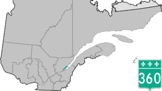
Route 360 is a provincial highway located in the Capitale-Nationale region in the south central part of the province of Quebec. The highway runs from Quebec City's Beauport sector and ends at the junction of Route 138 northeast of Saint-Tite-des-Caps in the Charlevoix region. For a large portion of its length it runs right beside Route 138, overlapping it briefly near Beaupré. The road also travels through significant portions of the Charlevoix touristic area and also crosses Mont-Sainte-Anne ski resort and the Montmorency Falls located at the Montmorency River which connects the Saint Lawrence River nearby.
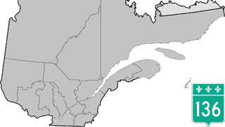
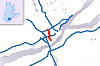
Route 136 is a provincial highway located in the Capitale-Nationale region of Quebec. The highway runs from Autoroute 440 to Autoroute 73 near the Pierre Laporte and Quebec bridges in Quebec City. A short route, most of Route 136 is a parkway along the Saint Lawrence River connecting the Basse-Ville of Old Quebec to the bridges. The eastern section follows city streets in that community.
The rivière aux Pommes is a tributary of the Jacques-Cartier River, flowing in the municipalities of Sainte-Catherine-de-la-Jacques-Cartier, Pont-Rouge, Neuville and Donnacona, in the Portneuf Regional County Municipality, in the administrative region of Capitale-Nationale, in Quebec, Canada.


