
Route 138 is a major highway in the Canadian province of Quebec, following the entire north shore of the Saint Lawrence River past Montreal to the temporary eastern terminus in Kegashka on the Gulf of Saint Lawrence. The western terminus is in Elgin, at the border with New York State south-west of Montreal. Part of this highway is known as the Chemin du Roy, or King's Highway, which is one of the oldest highways in Canada.

Route 317 is a provincial highway in the Papineau County of the Outaouais region east of Gatineau, Quebec. The 36-kilometer highway connects Thurso, at the junction of Route 148, to Ripon at the junction of Route 321. It is also a link to Montpellier in which a rural route connects both the 315 and 317 towards the village.

Route 299 is a 137-kilometre (85 mi) long two-lane highway which cuts through the Appalachian Mountains in Quebec, Canada. It starts at the junction of Route 132 in Cascapédia–Saint-Jules, runs through Gaspésie National Park and ends at the junction of Route 132 in Sainte-Anne-des-Monts. It is an isolated highway with only a few small settlements along the way.

Route 265 is a two-lane north/south highway on the south shore of the Saint Lawrence River in Quebec, Canada. Its northern terminus is in Deschaillons at the junction of Route 132, and the southern terminus is at the junction of Route 165 in Plessisville. It used to continue up to Black Lake at the junction of Route 112, but the segment between Plessisville and Black Lake was later re-numbered to Route 165 in the 1990s.

Route 165 is a 68 km north–south highway on the south shore of the Saint Lawrence River in Quebec, Canada. Its southern terminus is in Black Lake, now part of Thetford Mines, at the junction of Route 112 and its northern terminus is in Saint-Louis-de-Blandford at the junction of Autoroute 20. The stretch between Plessisville and Black Lake used to be Route 265 but it was re-numbered Route 165 in the 1990s.

Route 255 is a north/south highway on the south shore of the St. Lawrence River. Its northern terminus is in Baie-du-Febvre at the junction of Route 132 and its southern terminus is in Bury at the junction of Quebec Route 214.

Route 298 is 40 km two-lane north/south highway in Quebec, Canada, which starts in Sainte-Luce at the junction of Route 132 and ends in Saint-Charles-Garnier. Provincial highways with even numbers usually follow the Saint Lawrence River in a somewhat east/west direction, but Route 298 is a north/south highway in almost all of its length.

Autoroute 85 is a Quebec Autoroute and the route of the Trans-Canada Highway in the province's Bas-Saint-Laurent region, also known as the Autoroute Claude-Béchard. It is currently under construction with committed Federal and Provincial funding for its completion, with an estimated completion date of 2025. Once this upgrade is completed, it will close the last gap in the nearly continuous freeway section of the Trans-Canada between Arnprior, Ontario, and Sutherlands River, Nova Scotia, and for an even longer interprovincial freeway route between Windsor, Ontario and Halifax, Nova Scotia. Running between Rivière-du-Loup and a junction with New Brunswick Route 2 at the Quebec-New Brunswick border, the A-85 when complete will be the only controlled access highway link between the Maritime Provinces and the rest of the country. The A-85 is projected to be approximately 100 km (60 mi) long when construction is complete and is intended to replace Route 185, which has been called one of the deadliest highways in Canada.

Route 167 is an isolated provincial highway in Quebec, Canada. It begins at the shore of Lac Saint-Jean in Saint-Félicien. It proceeds north-west to Chibougamau 232 km (144.2 mi) away. There are no services along this long stretch. At Chibougamau, the highway turns north-east towards Mistissini.

Route 301 is an 81.1-kilometre-long (50.4 mi) provincial highway located in the Outaouais region in western Quebec. The route serves as a direct connection between the Pontiac region and the Upper Gatineau region. The 82-kilometer route runs from the end of Ontario Highway 653 near Portage-du-Fort and joins Route 148 for a 9 km (5.6 mi) stretch up to Campbell's Bay where it continues eastward and ends in Kazabazua at the junction of Route 105.

Route 206 is a short provincial highway located in the Estrie region in Quebec. The highway stretches from Route 147 in Coaticook as an east/northeast continuation of Route 141 to Route 253 in eastern Saint-Malo via Sainte-Edwidge-De-Clifton. In the latter municipality it briefly overlaps Route 251, which runs to Saint-Herménégilde and Martinville.

Route 220 is a provincial highway located in the Estrie region of Quebec. The highway runs from Sainte-Anne-de-la-Rochelle at the junction of Route 243 and ends west of downtown Sherbrooke at Autoroute 410. The road connects the northern section of the Mont Orford Park.

Route 224 is a provincial highway located in the Montérégie region of Quebec. The 48-kilometer road runs from the junction of Route 137 south of Saint-Hyacinthe and runs northeastward pass Route 116 and Autoroute 20 towards its terminus in Saint-Bonaventure at the junction of Route 143. It is also concurrent with Route 239 in Saint-Marcel-de-Richelieu.
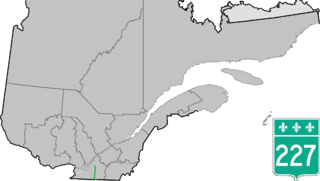
Route 227 is a provincial highway located in the Montérégie region of Quebec. The highway runs from Venise-en-Québec at the junction of Route 202 in the northwestern shores of Lake Champlain and ends at the junction of Autoroute 20 in Sainte-Marie-Madeleine, near Mont-Saint-Hilaire. It briefly overlaps Route 229 in Saint-Jean-Baptiste.

Route 231 is a provincial highway located in the Montérégie region of Quebec. It runs from the junction of Route 112 between Rougemont and Saint-Césaire northeastward towards Saint-Hyacinthe until the junction of Route 116.

Route 329 is a provincial highway in the Laurentides and Lanaudière regions of Quebec, serving a large portion of the popular tourist area as well as numerous lakes and cottage areas in the Middle and Upper Laurentians. Beginning at the junction of Route 148 just east of Lachute, it ends 93 kilometers further north at the junction of Route 125 in Saint-Donat, just south of Mont-Tremblant National Park. It is briefly concurrent with Route 364 in Morin-Heights and Route 117 in Sainte-Agathe-des-Monts.

Route 333 is a short provincial highway located in the Laurentides region of Quebec. It runs for 16 kilometers from Saint-Jérôme at the junction of Route 117 to Saint-Hippolyte and serves mainly several large lakes located between Sainte-Adèle and Saint-Jérôme.

Quebec Route 191 is a provincial highway in the Canadian province of Quebec. This route provides a link connecting Quebec Autoroute 20 and Quebec Autoroute 85 from Rivière-du-Loup and Cacouna and a direct link for areas east of Rivière-du-Loup towards the southern part of the Bas-Saint-Laurent region, New Brunswick and Maine.
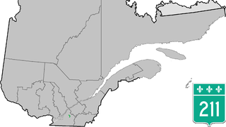
Quebec Route 211 is a provincial highway in the Canadian province of Quebec. Located in the Montérégie and Estrie regions in the southern part of the province, the highway's southern terminus is at Route 137 north of Granby and its northern terminus is at Quebec Autoroute 20 in Saint-Simon, east of Saint-Hyacinthe.


