Saint-Sulpice, Quebec

Last updated • 1 min readFrom Wikipedia, The Free Encyclopedia

Saint-Sulpice
Mairie de Saint-Sulpice.jpg
Saint-Sulpice Quebec location diagram.png
Location within L'Assomption RCM
Canada Central Quebec location map.png
Red pog.svg
St-Sulpice
Location in central Quebec
Coordinates: 45°50′N73°21′W / 45.833°N 73.350°W / 45.833; -73.350 [1]
Country Canada
Province Quebec
Region Lanaudière
RCM L'Assomption
Settled1680
ConstitutedJuly 1, 1855
Government
[2]
  MayorSteve Mador
   Federal riding Repentigny
   Prov. riding Repentigny
Area
  Total52.73 km2 (20.36 sq mi)
  Land36.17 km2 (13.97 sq mi)
  Urban
[4]
1.17 km2 (0.45 sq mi)
Population
 (2021) [3]
  Total3,360
  Density92.9/km2 (241/sq mi)
   Urban
[4]
1,769
  Urban density1,515.3/km2 (3,925/sq mi)
  Pop (2016–21)
Decrease2.svg 2.3%
  Dwellings
1,517
Time zone UTC−5 (EST)
  Summer (DST) UTC−4 (EDT)
Postal code(s)
Area code(s) 450 and 579
Highways
Quebec Autoroute 40.svg A-40

Qc138.svg R-138 Qc343.svg R-343
Website www.municipalitesaintsulpice.com OOjs UI icon edit-ltr-progressive.svg

Saint-Sulpice (French pronunciation: [sɛ̃sylpis] ) is a municipality in the Lanaudière region of Quebec, Canada, part of the L'Assomption Regional County Municipality. It is located on the north shore of the Saint Lawrence River and includes most of Verchères Islands.

Contents

History

From 1680 onwards, French settlers colonized this area, clearing the land for cultivation. At that time it was part of the Saint-Sulpice Seignory that was owned by the Society of Saint-Sulpice. In 1640 the seignory granted a concession to Pierre Chevrier, Baron of Fancamp, and to Jérôme Le Royer. [1]

In 1706, the settlement was assigned its first pastor and in 1715, it had the region's only flour mill in operation. The Parish of Saint-Sulpice was formed in 1722, taking its name from the seignory. In 1845, the parish municipality was formed and in 1854, its post office opened. [1]

Demographics

In the 2021 Census of Population conducted by Statistics Canada, Saint-Sulpice had a population of 3,360 living in 1,466 of its 1,517 total private dwellings, a change of

Historical Census Data - Saint-Sulpice, Quebec
YearPop.±%
1861 1,015    
1871 864−14.9%
1881 768−11.1%
1891 622−19.0%
1901 665+6.9%
1911 674+1.4%
1921 610−9.5%
1931 624+2.3%
YearPop.±%
1941 702+12.5%
1951 903+28.6%
1956 1,082+19.8%
1961 1,285+18.8%
1966 1,418+10.4%
1971 1,529+7.8%
1976 1,568+2.6%
1981 1,812+15.6%
YearPop.±%
1986 1,969+8.7%
1991 2,549+29.5%
1996 3,307+29.7%
2001 3,343+1.1%
2006 3,332−0.3%
2011 3,273−1.8%
2016 3,439+5.1%
2021 3,360−2.3%
Source: Statistics Canada [5]
Canada census – Saint-Sulpice community profile
2021 2016 2011
Population3,360 (-2.3% from 2016)3,439 (+5.1% from 2011)3,273 (-1.8% from 2006)
Land area36.17 km2 (13.97 sq mi)36.36 km2 (14.04 sq mi)36.38 km2 (14.05 sq mi)
Population density92.9/km2 (241/sq mi)94.6/km2 (245/sq mi)90.0/km2 (233/sq mi)
Median age44.4 (M: 44.0, F: 44.8)43.2 (M: 42.7, F: 43.8)41.3 (M: 40.9, F: 41.7)
Private dwellings1,517 (total)  1,466 (occupied)1,494 (total) 1,375 (total) 
Median household income$83,000$72,414$69,989
References: 2021 [6] 2016 [7] 2011 [8] earlier [9] [10]
Canada Census Mother Tongue - Saint-Sulpice, Quebec [5]
CensusTotal
French
English
French & English
Other
YearResponsesCountTrendPop %CountTrendPop %CountTrendPop %CountTrendPop %
2021
3,345
3,200Decrease2.svg 3.2%95.7%30Steady2.svg 0.0%0.9%30Increase2.svg 100.0%0.9%80Increase2.svg 6.7%2.4%
2016
3,420
3,305Increase2.svg 5.3%96.6%30Decrease2.svg 14.3%0.9%15Steady2.svg 0.0%0.4%75Increase2.svg 15.4%2.2%
2011
3,255
3,140Decrease2.svg 2.6%96.5%35Increase2.svg 133.3%1.1%15Decrease2.svg 40.0%0.5%65Increase2.svg 30.0%2.0%
2006
3,315
3,225Decrease2.svg 1.4%97.3%15Increase2.svg 50.0%0.5%25Decrease2.svg n/a%0.8%50Decrease2.svg 9.1%1.5%
2001
3,335
3,270Increase2.svg 2.0%98.1%10Decrease2.svg 71.4%0.3%0Decrease2.svg 100.0%0.0%55Increase2.svg 120.0%1.7%
1996
3,280
3,205n/a97.7%35n/a1.1%15n/a0.5%25n/a0.8%

Government

List of former mayors:

Education

The Sir Wilfrid Laurier School Board operates anglophone public schools, including:

Sister cities

Notable People

See also

Related Research Articles

<span class="mw-page-title-main">L'Assomption</span> City in Quebec, Canada

L'Assomption is an off-island suburb of Montreal, in southwestern Quebec, Canada on the L'Assomption River. It is the seat of the Regional County Municipality of L'Assomption. It is located on the outer fringes of the Montreal urban area.

<span class="mw-page-title-main">Saint-Lin–Laurentides</span> City in Quebec, Canada

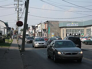
Saint-Lin–Laurentides is a small city located in the Montcalm Regional County Municipality of Quebec, Canada. Its official name uses an en dash; however, the city's own website uses the two-hyphen version of its name: Saint-Lin-Laurentides. In the Canada 2021 Census its population was 24,030.

<span class="mw-page-title-main">Sainte-Marie-Salomé</span> Municipality in Quebec, Canada

Sainte-Marie-Salomé is a municipality in the Lanaudière region of Quebec, Canada, part of the Montcalm Regional County Municipality.

<span class="mw-page-title-main">Saint-Damien, Quebec</span> Parish municipality in Quebec, Canada

Saint-Damien is a parish municipality of 2,393 inhabitants in Quebec, Canada. It is located in Matawinie Regional County Municipality in the Lanaudière region.

<span class="mw-page-title-main">Saint-Esprit, Quebec</span> Municipality in Quebec, Canada

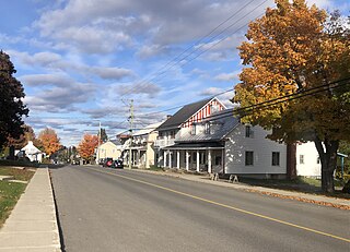
Saint-Esprit is a municipality in the Lanaudière region of Quebec, Canada, part of the Montcalm Regional County Municipality. It is located on both banks of the Saint-Esprit River, a tributary of the L'Assomption River.

<span class="mw-page-title-main">Saint-Ambroise-de-Kildare</span> Municipality in Quebec, Canada

Saint-Ambroise-de-Kildare is a municipality in the Lanaudière region of Quebec, Canada, part of the Joliette Regional County Municipality.

<span class="mw-page-title-main">Sainte-Mélanie, Quebec</span> Municipality in Quebec, Canada

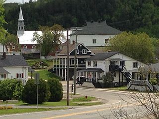
Sainte-Mélanie is a municipality in the Lanaudière region of Quebec, Canada, part of the Joliette Regional County Municipality. It is located along the western shores of the L'Assomption River.

<span class="mw-page-title-main">Notre-Dame-des-Prairies</span> City in Quebec, Canada

Notre-Dame-des-Prairies is a town in the Lanaudière region of Quebec, Canada, part of the Joliette Regional County Municipality. It is a suburb of Joliette, located along the eastern shores of the L'Assomption River.

<span class="mw-page-title-main">Saint-Thomas, Quebec</span> Municipality in Quebec, Canada

Saint-Thomas is a town in Joliette Regional County Municipality in the Lanaudière region of Quebec, Canada.

<span class="mw-page-title-main">Lanoraie</span> Municipality in Quebec, Canada

Lanoraie is a town in the Lanaudière region of Quebec, Canada, part of the D'Autray Regional County Municipality.

<span class="mw-page-title-main">La Visitation-de-l'Île-Dupas</span> Municipality in Quebec, Canada

La Visitation-de-l'Île-Dupas is a municipality in the Lanaudière region of Quebec, Canada, part of the D'Autray Regional County Municipality. Its territory is located on several of the Sorel Islands in the Saint Lawrence River where it flows into Lac Saint-Pierre. The largest of these islands is Dupas Island, also known as Isle du Pads, Île d'Angoulème, and Île du Richelieu at various times in the past.

<span class="mw-page-title-main">Saint-Norbert</span> Parish municipality in Quebec, Canada

Saint-Norbert is a parish municipality in D'Autray Regional County Municipality the Lanaudière region of Quebec, Canada.

<span class="mw-page-title-main">Saint-Cuthbert</span> Municipality in Quebec, Canada

Saint-Cuthbert is a municipality in Quebec, Canada, located between Montreal and Trois-Rivieres, just north of Berthierville. It is part of the D'Autray Regional County Municipality in the Lanaudière administrative region. The population as of the 2021 Canadian census was 1,821.

<span class="mw-page-title-main">Saint-Barthélemy, Quebec</span> Parish municipality in Quebec, Canada

Saint-Barthélemy is a parish municipality in the Lanaudière region of Quebec, Canada, part of the D'Autray Regional County Municipality.

<span class="mw-page-title-main">Saint-Félix-de-Valois</span> Municipality in Quebec, Canada

Saint-Félix-de-Valois is a municipality in the Lanaudière region of Quebec, Canada, part of the Matawinie Regional County Municipality.

<span class="mw-page-title-main">Saint-Cléophas-de-Brandon</span> Municipality in Quebec, Canada

Saint-Cléophas-de-Brandon is a municipality in D'Autray Regional County Municipality in the Lanaudière region of Quebec, Canada. Before 1997 it was known simply as Saint-Cléophas.

<span class="mw-page-title-main">Saint-Gabriel-de-Brandon</span> Municipality in Quebec, Canada

Saint-Gabriel-de-Brandon is a municipality in the D'Autray Regional County Municipality in the Lanaudière region of Quebec, Canada.

<span class="mw-page-title-main">Saint-Gabriel, Quebec</span> City in Quebec, Canada

Saint-Gabriel is a town in the Lanaudière region of Quebec, Canada, part of the D'Autray Regional County Municipality. It is located on the shores of Lake Maskinongé, in the shadows of the Laurentian Mountains.

<span class="mw-page-title-main">Saint-Côme, Quebec</span> Municipality in Quebec, Canada

Saint-Côme is a municipality in the Lanaudière region of Quebec, Canada, part of the Matawinie Regional County Municipality.

<span class="mw-page-title-main">Sainte-Émélie-de-l'Énergie</span> Municipality in Quebec, Canada

Sainte-Émélie-de-l'Énergie is a municipality in the Lanaudière region of Quebec, Canada, part of the Matawinie Regional County Municipality.

References

  1. 1 2 3 "Saint-Sulpice (Municipalité de paroisse)" (in French). Commission de toponymie du Québec. Retrieved 2009-09-22.
  2. 1 2 "Répertoire des municipalités: Geographic code 60020". www.mamh.gouv.qc.ca (in French). Ministère des Affaires municipales et de l'Habitation.
  3. 1 2 3 "Saint-Sulpice, Quebec (Code 2460020) Census Profile". 2021 census . Government of Canada - Statistics Canada . Retrieved 2024-06-17.
  4. 1 2 "Saint-Sulpice Quebec [Population centre] Census Profile, 2021 Census of Population". www12.statcan.gc.ca. Government of Canada - Statistics Canada. 9 February 2022. Retrieved 16 September 2024.
  5. 1 2 1996, 2001, 2006, 2011, 2016, 2021 census
  6. "2021 Community Profiles". 2021 Canadian census . Statistics Canada. February 4, 2022. Retrieved 2022-04-27.
  7. "2016 Community Profiles". 2016 Canadian census . Statistics Canada. August 12, 2021. Retrieved 2024-06-16.
  8. "2011 Community Profiles". 2011 Canadian census . Statistics Canada. March 21, 2019. Retrieved 2014-05-24.
  9. "2006 Community Profiles". 2006 Canadian census . Statistics Canada. August 20, 2019.
  10. "2001 Community Profiles". 2001 Canadian census . Statistics Canada. July 18, 2021.
  11. "JOLIETTE ELEMENTARY ZONE Archived 2017-09-17 at the Wayback Machine ." Sir Wilfrid Laurier School Board. Retrieved on September 17, 2017.
  12. "Municipalité de Saint-Sulpice".