Saint-Lazare | |
---|---|
Ville de Saint-Lazare | |
Coordinates: 45°24′N74°08′W / 45.400°N 74.133°W [1] | |
Country | Canada |
Province | Quebec |
Region | Montérégie |
RCM | Vaudreuil-Soulanges |
Constituted | 31 December 1875 |
Government | |
• Mayor | Genevieve Lachance |
• Federal riding | Vaudreuil-Soulanges |
• Prov. riding | Soulanges |
Area | |
• Total | 67.5 km2 (26.1 sq mi) |
• Land | 66.86 km2 (25.81 sq mi) |
Population | |
• Total | 22,354 |
• Density | 334.3/km2 (866/sq mi) |
• Pop 2016-2021 | 12.2% |
• Dwellings | 7,848 |
Time zone | UTC−5 (EST) |
• Summer (DST) | UTC−4 (EDT) |
Postal code(s) | |
Area code(s) | 450 and 579 |
Highways A-40 (TCH) | R-340 R-342 |
Website | ville |
Saint-Lazare is an off-island suburb of Montreal, in southwestern Quebec, Canada in the Regional County Municipality of Vaudreuil-Soulanges.
Originally part of the Seigneurie de Vaudreuil in the 18th century, the territory corresponding to Saint-Lazare was considered difficult to farm owing to sandy soil, and remained mostly uninhabited. In 1812, the first settlers were Americans from New England, then circa 1820 English from Cumberland, followed soon after by French Canadians. [1]
Saint-Lazare was founded as a parish municipality on December 29, 1875. [1] The first church was built in 1877, destroyed by a fire in 1942 and subsequently rebuilt in 1947.
A passenger train from Canadian Pacific Railway previously ran through the town but was discontinued in 1960. The station located on the corner of Sainte-Angélique and Duhamel was demolished.
Originally a rural farming town, the city of Saint-Lazare experienced rapid growth in the 1990s, fueled predominantly by the arrival of young, middle-class families. New residents flocked to the area seeking a more relaxed lifestyle than that of the island of Montreal, as well as larger homes and property for less money than on the island of Montreal.
In December 2001, Saint-Lazare changed its statutes and became a city. [1]
In 2015, the Saint-Lazare government began using pictograms instead of text on signs when the Office québécois de la langue française (OQLF) asked it to remove its English-language signs; the Saint-Lazare community believes in accommodating bilingualism and its Anglophone residents. [6]
In April 2023, there was a massive power outage that cause approximately 8000 households to lose electricity, according to Hydro-Quebec at that time. Only 8 households had electricity at the height of the ice-storm crisis. [7]
|
| ||||||||||||||||||||||||||||||||||||
Source: Statistics Canada [5] [8] |
In the 2021 Census of Population conducted by Statistics Canada, Saint-Lazare had a population of 22,354 living in 7,749 of its 7,848 total private dwellings, a change of 12.2% from its 2016 population of 19,917. With a land area of 66.86 km2 (25.81 sq mi), it had a population density of 334.3/km2 (865.9/sq mi) in 2021. [4]
2021 | 2016 | 2011 | |
---|---|---|---|
Population | 22,354 (+12.2% from 2016) | 19,917 (+3.2% from 2011) | 19,295 (+13.4% from 2006) |
Land area | 66.86 km2 (25.81 sq mi) | 66.80 km2 (25.79 sq mi) | 66.62 km2 (25.72 sq mi) |
Population density | 334.3/km2 (866/sq mi) | 297.8/km2 (771/sq mi) | 289.6/km2 (750/sq mi) |
Median age | 40.8 (M: 40.4, F: 41.2) | 40.9 (M: 41.0, F: 40.9) | 38.4 (M: 38.7, F: 38.2) |
Private dwellings | 7,848 (total) 7,749 (occupied) | 6,834 (total) | 6,546 (total) |
Median household income | $123,000 | $116,736 | $97,138 |
Canada Census Mother Tongue - Saint-Lazare, Quebec [8] | ||||||||||||||||||
---|---|---|---|---|---|---|---|---|---|---|---|---|---|---|---|---|---|---|
Census | Total | French | English | French & English | Other | |||||||||||||
Year | Responses | Count | Trend | Pop % | Count | Trend | Pop % | Count | Trend | Pop % | Count | Trend | Pop % | |||||
2021 | 22,355 | 10,485 | 0.3% | 46.9% | 8,195 | 14.2% | 36.7% | 815 | 68.0% | 3.6% | 2,490 | 54.2% | 11.1% | |||||
2016 | 19,890 | 10,450 | 1.6% | 52.6% | 7,175 | 1.8% | 36.1% | 485 | 10.3% | 2.4% | 1,615 | 14.5% | 8.1% | |||||
2011 | 19,185 | 10,290 | 11.5% | 53.6% | 7,045 | 3.12% | 36.7% | 440 | 76.0% | 2.3% | 1,410 | 2.9% | 7.4% | |||||
2006 | 17,015 | 9,230 | 30.8% | 54.3% | 6,165 | 29.8% | 36.2% | 250 | 5.7% | 1.5% | 1,370 | 65.1% | 8.1% | |||||
2001 | 12,900 | 7,055 | 14.5% | 54.7% | 4,750 | 18.9% | 36.8% | 265 | 15.2% | 2.1% | 830 | 12.9% | 6.4% | |||||
1996 | 11,120 | 6,160 | n/a | 55.4% | 3,995 | n/a | 35.9% | 230 | n/a | 2.1% | 735 | n/a | 6.6% |
Saint-Lazare was built on thick deposits of sand. Poorly drained areas are most common in the eastern part of town and have been mapped as muck, Peat or Vaudreuil series (a "half-bog" or gleysol), while the well to rapidly drained classic podzols are assigned to Ste. Sophie or Upland series. [14]
Some of the popular attractions are:
Saint-Lazare is graced by significant public funding for its ambitious recreational projects. Bedard Park in the centre of the town is a relatively large park equipped with a small water park, a grass field, three baseball diamonds, and tennis courts. In the winter two hockey rinks and an ice skating oval are added. Another large, multi-use park is called Le Parc nature les Forestiers de Saint-Lazare (2800 Chemin Lotbinière, Saint-Lazare, QC J7T 3H9). It is a 4-season park, with an outdoor pool, trails for hiking, cross-country skiing, horse riding, and snowshoeing, and picnic areas.
Other parks in Saint-Lazare are scattered among the small subdivisions throughout the municipality.
A new privately-financed sports centre was opened to the public in 2006 which includes an indoor soccer turf, a hockey rink, and a gym.
Areas surrounding Saint-Lazare are dedicated to equestrian horse riding, including sanctioned trails that flow through wooded forests and nearby lakes in the region. Many trails are sand based, which is due in part to the popularity of this type of activity in the region. The town has one of the largest populations of horses, approximately 3,500 with many residential properties fully dedicated to breeding and horse training.
All-terrain vehicles are very popular in the region with an officially sanctioned trail, which runs between Saint-Lazare and the nearby town of Rigaud, Quebec. The trail is maintained by regional members of local ATV clubs. The trails are open in all four seasons, and groomed in the winter using heavy machinery.
The city is served by the 51 bus from the Exo La Presqu’Île, terminating at the Vaudreuil train station.
Commission Scolaire des Trois-Lacs operates Francophone schools. [15]
There is one French language public high school (École secondaire Cité-des-Jeunes in Vaudreuil-Dorion) in the area.
Lester B. Pearson School Board operates Anglophone schools. [17]
A new senior elementary school, Forest Hill Senior, was opened in 2006. There are also two English language public secondary schools in the surrounding area (Westwood Senior - formerly Hudson High School - and Westwood Junior-formerly known as Vaudreuil Catholic High School). A new English-language elementary school (Birchwood Elementary) has opened for the 2011–2012 school year, even after many delays in construction.
There is a semi-private[ citation needed ] French-speaking institution in Rigaud (Collège-Bourget).
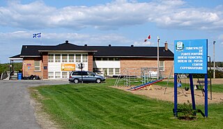
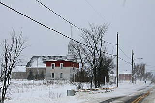
Pointe-Fortune is a municipality in southwestern Quebec, Canada, on the Ottawa River in Vaudreuil-Soulanges Regional County Municipality, northwest of Montreal. The population at the 2021 Census was 582.
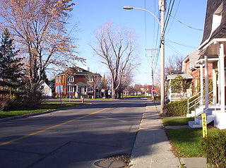
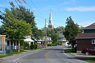
Rigaud is a city in southwestern Quebec, Canada, in the Vaudreuil-Soulanges Regional County Municipality in Vallée-du-Haut-Saint-Laurent region. It is located at the junction of the Ottawa River and the Rigaud River, about 70 kilometres (43 mi) west of downtown Montreal and 130 kilometres (81 mi) east of Ottawa. The population as of the Canada 2021 Census was 7,854.
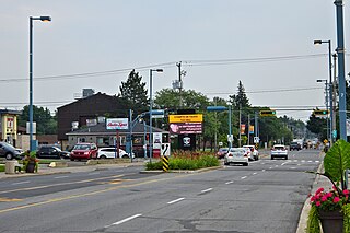
Vaudreuil-Dorion is a suburb of Greater Montreal, in the Montérégie region of southwestern Quebec, Canada. The result of the merger of two towns, Vaudreuil and Dorion, it is located in the Vaudreuil-Soulanges Regional County Municipality.
Hudson is an off-island suburb of Montreal, with a population of 5,411. It is located on the south-west bank of the lower Ottawa River, in Vaudreuil-Soulanges Regional County Municipality. Situated about 60 kilometres (37 mi) west of downtown Montreal, many residents commute to work on the Island of Montreal.
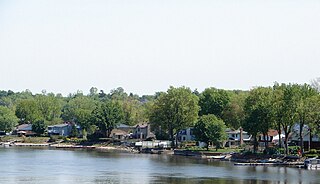
The Town of Île-Perrot is a town and municipality on Île Perrot in southwestern Quebec, Canada. The population as of the Canada 2016 Census was 10,756. The town is at the western end of Lake Saint-Louis, and borders the local island communities of Terrasse-Vaudreuil, Pincourt and Notre-Dame-de-l'Île-Perrot. It also includes Dowker Island and the small Claude and Bellevue Islands.
Saint-Télesphore is a municipality located in Vaudreuil-Soulanges Regional County Municipality, Quebec (Canada). The population as of the 2021 Canadian census was 754. The municipality is situated west of Saint-Polycarpe, south of Sainte-Justine-de-Newton, north of Rivière-Baudette and east of the provincial border near North Lancaster, Ontario.
Pincourt is a municipality on the island of Île Perrot, off the western tip of the island of Montreal, Quebec. The population as of the 2021 Canadian census was 14,751. The town shares the island with the three other municipalities of Notre-Dame-de-l'Île-Perrot, Terrasse Vaudreuil and L'Île-Perrot, bordering on each one. The south end of the Ottawa River flows between Vaudreuil-Dorion and Pincourt, defining the town's western boundary.
Coteau-du-Lac is a small city in southwestern Quebec, Canada. It is on the north shore of the St. Lawrence River in the Vaudreuil-Soulanges Regional County Municipality.
Saint-Zotique is a city located within the Vaudreuil-Soulanges Regional County Municipality in the Montérégie region located about 45 minutes west of Montreal, Quebec, Canada. It is named for Saint Zoticus of Comana.
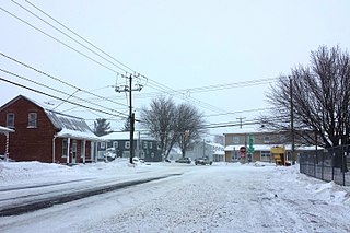
Saint-Polycarpe is a municipality located in the Vaudreuil-Soulanges Regional County Municipality in the Montérégie region west of Montreal, Quebec, Canada, and just east of the Quebec-Ontario border. It was named for Polycarp, a 2nd-century bishop of Smyrna. The population as of the 2021 Canadian Census was 2,372.
Notre-Dame-de-l'Île-Perrot is the largest of four municipalities located on Île Perrot, west of the island of Montreal, Quebec. The population as of the Canada 2016 Census was 10,654. It hosts the island's first church built in 1740 originally situated at Pointe-du-Moulin which was reconstituted as the Chapelle du Souvenir in 1953 beside the church of Sainte-Jeanne-de-Chantal across from the town hall.
Très-Saint-Rédempteur is a municipality located in the Montérégie region of Quebec, Canada, along the border with Ontario. The population as of the Canada 2021 Census was 978. The municipality includes the town of Saint-Redempteur, and lies south of Rigaud along Route 325.
Sainte-Justine-de-Newton is a municipality located in the Montérégie region of Quebec, Canada. The population as of the 2021 Canadian census was 947. The municipality is situated on Route 325 south of Très-Saint-Rédempteur, just east of the Ontario border.
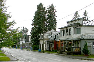
Saint-Clet is a municipality located in the Vaudreuil-Soulanges Regional County Municipality within the Montérégie region of Quebec, Canada. The population as of the 2021 Canadian census was 1,700. Completely surrounded by agricultural land, the town is centred on the intersection of two main provincial highways. The north–south Route 201 is known as rue Principale within the town limits, and the east–west Route 340 is known as Boulevard de la Cité des Jeunes.
Les Coteaux is a municipality in Vaudreuil-Soulanges Regional County Municipality in the Montérégie region of Quebec, Canada. It is located north of the Saint Lawrence River and Salaberry-de-Valleyfield.
Les Cèdres is a municipality located north of the Saint Lawrence River in the Montérégie of Quebec, Canada, near Vaudreuil-Dorion. The population as of the Canada 2021 Census was 7,184. The name means "The Cedars" in French.
Sainte-Marthe is a municipality located in the Vaudreuil-Soulanges Regional County Municipality of Quebec, Canada. The population as of the 2021 Canadian census was 1,014.
Pointe-des-Cascades is a village municipality in Vaudreuil-Soulanges Regional County Municipality in the Montérégie region of Quebec, Canada. It is located on a spit of land where the St. Lawrence River flows into Lake Saint-Louis. The river has here a significant drop, forming several cascades which give the village its name. The islands of Île des Cascades and Île des Joybert are connected by a narrow causeway, but Île des Cascades and Pointe-des-Cascades are only connected artificially.
Vaudreuil-sur-le-Lac is a village municipality in Vaudreuil-Soulanges Regional County Municipality in the Montérégie region of Quebec, Canada. It is located on the western portion of the Vaudreuil Peninsula, which projects into Lake of Two Mountains. The population as of the Canada 2016 Census was 1,341.
L'Île-Cadieux is a village and municipality in the Montérégie region of Quebec, Canada, part of the Vaudreuil-Soulanges Regional County Municipality. It is located on and contiguous with Cadieux Island, which projects into Lake of Two Mountains just north off Vaudreuil-sur-le-Lac. The population as of the Canada 2011 Census was 105.