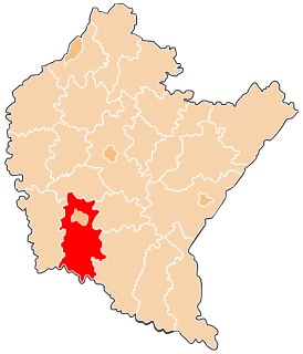
San Francisco de Daguas is a district of the province of Chachapoyas. The district of San Francisco de Daguas finds located in the province of Chachapoyas Departamento of the Amazon his soils they present an eventful topography. The capital Distrital is located to an altitude of 2,500 m.s.n.m.
Shevchenkove is an urban-type settlement in Ukraine in Kharkiv Oblast. It serves as the administrative center of Shevchenkove Raion. Population: 6,970 (2017 est.)

Dębiny Osuchowskie is a village in the administrative district of Gmina Mszczonów, within Żyrardów County, Masovian Voivodeship, in east-central Poland. It lies approximately 10 kilometres (6 mi) south-east of Mszczonów, 21 km (13 mi) south-east of Żyrardów, and 44 km (27 mi) south-west of Warsaw.
Jonaki is a village in the administrative district of Gmina Janów Lubelski, within Janów Lubelski County, Lublin Voivodeship, in eastern Poland.
Konopki is a village in the administrative district of Gmina Grajewo, within Grajewo County, Podlaskie Voivodeship, in north-eastern Poland.

Cütçü is a village in the Khojavend Rayon of Azerbaijan.

Janowice is a village in the administrative district of Gmina Pabianice, within Pabianice County, Łódź Voivodeship, in central Poland. It lies approximately 13 kilometres (8 mi) west of Pabianice and 21 km (13 mi) south-west of the regional capital Łódź.

Kozłówek is a village in the administrative district of Gmina Tarłów, within Opatów County, Świętokrzyskie Voivodeship, in south-central Poland. It lies approximately 4 kilometres (2 mi) south-west of Tarłów, 27 km (17 mi) north-east of Opatów, and 77 km (48 mi) east of the regional capital Kielce.

Wólka Mlęcka is a village in the administrative district of Gmina Dobre, within Mińsk County, Masovian Voivodeship, in east-central Poland. It lies approximately 6 kilometres (4 mi) south-west of Dobre, 13 km (8 mi) north of Mińsk Mazowiecki, and 43 km (27 mi) east of Warsaw.
Stanisławowo is a village in the administrative district of Gmina Drobin, within Płock County, Masovian Voivodeship, in east-central Poland.

Jeziorki is a village in the administrative district of Gmina Chojnice, within Chojnice County, Pomeranian Voivodeship, in northern Poland. It lies approximately 10 kilometres (6 mi) east of Chojnice and 95 km (59 mi) south-west of the regional capital Gdańsk.

Gruszynki is a settlement in the administrative district of Gmina Bartoszyce, within Bartoszyce County, Warmian-Masurian Voivodeship, in northern Poland, close to the border with the Kaliningrad Oblast of Russia. It lies approximately 12 kilometres (7 mi) west of Bartoszyce and 52 km (32 mi) north of the regional capital Olsztyn.
Nowa Karczma is a village in the administrative district of Gmina Górowo Iławeckie, within Bartoszyce County, Warmian-Masurian Voivodeship, in northern Poland, close to the border with the Kaliningrad Oblast of Russia.

Rybaki is a village in the administrative district of Gmina Małdyty, within Ostróda County, Warmian-Masurian Voivodeship, in northern Poland. It lies approximately 5 kilometres (3 mi) north-west of Małdyty, 33 km (21 mi) north-west of Ostróda, and 56 km (35 mi) west of the regional capital Olsztyn.

Zdrużno is a settlement in the administrative district of Gmina Ruciane-Nida, within Pisz County, Warmian-Masurian Voivodeship, in northern Poland. It lies approximately 6 kilometres (4 mi) south-west of Ruciane-Nida, 22 km (14 mi) west of Pisz, and 67 km (42 mi) east of the regional capital Olsztyn.
Stadio Giuseppe Moccagatta is a multi-use stadium in Alessandria, Italy. It is currently used mostly for football matches and is the home ground of U.S. Alessandria Calcio 1912 as well as of Juventus F.C. Under-23. The stadium holds 8,000 people.
North Weyburn is a hamlet in the Canadian province of Saskatchewan. Listed as a designated place by Statistics Canada, the hamlet had a population of 72 in the Canada 2006 Census.

Bukovany is a municipality and village in Benešov District in the Central Bohemian Region of the Czech Republic. It is located 31 kilometres (19 mi) south of Prague and 6 kilometres (3.7 mi) northwest of Benešov.

Qiaotou station is a station of Line 11, Shenzhen Metro, in China. It opened on 28 June 2016.


