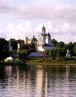
The Kotorosl River is a right tributary of the Volga in the Yaroslavl Oblast of Russia. The river flows from Lake Nero near Rostov past Karabikha and enters the Volga in Yaroslavl. In the medieval ages, the river was highly important strategically, for it connected Rostov with major waterways of Russia. The Kotorosl's main tributary is the Ustye River, which flows past Semibratovo to Borisogleb.

The Tvertsa is a river in Vyshnevolotsky, Spirovsky, Torzhoksky, and Kalininsky Districts, as well as in the cities of Torzhok and Tver in Tver Oblast, Russia, a left tributary of the Volga River. It is 188 kilometres (117 mi) long, and the area of its basin 6,510 square kilometres (2,510 sq mi). The principal tributaries of the Tvertsa are the Tigma River (left), the Shchegrinka River (right), the Osuga River (right), the Logovyazh River (left), and the Kava River (left).

Kerzhenets River is a river in the Nizhny Novgorod Oblast in Russia. It is a left tributary of the Volga, joining the Volga near Lyskovo, about 70 km east of Nizhny Novgorod.
Sknyatino is a village in Kalyazinsky District of Tver Oblast, Russia, situated at the confluence of the Nerl and the Volga Rivers, about halfway between Uglich and Tver. It is the site of the medieval town of Ksnyatin, founded by Yuri Dolgoruki in 1134 and named after his son Constantine.
Ksnyatin was intended as a fortress to defend the Nerl waterway, leading to Yuri's residence at Pereslavl-Zalessky, against Novgorodians. The latter sacked it on several occasions, before the Mongols virtually annihilated the settlement in 1239. After that, it belonged to the princes of Tver and was devastated by their enemies in 1288. By the 14th century, the neighbouring towns of Kalyazin and Kashin superseded it in importance. Since 1459, Ksnyatin has been documented as a village. Its kremlin area and cathedral were flooded in 1939, when they created the Uglich Reservoir.

Tsimlyansk Reservoir or Tsimlyanskoye Reservoir is an artificial lake on the Don River in the territories of Rostov and Volgograd Oblasts at 47°50′N 42°50′E. Completed in 1952, the reservoir is one of the largest in Russia, providing power and irrigation to the Rostov and Volgograd regions. Crops grown around the lake include wheat, rice, cotton, maize, alfalfa, fruit, grapes, and vegetables.

The Nerl River is a river in Pereslavsky District of Yaroslavl and Kalyazinsky District of Tver Oblast in Russia, a right tributary of the Volga River. The length of the river is 112 kilometres (70 mi). The area of its drainage basin is 3,270 square kilometres (1,260 sq mi). Its main tributary is the Kubr River (left).

The Moscow Canal, named the Moskva-Volga Canal until 1947, is a canal that connects the Moskva River with the Volga River. It is located in Moscow itself and in the Moscow Oblast. The canal connects to the Moskva River in Tushino, from which it runs approximately north to meet the Volga River in the town of Dubna, just upstream of the dam of the Ivankovo Reservoir. The length of the canal is 128 km.
Sister Pelagia is the heroine of a trilogy of mystery novels by Boris Akunin.

Kashinka is a river in Kesovogorsky and Kashinsky Districts of Tver Oblast, Russia, a left tributary of the Volga River. The length of the river is 128 kilometres (80 mi), and the area of its drainage basin is 661 square kilometres (255 sq mi). The town of Kashin and the urban-type settlement of Kesova Gora are located along the Kashinka.

The Tsna is a river in Kuvshinovsky, Ostashkovsky, Firovsky, and Vyshnevolotsky Districts of Tver Oblast of Russia. It flows into Lake Mstino, which is drained by the Msta and belongs to the drainage basin of the Neva and the Baltic Sea. It is 160 kilometres (99 mi) long, and the area of its basin 4,140 square kilometres (1,600 sq mi). The principal tributary of the Tsna is the Belaya River (right). In 1719, the river was dammed some 10 km above its mouth, creating the Vyshny Volochyok Reservoir.

Medveditsa is a river in Spirovsky, Likhoslavlsky, Rameshkovsky, Kashinsky, and Kimrsky Districts of Tver Oblast, Russia, a left tributary of the Volga River. The main tributaries are the Kushalka River (left), the Ivitsa River (right), the Drezna River (left), the Rudomosh River (left), and the Yakhroma River (right). The length of the Medveditsa is 259 kilometres (161 mi), and the area of its drainage basin is 5,570 square kilometres (2,150 sq mi).

The Volga Region is a historical region in Russia that encompasses the drainage basin of the Volga River, the longest river in Europe, in central and southern European Russia.

The Myosha is a river in Tatarstan, Russian Federation, a right-bank tributary of the Kama River. It flows southward, east of and parallel to the Volga and joins the Kama just before that river joins the Volga. It originates in a forest near the Yatmas-Dusay village of the Kukmorsky District and flows into the Kuybyshev Reservoir west of Narmonka village. It is 204 kilometres (127 mi) long, and its drainage basin covers 4,180 square kilometres (1,610 sq mi). The river is fed by snow and rain, and from November till April it is usually frozen.
The Sumka is a river in Zelenodolsky District of the Republic of Tatarstan, Russia, a left-bank tributary of the Volga River. It is 37 kilometres (23 mi) long, and its drainage basin covers 250 square kilometres (97 sq mi). It begins near Gremyachy Klyuch and flows to the Kuybyshev Reservoir, Volga, forming the western border of Vasilyevo, Tatarstan.

Neya is a river in Kostroma Oblast, Russia. It is a tributary of the Unzha River. It is 253 kilometers (157 mi) long, with a drainage basin of 6,060 square kilometers (2,340 sq mi).

Nyomda River is a river in Kostroma Oblast and Ivanovo Oblast in Russia, a left tributary of the Volga River. It flows into the Nyomda Bay of the Gorky Reservoir of the Volga River. The river is 146 kilometres (91 mi) long, and its drainage basin covers 4,750 square kilometres (1,830 sq mi). The Nemda freezes up in November and remains icebound until mid-April.

The Onega Canal is a canal that runs along the southern banks of Lake Onega in Vytegorsky District of Vologda Oblast and Podporozhsky District of Leningrad Oblasts in Russia. It was built 1818 - 1820 and 1845 - 1852 as a part of Mariinsk Canal System, to allow small riverboats to avoid Lake Onega, where storms are frequent and where many boats had perished through the centuries. The canal is 69 kilometres (43 mi) long and runs between the Vytegra River in the east and Svir River in the west. It is around 50 metres (160 ft) wide, and lies between 10 metres (33 ft) and 2 kilometres (1.2 mi) from the shores of the lake. At the mouth of the canal, in the selo of Voznesenye, a memorial obelisk has been erected.

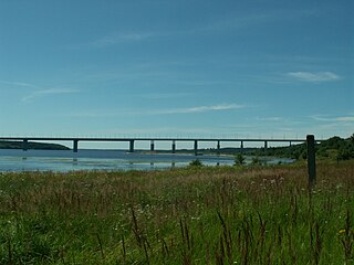
Kineshemsky Bridge is a bridge across the Volga River. It is located in Ivanovo Oblast, near Kineshma and Zavolzhsk. It is a part of Highway Kineshma-Kostroma. It connects the Trans-Volga region to the Zavolzhsky District, Ivanovo Oblast Pedestrians are prohibited from using the bridge. The total length of the bridge is 1.64 km.
The Korozhechna is a river in Sonkovsky Kesovogorsky, and Kashinsky Districts of Tver Oblast and in Myshkinsky and Uglichsky District of Yaroslavl Oblast in Russia. It is a left tributary of the Volga River. It is 147 kilometres (91 mi) long, and the area of its basin 1,690 square kilometres (650 sq mi).

The Osuga River is a river in Oleninsky, Rzhevsky, and Zubtsovsky Districts of Tver Oblast and in Sychyovsky District of Smolensk Oblast of Russia, a left tributary of the Vazuza River in the basin of the Volga River. The Osuga is 100 kilometres (62 mi) long, and the area of its drainage basin is 1,290 square kilometres (500 sq mi).


