Related Research Articles

Milam County is a county located in the U.S. state of Texas. As of the 2020 census, its population was 24,754. The county seat is Cameron. The county was created in 1834 as a municipality in Mexico and organized as a county in 1837. Milam County is named for Benjamin Rush Milam, an early settler and a soldier in the Texas Revolution.

Falls County is a county in the U.S. state of Texas. As of the 2020 census, its population was 16,968. The county seat is Marlin. It is named for the original 10-foot-tall waterfall on the Brazos River, which existed until the river changed course during a storm in 1866. The present falls is two miles northeast of the original falls, at the Falls on the Brazos Park, a camping site only a few miles out of Marlin on Farm to Market Road 712.

Cameron County, officially the County of Cameron, is the southernmost county in the U.S. state of Texas. As of the 2020 census, its population was 421,017. Its county seat is Brownsville.

Rosebud is a city in Falls County, Texas, United States. Its population was 1,296 at the 2020 census.

Cameron is a city in Milam County, Texas, United States. Its population was 5,306 at the 2020 census. It is the county seat of Milam County.
Milano is a city in Milam County, Texas, United States, located at the intersection of U.S. Route 79 and State Highway 36, twelve miles southeast of Cameron, the county seat. Its population was 390 at the 2020 census.
Milam is a census-designated place (CDP) in Sabine County, Texas, United States. It is located along the Sabine River at the junction of Highway 87 and Highway 21. The population was 1,355 at the 2020 census. Milam is the largest city in Sabine County.
Independence is an unincorporated community in Washington County, Texas, United States. According to the Handbook of Texas, the community had a population of 140 in 2000. It is located about an hour northwest of the Greater Houston metropolitan area.
Boonville was the first county seat of Brazos County, Texas, United States, now a ghost town.
The Little River is a river in Central Texas in the Brazos River watershed. It is formed by the confluence of the Leon River and the Lampasas River near Little River, Texas in Bell County. It flows generally southeast for 75 miles (121 km) until it empties into the Brazos River about 5 miles (8.0 km) southwest of Hearne, at a site called Port Sullivan in Milam County. The Little River has a third tributary, the San Gabriel River, which joins the Little about 8 miles (13 km) north of Rockdale and five miles southwest of Cameron. Cameron, the county seat of Milam County and the only city of any significant size on the Little River, was established in 1846.
Branchville is an unincorporated community located in Milam County, Texas, United States. According to the Handbook of Texas, the community had a population of 200 in 2000.
Lamar is a small, unincorporated community and census-designated place (CDP) in Aransas County, Texas, United States, 10 miles (16 km) north of Rockport and 40 miles (64 km) north of Corpus Christi. As of the 2010 census it had a population of 636. The community was named for Mirabeau B. Lamar, the second president of the Republic of Texas. This was a new CDP for the 2010 census.
Nashville was a community, now a ghost town, on the southeastern bank of the Brazos River in present-day Milam County, Texas, United States.
Ben Arnold is an unincorporated community and census-designated place in Milam County, Texas, United States. Ben Arnold (Benarnold) is on U.S. Highway 77, seven miles north of Cameron in northern Milam County.
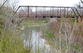
Bryant Station is a ghost town in Milam County, Texas, United States, located 12 miles west of Cameron on the Little River.

Uptown is a PID and a dense neighborhood in Dallas, Texas. Uptown is north of and adjacent to downtown Dallas, and is bordered by US 75 on the east, N Haskell Avenue on the northeast, the Katy Trail on the northwest, Bookhout Street and Cedar Springs Road on the west, N Akard Street on the southwest and Spur 366 on the south.
Corinth is an unincorporated community in Milam County, Texas, United States.
West Buffalo is a ghost town in Williams County, in the U.S. state of Ohio.
Reverend Joseph Perkins Sneed was an American preacher, farmer and educator. A minister of the Methodist Episcopal Church, South, he established the first-ever Methodist church in Waco, Texas. Prior to and during the course of the American Civil War, he converted many slaves to the Methodist faith.
Marak is an unincorporated community in Milam County, Texas, United States.
References
- ↑ "PORT SULLIVAN, TX". Handbook of Texas Online . Texas State Historical Association . Retrieved February 9, 2016.
- 1 2 Luecke, Jan (March 28, 1968). "Brazos' Port Sullivan... Marker, Cemetery Remain" . The Cameron Herald. Cameron, Texas. Retrieved February 9, 2016– via Newspapers.com.
- ↑ "Port Sullivan Cemetery". Milam County Historical Commission. Retrieved February 9, 2016.
30°51′58″N96°41′44″W / 30.86611°N 96.69556°W
 | This article about a location in Milam County, Texas is a stub. You can help Wikipedia by expanding it. |