Posavski Bregi

Last updated
Posavski Bregi
Settlement
CountryFlag of Croatia.svg  Croatia
County Zagreb
Town Ivanić-Grad
Population (2011)
  Total 816
Time zone CET (UTC+1)
  Summer (DST) CEST (UTC+2)

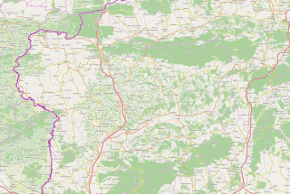
Posavski Bregi is a settlement in the Ivanić-Grad town of Zagreb County, Croatia. As of 2011 it had a population of 816 people. [1]

Ivanić-Grad Town in Zagreb, Croatia

Ivanić-Grad or Ivanić Grad (pronounced [ǐʋanitɕ ɡrâːd] is a town in Zagreb County, Croatia. It is part of Moslavina.

Zagreb County County in Croatia

Zagreb County is a county in central Croatia. It surrounds – but does not contain – the nation's capital Zagreb, which is a separate territorial unit. For that reason, it is often nicknamed "Zagreb ring". According to the 2011 census, the county has 317,606 inhabitants.

Croatia Republic in Central Europe

Croatia, officially the Republic of Croatia, is a country at the crossroads of Central and Southeast Europe, on the Adriatic Sea. It borders Slovenia to the northwest, Hungary to the northeast, Serbia to the east, Bosnia and Herzegovina, and Montenegro to the southeast, sharing a maritime border with Italy. Its capital, Zagreb, forms one of the country's primary subdivisions, along with twenty counties. Croatia has an area of 56,594 square kilometres and a population of 4.28 million, most of whom are Roman Catholics.

Related Research Articles

Orle is a village and a municipality ("općina") in Croatia in Zagreb County. According to the 2011 census, there are 1,975 inhabitants in the municipality, an absolute majority of which are Croats.

Koprivnički Bregi Municipality in Koprivnica-Križevci County, Croatia

Koprivnički Bregi is a municipality in the Koprivnica-Križevci County in Croatia. According to the 2011 census, there are 2,381 inhabitants in the area, with Croats forming an absolute majority.

Radoboj Municipality in Krapina-Zagorje County, Croatia

Radoboj is a village and municipality in Krapina-Zagorje County in Croatia. In the 2011 census, the total population was 3,387, in the following settlements:

Goričan Municipality in Međimurje, Croatia

Goričan is a municipality in Međimurje County, Croatia.

Vukovina is a village in Croatia. It is connected by the D30 highway.

Moštanica Village in Croatia

Moštanica is a village in central Croatia, in the municipality/town of Petrinja, Sisak-Moslavina County. It is connected by the D30 highway.

Veliškovci is a village in Croatia. It is connected by the D34 highway.

Miholjsko Village in Karlovac County, Croatia

Miholjsko is a village in central Croatia, in the municipality of Vojnić, Karlovac County. It is connected by the D216 highway.

Kuče is a village in Croatia.

Okuje is a village in Croatia.

Zamost is a village in Croatia.

Čamagajevci is a village in Croatia.

Gornja Lomnica is a settlement of Velika Gorica, which is part of the Zagreb metropolitan area, Croatia. The population is 580.

Brebrovac is a settlement in the Jastrebarsko administrative area of Zagreb County, Croatia. As of 2011 it had a population of 74.

Donji Desinec is a settlement in the Jastrebarsko administrative area of Zagreb County, Croatia. As of 2011 it had a population of 799.

Zaklepica is a settlement in the Ivanić-Grad town of Zagreb County, Croatia. As of 2011 it had a population of 88 people.

Otruševec is a settlement (naselje) in the Samobor administrative territory of Zagreb County, Croatia. As of 2011 it had a population of 303 people.

Zrinšćina is a settlement (naselje) in the Sveti Ivan Zelina administrative territory of Zagreb County, Croatia. As of 2011 it had a population of 126 people.

Dijaneš is a settlement (naselje) in the Vrbovec administrative territory of Zagreb County, Croatia. As of 2011 it had a population of 167 people.

References

  1. "Population by Age and Sex, by Settlements, 2011 Census: Posavski Bregi". Census of Population, Households and Dwellings 2011. Zagreb: Croatian Bureau of Statistics. December 2012.

Coordinates: 45°41′N16°21′E / 45.683°N 16.350°E / 45.683; 16.350

Geographic coordinate system Coordinate system

A geographic coordinate system is a coordinate system that enables every location on Earth to be specified by a set of numbers, letters or symbols. The coordinates are often chosen such that one of the numbers represents a vertical position and two or three of the numbers represent a horizontal position; alternatively, a geographic position may be expressed in a combined three-dimensional Cartesian vector. A common choice of coordinates is latitude, longitude and elevation. To specify a location on a plane requires a map projection.