Posterholt  | |
|---|---|
Village  | |
|   Road panorama near Posterholt  | |
| Coordinates: 51°07′20″N6°02′10″E / 51.12222°N 6.03611°E | |
| Country | Netherlands | 
| Province | Limburg | 
| Municipality | Roerdalen | 
| Area | |
 • Total  | 9.30 km2 (3.59 sq mi) | 
| Elevation | 25 m (82 ft) | 
| Population  (2021) [1]   | |
 • Total  | 3,730 | 
| • Density | 401/km2 (1,040/sq mi) | 
| Time zone | UTC+1 (CET) | 
| • Summer (DST) | UTC+2 (CEST) | 
| Postal code | 6060-6061 [1]   | 
| Dialing code | 0475 | 
| Major roads | N274, N293 | 
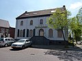
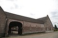
Posterholt is a village in the Dutch province of Limburg. It is located in the municipality of Roerdalen.
The village was first mentioned in 1147 as Posterholt. The etymology is unclear. [3] Posterholt is a linear forest cultivation village from the 12th century. It became an independent parish in 1793. [4]
The Catholic St Mathias was built between 1950 and 1951 to replace the earlier church which was destroyed in 1945. The tower was added between 1961 and 1962. [4] The Aerwinckel estate was built in 1856 and designed by Pierre Cuypers to replace the medieval castle. [4]
Posterholt was home to 605 people in 1840. [5] It merged with the municipalities Montfort and Sint Odiliënberg in 1991, and the new municipality changed its name to Ambt Montfort three years later. [6] In 2007, it became part of the municipality of Roerdalen. [5]
Together with a few other villages in the region it has also an active local history association. This association is situated in St. Odiliënberg. [7]