
GVB is the municipal public transport operator for Amsterdam, the capital of the Netherlands, operating metro, tram, bus and ferry services in the metropolitan area of Amsterdam.

The Amsterdam Metro is a rapid transit system serving Amsterdam, Netherlands, and extending to the surrounding municipalities of Diemen and Ouder-Amstel. Until 2019, it also served the municipality of Amstelveen, but this route was closed and converted into a tram line. The network is owned by the City of Amsterdam and operated by municipal public transport company Gemeente Vervoerbedrijf (GVB), which also operates trams, free ferries and local buses.

The Damrak is an avenue and partially filled in canal at the centre of Amsterdam, Netherlands, running between Amsterdam Centraal in the north and Dam Square in the south. It is the main street where people arriving at the station enter the centre of the city. Also, it is one of the two GVB tram routes from the station into the centre, with lines 4, 9, 16, and 25 running down it. It is also on the route of the North/South Line being constructed between the existing metro station at Centraal Station and the new Rokin station.

Amsterdam Centraal station is the largest railway station in Amsterdam, North Holland, the Netherlands. A major international railway hub, it is used by 192,000 passengers a day, making it the second busiest railway station in the country after Utrecht Centraal and the most visited Rijksmonument of the Netherlands.

Amsterdam Sloterdijk is a major railway junction to the west of Amsterdam Centraal station. It is at a rail-rail crossing, with an additional chord (Hemboog). It is on the railway line from Amsterdam Centraal to Haarlem and the last station before the junction where the line Amsterdam Centraal-Zaandam diverges from it and on the crossing west branch of the Amsterdam–Schiphol railway line between Schiphol and Amsterdam Centraal.

IJburg is a residential neighbourhood under construction in Amsterdam, Netherlands. It is situated in the IJmeer and is being built on artificial islands which have been raised from the lake. The Haveneiland, Rieteilanden, Steigereiland and Centrumeiland are already inhabited as of 2004. It is part of the municipality Amsterdam-Oost and also contains the Diemerpark, one of the city's largest parks.

Tramlijn 5 is a tram line operating between Amsterdam and Amstelveen in the Netherlands. Operated by the municipal transport company GVB, the route normally runs between Van Hallstraat in Amsterdam and Stadshart in the neighbouring municipality of Amstelveen. Tram line 5 connects several important areas of the city, including the Zuidas financial district and Leidseplein, and also provides a rapid tram route south of Amsterdam Zuid station to Stadshart, Amstelveen's town centre.

The Amsterdam Tram is a tram network in Amsterdam, Netherlands. It dates back to 1875 and since 1943 has been operated by municipal public transport operator Gemeentelijk Vervoerbedrijf (GVB), which also runs the Amsterdam Metro and the city bus and ferry services. Amsterdam has the largest tram network in the Netherlands and one of the largest in Europe.
Amsterdam RAI is a railway station situated in southern Amsterdam, Netherlands. It is located between the two directions of the A10 Amsterdam ring road. It is also a metro station at which GVB runs two lines. The station takes its name from the nearby RAI Amsterdam Convention Centre.

Amsterdam Lelylaan is a railway, metro, tram and bus station in west Amsterdam. It is served by trains of the Nederlandse Spoorwegen and metros of the GVB. The station opened on 1 June 1986. It is located on the Amsterdam-Schiphol railway, a few km south of Amsterdam Sloterdijk railway station. South of this station, trains turn west towards Schiphol railway station, while metros turn east towards Amsterdam Zuid railway station. The station is located in the Amsterdam borough of Slotervaart, on a long viaduct spanning three roads.

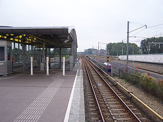
Diemen Zuid is a railway station is located in Diemen, a city to the southeast of Amsterdam. The railway station is served by Nederlandse Spoorwegen (NS) services as well as line 53 of the Amsterdam Metro.
De Vlugtlaan is a metro station on Line 50 and Line 51 in Amsterdam, the Netherlands. Between 1986 and 2000, Amsterdam De Vlugtlaan railway station was in use on the railway running parallel next to the metro line.

Westwijk is a tram stop serving the neighborhood of Westwijk in the city of Amstelveen, Netherlands. It serves tram line 25, dubbed the Amsteltram, which opened officially on 13 December 2020, unofficially 4 days earlier on 9 December. It used to be the southern terminus of the line until the opening of the extension to Uithoorn Centrum on 21 July 2024.
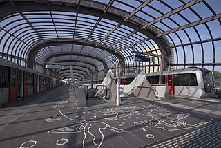
Station Noord is the northernmost station of the Amsterdam Metro's Route 52 in Amsterdam, Netherlands. The line and station were opened on 22 July 2018.

Rokin metro station is an Amsterdam Metro station on Line 52, the fifth and newest metro line in Amsterdam which connects the Amsterdam-Noord (north) borough to the Amsterdam-Zuid (south) via Amsterdam Centraal. It began service in July 2018 and is under the Rokin canal in Amsterdam, Netherlands.

Noorderpark is a station on the Amsterdam Metro's Route 52 in Amsterdam, Netherlands. The line and station were opened on 22 July 2018.

Amsterdam tram line 25, also known as the Amsteltram, is a tram line running south from Amsterdam Zuid station in Amsterdam via Westwijk in Amstelveen to Uithoorn Centrum in Uithoorn. It officially opened to Westwijk on 13 December 2020. The tram line replaced metro line 51, a light rail line (sneltram) that ceased running south of Amsterdam Zuid station on 3 March 2019 to convert it for low-floor trams. Tram line 5 shares the stops with line 25 between Zuid station and Oranjebaan stations. Line 5 had also shared the same tracks with metro line 51, the former using low-level platforms for regular trams, and the latter using high-level platforms.

Metro Line 50 is a line of the Amsterdam Metro between the Isolatorweg and the Gein district in Amsterdam-Zuidoost. Although the line is a tangential line, it is also known as the Ring Line (Ringlijn), because the embankment of the Ringspoorbaan is used between Sloterdijk station and the Rozenoordspoorbrug.

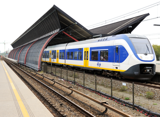
The Alstom Metropolis M5 is a fleet of 28 six-car electric multiple unit (EMU) trains for the Amsterdam Metro, delivered by the French manufacturer Alstom between 2012 and 2015. The trains are based on the Alstom Metropolis series, with variants in use by metro systems in various foreign cities such as Barcelona, Budapest, Santiago, and Shanghai. Although the trains are suitable for driverless operation, they are currently operated by drivers.

The CAF Inneo M7 is a series of electric multiple unit (EMU) trainsets used in the Amsterdam Metro. This train was put into service on 28 February 2023, and is expected to remain in operation for at least 30 years.

