Pot Creek Cultural Site

Last updated
Pot Creek Entrance Pot Creek Entrance 1.JPG
Pot Creek Entrance
Pot Creek Pueblo Pot Creek Pueblo 7.JPG
Pot Creek Pueblo
Some of the pueblos in New Mexico Pueblo01.png
Some of the pueblos in New Mexico

Pot Creek Cultural Site is an abandoned 13th century pueblo located on private land owned by Southern Methodist University and on public Carson National Forest land in Taos County, New Mexico.

Contents

Geography

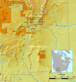
Located within the Rio Grande valley [1] and surrounded by the Sangre de Cristo Mountains, the site is at 2,195 metres (7,201 ft) in elevation. [2] Its sources of water were the Rio Grande del Rancho, also known as the Little Rio Grande, and Rio del la Olla, also known as Pot Creek. [1] [2]

Archaeological site

The site was a large adobe pueblo consisting of a large plaza, great kiva, and small plazas with multiple-storied blocks of rooms and smaller kivas. Its height of occupation was between 1260 [nb 1] and 1320 CE. The pueblo is believed to have been similar to Taos Pueblo and had about 400 rooms on the ground floor for storage, with additional rooms in the multiple-storied dwellings used as dwellings. [4] It is estimated that the pueblo was occupied for about three generations, with its peak population about 1310. Around 1318 a great kiva was under construction, but it was never completed. It is believed that the pueblo was abandoned about 1320, at which time the southern portion of the site was destroyed by fire. [1] Residents moved to nearby Picuris and Taos Pueblos. [4]

The pueblo people lived primarily on a diet of corn, squash and beans that they grew. They also ate bison, local animals and wild plants. The made their own pottery. Gray pottery was used for cooking. They also decorated black-on-white pottery vessels and made tools from stone and animal bones. [4]

The site has been studied by Southern Methodist University for more than 50 years. [1]

Carson National Forest site

The portion of the pueblo located on Carson National Forest is open to visitors from June to September. It is about 50 yards from a parking area on Highway 518 at milepost 66.4 and has a picnic area and restrooms. [4] [5] The one-mile loop trail has signs that interpret the lifestyle of the pueblo residents and leads to a reproduction of a pueblo room and a kiva. [5]

See also

Notes

  1. Based upon archaeological evidence and Puebloan folklore, it is believed that some of the people from the abandoned Chaco Canyon migrated to the Taos Valley about 1250. [3]

Related Research Articles

<span class="mw-page-title-main">Puebloans</span> Native Americans in the Southwestern US

The Puebloans, or Pueblo peoples, are Native Americans in the Southwestern United States who share common agricultural, material, and religious practices. Among the currently inhabited Pueblos, Taos, San Ildefonso, Acoma, Zuni, and Hopi are some of the most commonly known. Pueblo people speak languages from four different language families, and each Pueblo is further divided culturally by kinship systems and agricultural practices, although all cultivate varieties of corn (maize).

<span class="mw-page-title-main">Taos Pueblo</span> Ancient Tiwa pueblo in New Mexico

Taos Pueblo is an ancient pueblo belonging to a Taos-speaking (Tiwa) Native American tribe of Puebloan people. It lies about 1 mile (1.6 km) north of the modern city of Taos, New Mexico. The pueblos are one of the oldest continuously inhabited communities in the United States. This has been designated a UNESCO World Heritage Site.

<span class="mw-page-title-main">Pueblo</span> Native settlements of Southwestern United States

Pueblo refers to the settlements and to the Native American tribes of the Pueblo peoples in the Southwestern United States, currently in New Mexico, Arizona, and Texas. The permanent communities, including some of the oldest continually occupied settlements in the United States, are called pueblos (lowercased).

<span class="mw-page-title-main">Mesa Verde National Park</span> U.S. national park in Colorado

Mesa Verde National Park is an American national park and UNESCO World Heritage Site located in Montezuma County, Colorado, and the only World Heritage Site in Colorado. The park protects some of the best-preserved Ancestral Puebloan ancestral sites in the United States.

<span class="mw-page-title-main">Bandelier National Monument</span> United States historic place

Bandelier National Monument is a 33,677-acre (136 km2) United States National Monument near Los Alamos in Sandoval and Los Alamos counties, New Mexico. The monument preserves the homes and territory of the Ancestral Puebloans of a later era in the Southwest. Most of the pueblo structures date to two eras, dating between AD 1150 and 1600.

<span class="mw-page-title-main">El Cuartelejo</span> Region in Colorado and Kansas, United States

El Cuartelejo, or El Quartelejo, is a region in eastern Colorado and western Kansas where Plains Apache cohabited with Puebloans. Subject to religious persecution, Puebloans fled the Spanish Nuevo México territory and cohabitated with the Cuartelejo villagers in the 1600s.

The Galisteo Basin is a surface basin and a closely related groundwater basin in north-central New Mexico. Its primary watercourse is the Galisteo River or Galisteo Creek, a perennial stream, for part of its course, that flows from the eastern highlands down into the Rio Grande about three miles above the Santo Domingo Pueblo. The Galisteo basin covers approximately 467,200 acres and runs from San Miguel County in the east, across Santa Fe County, and into Sandoval County at its westernmost point, the Rio Grande. Northeast of Galisteo Basin rise the Sangre de Cristo Mountains and to the southwest lie the Sandia Mountains. Because of its location lying between mountain ranges and connecting the upper Rio Grande Valley with the Great Plains, the Galisteo Basin was used as a trade route by prehistoric and historic indigenous and later also by the Spanish explorers.

<span class="mw-page-title-main">Canyons of the Ancients National Monument</span> Monument protecting significant sites of ancient Native Americans

Canyons of the Ancients National Monument is a national monument protecting an archaeologically significant landscape located in the southwestern region of the U.S. state of Colorado. The monument's 176,056 acres (712.47 km2) are managed by the Bureau of Land Management, as directed in the presidential proclamation which created the site on June 9, 2000. Canyons of the Ancients National Monument is part of the National Landscape Conservation System, better known as the National Conservation Lands. This system comprises 32,000,000 acres (130,000 km2) managed by the Bureau of Land Management to conserve, protect, and restore these nationally significant landscapes recognized for their outstanding cultural, ecological, and scientific values. Canyons of the Ancients encompasses and surrounds three of the four separate sections of Hovenweep National Monument, which is administered by the National Park Service. The monument was proclaimed in order to preserve the largest concentration of archaeological sites in the United States, primarily Ancestral Puebloan ruins. As of 2022, over 8,500 individual archeological sites had been documented within the monument.

<span class="mw-page-title-main">Carson National Forest</span> National forest in New Mexico, United States

Carson National Forest is a national forest in northern New Mexico, United States. It encompasses 6,070 square kilometers and is administered by the United States Forest Service. The Forest Service's "mixed use" policy allows for its use for recreation, grazing, and resource extraction.

<span class="mw-page-title-main">Ancestral Puebloan dwellings</span> Ancestral Puebloan homes

Hundreds of Ancestral Puebloan dwellings are found across the American Southwest. With almost all constructed well before 1492 CE, these Puebloan towns and villages are located throughout the geography of the Southwest.

<span class="mw-page-title-main">Pueblo I Period</span> Era in the history of the Pueblo peoples

The Pueblo I Period was the first period in which Ancestral Puebloans began living in pueblo structures and realized an evolution in architecture, artistic expression, and water conservation.

<span class="mw-page-title-main">Pueblo II Period</span> Era in the history of the Pueblo peoples

The Pueblo II Period was the second pueblo period of the Ancestral Puebloans of the Four Corners region of the American southwest. During this period people lived in dwellings made of stone and mortar, enjoyed communal activities in kivas, built towers and dams for water conservation, and implemented milling bins for processing maize. Communities with low-yield farms traded pottery with other settlements for maize.

<span class="mw-page-title-main">Pueblo III Period</span> Era in the history of the Pueblo peoples

The Pueblo III Period was the third period, also called the "Great Pueblo period" when Ancestral Puebloans lived in large cliff-dwelling, multi-storied pueblo, or cliff-side talus house communities. By the end of the period, the ancient people of the Four Corners region migrated south into larger, centralized pueblos in central and southern Arizona and New Mexico.

<span class="mw-page-title-main">Pueblo IV Period</span> Era in the history of the Pueblo peoples

The Pueblo IV Period was the fourth period of ancient pueblo life in the American Southwest. At the end of prior Pueblo III Period, Ancestral Puebloans living in the Colorado and Utah regions abandoned their settlements and migrated south to the Pecos River and Rio Grande valleys. As a result, pueblos in those areas saw a significant increase in total population.

<span class="mw-page-title-main">Pueblo V Period</span> Ancestral puebloan period 1600 to present

The Pueblo V Period is the final period of ancestral puebloan culture in the American Southwest, or Oasisamerica, and includes the contemporary Pueblo peoples. From the previous Pueblo IV Period, all 19 of the Rio Grande valley pueblos remain in the contemporary period. The only remaining pueblo in Texas is Ysleta del Sur Pueblo, and the only remaining pueblos in Arizona are maintained by the Hopi Tribe. The rest of the Pueblo IV pueblos were abandoned by the 19th century.

The Sopris phase is a Late Ceramic period hunter-gatherer culture of the Upper Purgatoire, also known as the Upper Purgatoire complex. It was first discovered in the southern Colorado, near the present town of Trinidad, Colorado. The Sopris phase appeared to be greatly influenced by Puebloan people, such as the Taos Pueblo and Pecos Pueblo, and through trade in the Upper Rio Grande area.

<span class="mw-page-title-main">Northern Rio Grande National Heritage Area</span> United States National Heritage Area in New Mexico

Northern Rio Grande National Heritage Area is a federally designated National Heritage Area in the U.S. state of New Mexico. The national heritage area includes a section of the upper Rio Grande Valley that has been inhabited by the Puebloan peoples since the early Pre-Columbian era.

<span class="mw-page-title-main">Ancestral Puebloans</span> Ancient Native American culture in Four Corners region of the US

The Ancestral Puebloans, also known as the Anasazi, were an ancient Native American culture that spanned the present-day Four Corners region of the United States, comprising southeastern Utah, northeastern Arizona, northwestern New Mexico, and southwestern Colorado. They are believed to have developed, at least in part, from the Oshara tradition, which developed from the Picosa culture. The people and their archaeological culture are often referred to as Anasazi, meaning "ancient enemies", as they were called by Navajo. Contemporary Puebloans object to the use of this term, with some viewing it as derogatory.

<span class="mw-page-title-main">Pueblo pottery</span> Pottery of the Pueblo people of the American Southwest

Pueblo pottery are ceramic objects made by the Indigenous Pueblo people and their antecedents, the Ancestral Puebloans and Mogollon cultures in the Southwestern United States and Northern Mexico. For centuries, pottery has been central to pueblo life as a feature of ceremonial and utilitarian usage. The clay is locally sourced, most frequently handmade, and fired traditionally in an earthen pit. These items take the form of storage jars, canteens, serving bowls, seed jars, and ladles. Some utility wares were undecorated except from simple corrugations or marks made with a stick or fingernail, however many examples for centuries were painted with abstract or representational motifs. Some pueblos made effigy vessels, fetishes or figurines. During modern times, pueblo pottery was produced specifically as an art form to serve an economic function. This role is not dissimilar to prehistoric times when pottery was traded throughout the Southwest, and in historic times after contact with the Spanish colonialists.

References

  1. 1 2 3 4 Catrina B. Witley. May 2012. Evidence of Violent Conflict in Males from Pot Creek. Landscapes of Violence. Retrieved July 23, 2014.
  2. 1 2 Peter N. Peregrine; Melvin Ember (31 May 2003). Encyclopedia of Prehistory Complete Set of Volumes 1-8 and Volume 9, the Index Volume: Published in Conjunction with the Human Relations Area Files. Springer Science & Business Media. p. 238. ISBN   978-0-306-46264-1.
  3. Taos Valley. Fifty Years of Highway Archaeology in New Mexico. Roads to the Past. Retrieved August 12, 2014.
  4. 1 2 3 4 Pot Creek Cultural Site. Carson National Forest. Four Corners Geotourism. Retrieved July 23, 2014.
  5. 1 2 High Road To Taos | Scenic Byway & Santuario de Chimayo. NewMexico.org Retrieved July 23, 2014.

36°16′45″N105°34′34.61″W / 36.27917°N 105.5762806°W / 36.27917; -105.5762806