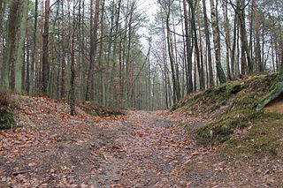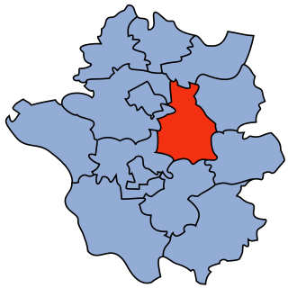
Biri is a village in Szabolcs-Szatmár-Bereg county, in the Northern Great Plain region of eastern Hungary.

Toporzyszczewo is a village in the administrative district of Gmina Bądkowo, within Aleksandrów County, Kuyavian-Pomeranian Voivodeship, in north-central Poland. It lies 19 kilometres (12 mi) south-east of Aleksandrów Kujawski and 38 km (24 mi) south of Toruń.
Poienarii de Argeș is a commune in Argeș County, in southern central Romania. It is composed of four villages: Ceaurești, Ioanicești, Poienari and Tomulești.

Będzelin is a village in the administrative district of Gmina Koluszki, within Łódź East County, Łódź Voivodeship, in central Poland. It lies approximately 4 kilometres (2 mi) south of Koluszki and 26 km (16 mi) east of the regional capital Łódź. The population of the village is approximately 430 people.

Burkaty is a village in the administrative district of Gmina Sońsk, within Ciechanów County, Masovian Voivodeship, in east-central Poland. It lies approximately 4 kilometres (2 mi) north of Sońsk, 8 km (5 mi) south-east of Ciechanów, and 70 km (43 mi) north of Warsaw.

Nowy Goniwilk is a village in the administrative district of Gmina Żelechów, within Garwolin County, Masovian Voivodeship, in east-central Poland. It lies approximately 7 kilometres (4 mi) west of Żelechów, 16 km (10 mi) south-east of Garwolin, and 72 km (45 mi) south-east of Warsaw. The village has a population of 314.

Grażyna is a village in the administrative district of Gmina Warka, within Grójec County, Masovian Voivodeship, in east-central Poland. It lies approximately 5 kilometres (3 mi) north-east of Warka, 26 km (16 mi) east of Grójec, and 48 km (30 mi) south of Warsaw.

Niwy Ostrołęckie is a village in the administrative district of Gmina Warka, within Grójec County, Masovian Voivodeship, in east-central Poland. It lies approximately 6 kilometres (4 mi) north-east of Warka, 27 km (17 mi) east of Grójec, and 48 km (30 mi) south of Warsaw.

Prusy is a village in the administrative district of Gmina Warka, within Grójec County, Masovian Voivodeship, in east-central Poland. It lies approximately 5 kilometres (3 mi) north-west of Warka, 22 km (14 mi) east of Grójec, and 46 km (29 mi) south of Warsaw.

Tłubice is a village in the administrative district of Gmina Bielsk, within Płock County, Masovian Voivodeship, in east-central Poland. It lies approximately 6 kilometres (4 mi) north of Bielsk, 21 km (13 mi) north-east of Płock, and 98 km (61 mi) north-west of Warsaw.
Səbir is a village in the municipality of Darquba in the Lankaran Rayon of Azerbaijan.

Tworzanice is a village in the administrative district of Gmina Rydzyna, within Leszno County, Greater Poland Voivodeship, in west-central Poland. It lies approximately 4 kilometres (2 mi) north-east of Rydzyna, 11 km (7 mi) east of Leszno, and 67 km (42 mi) south of the regional capital Poznań.

Szczury is a village in the administrative district of Gmina Ostrów Wielkopolski, within Ostrów Wielkopolski County, Greater Poland Voivodeship, in west-central Poland. It lies approximately 11 kilometres (7 mi) north-east of Ostrów Wielkopolski and 98 km (61 mi) south-east of the regional capital Poznań.

Sowiny is a village in the administrative district of Gmina Bojanowo, within Rawicz County, Greater Poland Voivodeship, in west-central Poland. It lies approximately 5 kilometres (3 mi) east of Bojanowo, 13 km (8 mi) north of Rawicz, and 77 km (48 mi) south of the regional capital Poznań.

Oleksiki is a settlement in the administrative district of Gmina Herby, within Lubliniec County, Silesian Voivodeship, in southern Poland. It lies approximately 11 kilometres (7 mi) east of Lubliniec and 54 km (34 mi) north of the regional capital Katowice.

Węgliny is a village in the administrative district of Gmina Gubin, within Krosno Odrzańskie County, Lubusz Voivodeship, in western Poland, close to the German border. It lies approximately 15 kilometres (9 mi) south of Gubin, 36 km (22 mi) south-west of Krosno Odrzańskie, and 56 km (35 mi) west of Zielona Góra.

Przynotecko is a village in the administrative district of Gmina Stare Kurowo, within Strzelce-Drezdenko County, Lubusz Voivodeship, in western Poland. It lies approximately 6 kilometres (4 mi) south-east of Stare Kurowo, 15 km (9 mi) south-east of Strzelce Krajeńskie, and 33 km (21 mi) east of Gorzów Wielkopolski.
Kõnnu is a village in Põhja-Pärnumaa Parish, Pärnu County in western-central Estonia.
Ostra Glava is a village in the municipality of Vranje, Serbia. According to the 2002 census, the village has a population of 72 people.


