Zvánovice is a village in the Central Bohemian Region of the Czech Republic. On the date August 28, 2006 it has 396 inhabitants. First written notice about village is from year 1320. The municipality lies at an altitude of 418 metres and covers an area of 6.5 km².
Piętacz is a village in the administrative district of Gmina Nakło nad Notecią, within Nakło County, Kuyavian-Pomeranian Voivodeship, in north-central Poland.

Mrowiniec is a village in the administrative district of Gmina Tuchola, within Tuchola County, Kuyavian-Pomeranian Voivodeship, in north-central Poland. It lies approximately 12 kilometres (7 mi) north-west of Tuchola and 66 km (41 mi) north of Bydgoszcz.
Brzozowo-Muzyły is a village in the administrative district of Gmina Poświętne, within Białystok County, Podlaskie Voivodeship, in north-eastern Poland.
Wólka Mała is a village in the administrative district of Gmina Rajgród, within Grajewo County, Podlaskie Voivodeship, in north-eastern Poland.
Moczydły-Pszczółki is a village in the administrative district of Gmina Perlejewo, within Siemiatycze County, Podlaskie Voivodeship, in north-eastern Poland.
Zaborów is a settlement in the administrative district of Gmina Zadzim, within Poddębice County, Łódź Voivodeship, in central Poland. It lies approximately 8 kilometres (5 mi) east of Zadzim, 15 km (9 mi) south of Poddębice, and 35 km (22 mi) west of the regional capital Łódź.
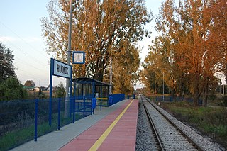
Rudnik is a village in the administrative district of Gmina Wólka, within Lublin County, Lublin Voivodeship, in eastern Poland.
Chomranice is a village in the administrative district of Gmina Chełmiec, within Nowy Sącz County, Lesser Poland Voivodeship, in southern Poland. It lies approximately 8 kilometres (5 mi) north-west of Chełmiec, 10 km (6 mi) north-west of Nowy Sącz, and 64 km (40 mi) south-east of the regional capital Kraków.
Rajchotka is a village in the administrative district of Gmina Imielno, within Jędrzejów County, Świętokrzyskie Voivodeship, in south-central Poland.
Małgorzacin is a village in the administrative district of Gmina Lipsko, within Lipsko County, Masovian Voivodeship, in east-central Poland.
Prusy is a village in the administrative district of Gmina Łosice, within Łosice County, Masovian Voivodeship, in east-central Poland. It lies approximately 7 kilometres (4 mi) north-east of Łosice and 121 km (75 mi) east of Warsaw.
Tchórz is a village in the administrative district of Gmina Bielsk, within Płock County, Masovian Voivodeship, in east-central Poland. It lies approximately 9 kilometres (6 mi) south of Bielsk, 7 km (4 mi) north-east of Płock, and 95 km (59 mi) north-west of Warsaw.
Pilitowo is a village in the administrative district of Gmina Płońsk, within Płońsk County, Masovian Voivodeship, in east-central Poland.
Białebłoto-Nowa Wieś is a village in the administrative district of Gmina Brańszczyk, within Wyszków County, Masovian Voivodeship, in east-central Poland. It lies approximately 7 kilometres (4 mi) north of Brańszczyk, 15 km (9 mi) north-east of Wyszków, and 67 km (42 mi) north-east of Warsaw.
Nowa Wieś Królewska is a village in the administrative district of Gmina Września, within Września County, Greater Poland Voivodeship, in west-central Poland. It lies approximately 9 kilometres (6 mi) south of Września and 49 km (30 mi) east of the regional capital Poznań.
Kicina is a village in the administrative district of Gmina Bartoszyce, within Bartoszyce County, Warmian-Masurian Voivodeship, in northern Poland, close to the border with the Kaliningrad Oblast of Russia. It lies approximately 14 kilometres (9 mi) west of Bartoszyce and 50 km (31 mi) north of the regional capital Olsztyn.
Wójtowo is a village in the administrative district of Gmina Barczewo, within Olsztyn County, Warmian-Masurian Voivodeship, in northern Poland.
Warlity Małe is a village in the administrative district of Gmina Olsztynek, within Olsztyn County, Warmian-Masurian Voivodeship, in northern Poland.
Górzno is a village in the administrative district of Gmina Bierzwnik, within Choszczno County, West Pomeranian Voivodeship, in north-western Poland. It lies approximately 6 kilometres (4 mi) south-west of Bierzwnik, 23 km (14 mi) south-east of Choszczno, and 82 km (51 mi) south-east of the regional capital Szczecin.


