Bhadrachalam is a census town in the Indian state of Telangana, Bhadradri Kothagudem district. It is an important Hindu pilgrimage town with an existence of the Bhadrachalam Temple of Lord Rama, situated on the banks of Godavari river. It is located 312 kilometres (194 mi) from east of state capital, Hyderabad,115 kilometres (71 mi) from Khammam, 177 kilometres (110 mi) from Suryapet, 180 kilometres (112 mi) from Warangal and 178 kilometres (111 mi) from the Andhra Pradesh State Capital Amaravathi.

Kodad is a town in Suryapet district of the Indian state of Telangana. It is a municipality and the mandal headquarters of Kodad mandal in Kodad revenue division. It lies on the National Highway 65 between Hyderabad and Vijayawada.It is 44 km far away from the district headquarters Suryapet.

Bhuvanagiri is a town and District Headquarter of Yadadri Bhuvanagiri district of the Indian state of Telangana. It comes under Hyderabad Metropolitan Development Authority, located on National Highway 163.

Gajapathinagaram is a census town in Vizianagaram district of the Indian state of Andhra Pradesh. It is located in Gajapathinagaram mandal of Vizianagaram revenue division. It is located on National Highway 26 between Vizianagaram and Ramabhadrapuram.

Kilpennathur is a Panchayat Town in Tiruvanamalai district in the Indian state of Tamil Nadu. Kilpennathur is one of the taluks of Tiruvannamalai district and an assembly constituency of Tamil Nadu.The MLA of Kilpennathur assembly constituency is DMK party Mr. K. Pichandi.. Vettavalam is the most populous town panchayat in this taluk.

Talegaon Dabhade is a town in Mawal Taluka, Pune district, in the Indian state of Maharashtra. It is 120 km (75 mi) from Mumbai and 35 km (22 mi) from Pune.
Uppal Kalan is a neighbourhood of Hyderabad in the Medchal-Malkajgiri district of the Indian state of Telangana. It is the mandal headquarters of Uppal mandal in Keesara revenue division. It was a municipality prior to its merger into the Greater Hyderabad Municipal Corporation.
Garidepally is a census town in the Suryapet district of Telangana, India. It is the headquarters of the Garidepally mandal of the Suryapet revenue division. It is located 33 kilometres from its district headquarters in Suryapet.

Yadagirigutta is a census town in Yadadri Bhuvanagiri district of the Indian state of Telangana. It is a temple town due to the presence of Lakshmi Narasimha Temple.

Karajagi is a village in jath, in the state of Maharashtra]], India. It is located in the [jath]] taluk of sangli district.
Chilkur (Chilkuru) is a census town in Suryapet district of the Indian state of Telangana. It is the headquarters of Chilkur mandal of Kodad revenue division. It is 50 km away from district headquarters, Suryapet and Lies between Kodad and Huzurnagar.
Tashar also called as Tushar is a generic reference to two villages viz. Tashar and Tashar Chanhong located south-west of Ukhrul in Ukhrul district, Manipur state, India. The village is about 18 kilometers from Ukhrul via National Highway that connects Imphal and Kohima via Ukhrul and Jessami. Tashar is flanked by Pharung in the north, Ramva in the south, Shangshak in the east and Sirarakhong in the West. The village is divided into two major parts, Tashar main and Tashar Chanhong. Locally, the inhabitants speak Tashar tui which belongs to the Tibeto-Burman language family.

Mahabubabad is a district in the Indian state of Telangana. It was a part of the Warangal district prior to the re-organisation of districts in the state in October 2016.The district shares boundaries with Suryapet, Khammam, Bhadradri Kothagudem, Warangal Rural, Jayashankar Bhupalpalle and Jangaon districts. It consists of Dornakal, Mahabubabad, Maripeda, Thorrur Municipalities.
Maddirala is a village in Suryapet district of the Indian state of Telangana.It is located in Maddirala mandal of Suryapet division..It is about 36 km from the district headquarters Suryapet.
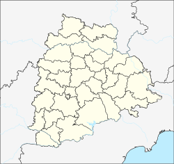
Chilkur mandal is one of the 23 mandals in Suryapet district of the Indian state of Telangana. It is under the administration of Kodad revenue division with its headquarters at Chilkur. The mandal is bounded by Kodad mandal to the east, Huzurnagar mandal to the south, Munagala mandal to the north.
Cheedella is a village in Penpahad mandal of Suryapet district in Telangana, India.It is located 33 km from district headquarters, Suryapet.
Peddaveedu is a village in Mattampally mandal of Suryapet district in Telangana, India.It is located 73 km from district headquarters, Suryapet.