| Potoška Vas | |
|---|---|
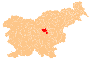
 Potoška Vas Location in Slovenia | |
| Coordinates: 46°9′18.41″N15°0′49.4″E / 46.1551139°N 15.013722°E Coordinates: 46°9′18.41″N15°0′49.4″E / 46.1551139°N 15.013722°E | |
| Country | |
| Traditional region | Upper Carniola |
| Statistical region | Central Sava |
| Municipality | Zagorje ob Savi |
| Area | |
| • Total | 2.82 km2 (1.09 sq mi) |
| Elevation | 333.4 m (1,093.8 ft) |
| Population (2002) | |
| • Total | 222 |
| [1] | |
Potoška Vas (pronounced [pɔˈtoːʃka ˈʋaːs] ; Slovene : Potoška vas, German : Potoschkawas [2] ) is a village north of Zagorje ob Savi in central Slovenia. The area is part of the traditional region of Upper Carniola. It is now included with the rest of the Municipality of Zagorje ob Savi in the Central Sava Statistical Region. [3]

Slovene or Slovenian belongs to the group of South Slavic languages. It is spoken by approximately 2.5 million speakers worldwide, the majority of whom live in Slovenia. It is the first language of about 2.1 million Slovenian people and is one of the 24 official and working languages of the European Union.

German is a West Germanic language that is mainly spoken in Central Europe. It is the most widely spoken and official or co-official language in Germany, Austria, Switzerland, South Tyrol (Italy), the German-speaking Community of Belgium, and Liechtenstein. It is also one of the three official languages of Luxembourg and a co-official language in the Opole Voivodeship in Poland. The languages which are most similar to German are the other members of the West Germanic language branch: Afrikaans, Dutch, English, the Frisian languages, Low German/Low Saxon, Luxembourgish, and Yiddish. There are also strong similarities in vocabulary with Danish, Norwegian and Swedish, although those belong to the North Germanic group. German is the second most widely spoken Germanic language, after English.

A village is a clustered human settlement or community, larger than a hamlet but smaller than a town, with a population ranging from a few hundred to a few thousand. Though villages are often located in rural areas, the term urban village is also applied to certain urban neighborhoods. Villages are normally permanent, with fixed dwellings; however, transient villages can occur. Further, the dwellings of a village are fairly close to one another, not scattered broadly over the landscape, as a dispersed settlement.
The Zagorje ob Savi airstrip is located south of the settlement. [4]

An airport is an aerodrome with extended facilities, mostly for commercial air transport. Airports often have facilities to store and maintain aircraft, and a control tower. An airport consists of a landing area, which comprises an aerially accessible open space including at least one operationally active surface such as a runway for a plane to take off or a helipad, and often includes adjacent utility buildings such as control towers, hangars and terminals. Larger airports may have airport aprons, taxiway bridges, air traffic control centres, passenger facilities such as restaurants and lounges, and emergency services. In some countries, the US in particular, they also typically have one or more fixed-base operators, serving general aviation.