Ravenska Vas

Last updated
Ravenska Vas
Sveti Urh (until 1955)
Ravenska vas IMG 6143.jpg
Slovenia location map.svg
Red pog.svg
Ravenska Vas
Location in Slovenia
Coordinates: 46°8′2.94″N15°1′8.49″E / 46.1341500°N 15.0190250°E / 46.1341500; 15.0190250 Coordinates: 46°8′2.94″N15°1′8.49″E / 46.1341500°N 15.0190250°E / 46.1341500; 15.0190250
Country Flag of Slovenia.svg Slovenia
Traditional region Upper Carniola
Statistical region Central Sava
Municipality Zagorje ob Savi
Area
  Total 4.41 km2 (1.70 sq mi)
Elevation 423.9 m (1,390.7 ft)
Population (2002)
  Total 214
[1]

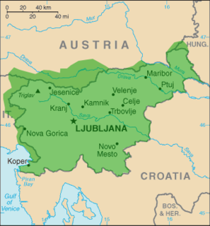
Ravenska Vas (pronounced  [ɾaˈʋeːnska ˈʋaːs] or [ˈɾaːʋɛnska ˈʋaːs] ; Slovene : Ravenska vas, formerly Sveti Urh, [2] German : Sankt Ulrich [2] ) is a settlement immediately east and southeast of Zagorje ob Savi in central Slovenia. The area is part of the traditional region of Upper Carniola. It is now included with the rest of the municipality in the Central Sava Statistical Region. [3]
Slovene language language spoken in Slovenia

Slovene or Slovenian belongs to the group of South Slavic languages. It is spoken by approximately 2.5 million speakers worldwide, the majority of whom live in Slovenia. It is the first language of about 2.1 million Slovenian people and is one of the 24 official and working languages of the European Union.

German language West Germanic language

German is a West Germanic language that is mainly spoken in Central Europe. It is the most widely spoken and official or co-official language in Germany, Austria, Switzerland, South Tyrol (Italy), the German-speaking Community of Belgium, and Liechtenstein. It is also one of the three official languages of Luxembourg and a co-official language in the Opole Voivodeship in Poland. The languages which are most similar to German are the other members of the West Germanic language branch: Afrikaans, Dutch, English, the Frisian languages, Low German/Low Saxon, Luxembourgish, and Yiddish. There are also strong similarities in vocabulary with Danish, Norwegian and Swedish, although those belong to the North Germanic group. German is the second most widely spoken Germanic language, after English.

Zagorje ob Savi Place in Upper Carniola, Slovenia

Zagorje ob Savi is a town in the Central Sava Valley in central Slovenia. It is the seat of the Municipality of Zagorje ob Savi. It is located in the valley of Medija Creek, a minor left tributary of the Sava River, 52 km (32 mi) east of Ljubljana 36 km (22 mi) southwest of Celje, and 6 km (4 mi) west of Trbovlje. Traditionally the area was part of the Upper Carniola region. The entire municipality is now included in the Central Sava Statistical Region. The town is home to about 7,000 people. It includes the hamlets of Toplice and Podvine.

Contents

Name

The name of the settlement was changed from Sveti Urh (literally, 'Saint Ulrich') to Ravenska vas (literally, 'level village') in 1955. The name was changed on the basis of the 1948 Law on Names of Settlements and Designations of Squares, Streets, and Buildings as part of efforts by Slovenia's postwar communist government to remove religious elements from toponyms. [4] [5] [6]

Mass graves

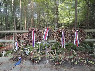
Ravenska Vas is the site of five known mass graves associated with the Second World War. They all contain the remains of unidentified victims. The Snežet Mass Grave (Slovene : Grobišče Snežet) is located in the woods 500 m south of the house at Ravenska Vas no. 38. [7] The Birch Mass Grave (Grobišče Pod brezo) is located in the woods 300 m east of the house at Ravenska Vas no. 39. [8] The Ravenska Vas 1–3 mass graves (Grobišče Ravenska vas 1–3) are located in a meadow on the edge of the woods. [9] [10] [11]

Mass graves in Slovenia

Mass graves in Slovenia were created in Slovenia as the result of extrajudicial killings during and after the Second World War. They are known as "concealed mass graves" or "silenced mass graves" because their existence was concealed under the communist regime from 1945 to 1990.

Church

The local church is dedicated to Saint Ulrich (Slovene : sveti Urh) and belongs to the Parish of Zagorje ob Savi. It dates to the late 16th century and was restyled in the Baroque in the late 18th century. [12]

Church (building) building constructed for Christian worship

A church building or church house, often simply called a church, is a building used for Christian religious activities, particularly for Christian worship services. The term is often used by Christians to refer to the physical buildings where they worship, but it is sometimes used to refer to buildings of other religions. In traditional Christian architecture, the church is often arranged in the shape of a Christian cross. When viewed from plan view the longest part of a cross is represented by the aisle and the junction of the cross is located at the altar area.

Ulrich of Augsburg German bishop and saint

Saint Ulrich of Augsburg, sometimes spelled Uodalric or Odalrici, was Bishop of Augsburg in Germany. He was the first saint to be canonized not by a local authority but by the Pope.

A parish is a territorial entity in many Christian denominations, constituting a division within a diocese. A parish is under the pastoral care and clerical jurisdiction of a parish priest, who might be assisted by one or more curates, and who operates from a parish church. Historically, a parish often covered the same geographical area as a manor. Its association with the parish church remains paramount.

Related Research Articles

Prebold Settlement in Styria, Slovenia

Prebold is a settlement in central Slovenia. It is the seat of the Municipality of Prebold. It lies on the edge of the lower Savinja Valley at the northern edge of the Sava Hills west of Celje. The area was part of the traditional region of Styria. The municipality is now included in the Savinja Statistical Region.

Bistrica ob Sotli Place in Styria, Slovenia

Bistrica ob Sotli is a settlement in eastern Slovenia. It is the seat of the Municipality of Bistrica ob Sotli. The settlement lies on a river terrace above the right bank of the Sotla River. The area traditionally belonged to the region of Styria. It is now included in the Lower Sava Statistical Region; until January 2014 it was part of the Savinja Statistical Region. The settlement includes the hamlets of Čehovec, Koče, and Marof.

Sveti Jurij ob Ščavnici Municipality in Slovenia

Sveti Jurij ob Ščavnici is a settlement and a municipality in northeastern Slovenia. It lies on the Ščavnica River in the region known as Prlekija. Traditionally the area was part of Styria. The municipality is now included in the Mura Statistical Region.

Šmarjeta pri Celju Place in Styria, Slovenia

Šmarjeta pri Celju is a settlement in the City Municipality of Celje in eastern Slovenia. It lies on the Hudinja River in the northern outskirts of Celje. The area was traditionally part of the Styria region. It is now included with the rest of the municipality in the Savinja Statistical Region.

Hrastovec, Velenje Place in Styria, Slovenia

Hrastovec is a settlement in the Municipality of Velenje in northern Slovenia. The area was traditionally part of Styria. The municipality is now included in the Savinja Statistical Region.

Zadnja Vas Place in Upper Carniola, Slovenia

Zadnja Vas is a small village in the Municipality of Radovljica in the Upper Carniola region of Slovenia.

Sveti Duh, Bloke Place in Inner Carniola, Slovenia

Sveti Duh is a small village north of Nova Vas in the Municipality of Bloke in the Inner Carniola region of Slovenia.

Jurski Vrh Place in Styria, Slovenia

Jurski Vrh is a settlement in the Municipality of Kungota in the western part of the Slovene Hills in northeastern Slovenia, right on the border with Austria. It includes the hamlet of Jurij ob Pesnici, on the left bank of the Pesnica River, as well as the dispersed houses in the hills north of the village.

Sveti Anton na Pohorju Place in Styria, Slovenia

Sveti Anton na Pohorju is a dispersed settlement in the Pohorje Hills in the Municipality of Radlje ob Dravi in Slovenia.

Sveti Trije Kralji, Radlje ob Dravi Place in Styria, Slovenia

Sveti Trije Kralji is a dispersed settlement in the hills northwest of Radlje ob Dravi in Slovenia, right on the border with Austria.

Sveti Florijan Village in Styria, Slovenia

Sveti Florijan is a settlement in the Municipality of Rogaška Slatina in eastern Slovenia. The wider area around Rogaška Slatina was traditionally part of the region of Styria. It is now included in the Savinja Statistical Region.

Podkum Place in Lower Carniola, Slovenia

Podkum is a settlement in the Municipality of Zagorje ob Savi in central Slovenia. The area is part of the traditional region of Lower Carniola. It is now included with the rest of the municipality in the Central Sava Statistical Region.

Vrhe, Trbovlje Place in Styria, Slovenia

Vrhe is a settlement in the Municipality of Trbovlje in central Slovenia. It lies in the hills northwest of the town of Trbovlje and part of the settlement lies in the neighbouring Municipality of Zagorje ob Savi. Traditionally the area was part of the Styria region. It is now included with the rest of the municipality in the Central Sava Statistical Region.

Gore, Hrastnik Place in Styria, Slovenia

Gore is a settlement in the Municipality of Hrastnik in central Slovenia. Traditionally the area was part of the Styria region. It is now included with the rest of the municipality in the Central Sava Statistical Region.

Olešče Place in Styria, Slovenia

Olešče is a settlement in the Municipality of Laško in eastern Slovenia. It lies in the hills east of Laško. The area was traditionally part of the Styria region. It is now included with the rest of the municipality in the Savinja Statistical Region.

Urh, Slovenska Bistrica Place in Styria, Slovenia

Urh is a small settlement in the Pohorje Hills in the Municipality of Slovenska Bistrica in northeastern Slovenia. The area is part of the traditional region of Styria. It is now included with the rest of the municipality in the Drava Statistical Region.

Pongrac Place in Styria, Slovenia

Pongrac is a settlement in the Municipality of Žalec in east-central Slovenia. It lies in the hills south of Žalec. The area is part of the traditional region of Styria. The municipality is now included in the Savinja Statistical Region.

Sveti Štefan, Šmarje pri Jelšah Place in Styria, Slovenia

Sveti Štefan is a small settlement in the Municipality of Šmarje pri Jelšah in eastern Slovenia. It lies in the hills south of Šmarje in the Kozje region. The area is part of the traditional region of Styria. The municipality is now included in the Savinja Statistical Region.

Vršna Vas Place in Styria, Slovenia

Vršna Vas is a dispersed settlement in the hills south of Šmarje pri Jelšah in eastern Slovenia. The area is part of Styria and is included in the Savinja Statistical Region. It is a scattered village on a ridge and slope on either side of Zibika Creek. It includes the hamlets of Planinca and Sveta Magdalena.

Sveti Urh may refer to several places in Slovenia:

References

  1. Statistical Office of the Republic of Slovenia
  2. 1 2 Leksikon občin kraljestev in dežel zastopanih v državnem zboru, vol. 6: Kranjsko. 1906. Vienna: C. Kr. Dvorna in Državna Tiskarna, p. 96.
  3. Zagorje ob Savi municipal site
  4. Spremembe naselij 1948–95. 1996. Database. Ljubljana: Geografski inštitut ZRC SAZU, DZS.
  5. Premk, F. 2004. Slovenska versko-krščanska terminologija v zemljepisnih imenih in spremembe za čas 1921–1967/68. Besedoslovne lastnosti slovenskega jezika: slovenska zemljepisna imena. Ljubljana: Slavistično društvo Slovenije, pp. 113–132.
  6. Urbanc, Mimi, & Matej Gabrovec. 2005. Krajevna imena: poligon za dokazovanje moči in odraz lokalne identitete. Geografski vestnik 77(2): 25–43.
  7. Snežet Mass Grave on Geopedia (in Slovene)
  8. Birch Mass Grave on Geopedia (in Slovene)
  9. Ravenska Vas 1 Mass Grave on Geopedia (in Slovene)
  10. Ravenska Vas 2 Mass Grave on Geopedia (in Slovene)
  11. Ravenska Vas 3 Mass Grave on Geopedia (in Slovene)
  12. Slovenian Ministry of Culture register of national heritage reference number ešd 2691