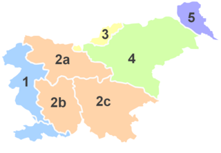
Dobrljevo is a settlement north of Izlake in the Municipality of Zagorje ob Savi in central Slovenia. The area is part of the traditional region of Upper Carniola. It is now included with the rest of the municipality in the Central Sava Statistical Region.

Dolenja Vas is a settlement in the Municipality of Zagorje ob Savi in central Slovenia. It extends from the western outskirts of Zagorje ob Savi to the left bank of the Sava River. The area is part of the traditional region of Upper Carniola. It is now included with the rest of the municipality in the Central Sava Statistical Region.

Družina is a small dispersed settlement in the hills above the left bank of the Sava River in the Municipality of Zagorje ob Savi in central Slovenia. It is accessible by road from Dolenja Vas. The area is part of the traditional region of Upper Carniola. It is now included with the rest of the municipality in the Central Sava Statistical Region.

Jablana is a settlement in the hills west of Zagorje ob Savi in central Slovenia. The area is part of the traditional region of Upper Carniola. It is now included with the rest of the Municipality of Zagorje ob Savi in the Central Sava Statistical Region.

Jelenk is a settlement in the hills east of Trojane in central Slovenia. It is part of the Municipality of Zagorje ob Savi. The area is part of the traditional region of Upper Carniola. It is now included with the rest of the municipality in the Central Sava Statistical Region.

Jesenovo is a settlement north of Zagorje ob Savi in central Slovenia. The area is part of the traditional region of Upper Carniola. It is now included with the rest of the Municipality of Zagorje ob Savi in the Central Sava Statistical Region.

Kandrše is a settlement in the Municipality of Zagorje ob Savi in central Slovenia. A small part of the settlement lies in the neighbouring Municipality of Litija. The area is part of the traditional region of Upper Carniola. The major part of the settlement is now included with the rest of the Municipality of Zagorje in the Central Sava Statistical Region.

Kolk is a small settlement in the hills above the left bank of the Sava River, south of Šentlambert, in the Municipality of Zagorje ob Savi in central Slovenia. The area is part of the traditional region of Upper Carniola. It is now included with the rest of the municipality in the Central Sava Statistical Region. It includes the hamlets of Zavšenik and Selišče.

Kostrevnica is a settlement in the hills southwest of Izlake in the Municipality of Zagorje ob Savi in central Slovenia. The area is part of the traditional region of Upper Carniola. It is now included with the rest of the municipality in the Central Sava Statistical Region.

Selo pri Zagorju is a settlement immediately east of Zagorje ob Savi in central Slovenia. The area is part of the traditional region of Upper Carniola. It is now included with the rest of the Municipality of Zagorje ob Savi in the Central Sava Statistical Region.

Šentgotard is a village in the hills east of Trojane in central Slovenia. It lies in the Municipality of Zagorje ob Savi. The area is part of the traditional region of Upper Carniola. It is now included with the rest of the municipality in the Central Sava Statistical Region.

Šentlambert is a village in the hills west of Zagorje ob Savi in central Slovenia. The area is part of the traditional region of Upper Carniola. It is now included with the rest of the Municipality of Zagorje ob Savi in the Central Sava Statistical Region.

Vine is a settlement in the Municipality of Zagorje ob Savi in central Slovenia. It lies in the hills immediately north of Zagorje ob Savi. The area is part of the traditional region of Upper Carniola. It is now included with the rest of the municipality in the Central Sava Statistical Region.

Vrhe is a remote dispersed settlement in the hills northeast of Izlake in the Municipality of Zagorje ob Savi in central Slovenia. Traditionally the area is part of the Lower Styria region. It is now included with the rest of the municipality in the Central Sava Statistical Region.

Zavine is a settlement in the hills north of Kisovec in the Municipality of Zagorje ob Savi in central Slovenia. The area is part of the traditional region of Upper Carniola. It is now included with the rest of the municipality in the Central Sava Statistical Region.

Zgornji Prhovec is a settlement north of Izlake in the Municipality of Zagorje ob Savi in central Slovenia. The area is part of the traditional region of Upper Carniola. It is now included with the rest of the municipality in the Central Sava Statistical Region.

Spodnji Šemnik is a small settlement in the Municipality of Zagorje ob Savi in central Slovenia. The settlement is part of the traditional region of the Upper Carniola and is included in the Central Sava Statistical Region.

Kal is a settlement in the hills west of Zagorje ob Savi in central Slovenia. The area is part of the traditional region of Styria. It is now included with the rest of the Municipality of Zagorje ob Savi in the Central Sava Statistical Region.

Špital is a settlement in the hills west of Zagorje ob Savi in central Slovenia. The area is part of the traditional region of Styria. It is now included with the rest of the Municipality of Zagorje ob Savi in the Central Sava Statistical Region.


