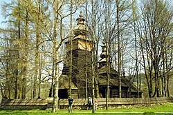
Michałówka is a village in the administrative district of Gmina Radymno, within Jarosław County, Subcarpathian Voivodeship, in south-eastern Poland, close to the border with Ukraine. It lies approximately 5 kilometres (3 mi) east of Radymno, 17 km (11 mi) south-east of Jarosław, and 64 km (40 mi) east of the regional capital Rzeszów.
Wodnica is a village in the administrative district of Gmina Wołów, within Wołów County, Lower Silesian Voivodeship, in south-western Poland. Prior to 1945 it was in Germany.
Niedźwiednik is a village in the administrative district of Gmina Ziębice, within Ząbkowice Śląskie County, Lower Silesian Voivodeship, in south-western Poland. Prior to 1945 it was in Germany.
Golce is a village in the administrative district of Gmina Wałcz, within Wałcz County, West Pomeranian Voivodeship, in north-western Poland. It lies approximately 12 kilometres (7 mi) north of Wałcz and 123 km (76 mi) east of the voivodeship capital Szczecin. Golce are inhabited by approximately 300 people.
Zakale is a village in the administrative district of Gmina Korycin, within Sokółka County, Podlaskie Voivodeship, in north-eastern Poland.
Mniszków is a village in Opoczno County, Łódź Voivodeship, in central Poland. It is the seat of the gmina called Gmina Mniszków. It lies approximately 18 kilometres (11 mi) west of Opoczno and 61 km (38 mi) south-east of the regional capital Łódź.
Koszary is a village in the administrative district of Gmina Limanowa, within Limanowa County, Lesser Poland Voivodeship, in southern Poland. It lies approximately 7 kilometres (4 mi) north-west of Limanowa and 48 km (30 mi) south-east of the regional capital Kraków.
Budynin is a village in the administrative district of Gmina Ulhówek, within Tomaszów Lubelski County, Lublin Voivodeship, in eastern Poland, close to the border with Ukraine. It lies approximately 13 kilometres (8 mi) east of Ulhówek, 38 km (24 mi) east of Tomaszów Lubelski, and 133 km (83 mi) south-east of the regional capital Lublin.
Kostrzeszyn is a village in the administrative district of Gmina Złota, within Pińczów County, Świętokrzyskie Voivodeship, in south-central Poland. It lies approximately 5 kilometres (3 mi) west of Złota, 19 km (12 mi) south of Pińczów, and 58 km (36 mi) south of the regional capital Kielce.
Słup Pierwszy is a village in the administrative district of Gmina Borowie, within Garwolin County, Masovian Voivodeship, in east-central Poland.
Gałki is a village in the administrative district of Gmina Gielniów, within Przysucha County, Masovian Voivodeship, in east-central Poland. It lies approximately 3 kilometres (2 mi) south-east of Gielniów, 8 km (5 mi) west of Przysucha, and 100 km (62 mi) south of Warsaw.
Michalin is a village in the administrative district of Gmina Zwoleń, within Zwoleń County, Masovian Voivodeship, in east-central Poland. It lies approximately 6 kilometres (4 mi) east of Zwoleń and 105 km (65 mi) south-east of Warsaw.
Warzymowo is a village in the administrative district of Gmina Skulsk, within Konin County, Greater Poland Voivodeship, in west-central Poland. It lies approximately 5 kilometres (3 mi) south-east of Skulsk, 27 km (17 mi) north of Konin, and 99 km (62 mi) east of the regional capital Poznań.
Biskupie Sarnowskie is a village in the administrative district of Gmina Ślesin, within Konin County, Greater Poland Voivodeship, in west-central Poland.
Ujazdowo is a village in the administrative district of Gmina Włoszakowice, within Leszno County, Greater Poland Voivodeship, in west-central Poland. It lies approximately 3 kilometres (2 mi) north-west of Włoszakowice, 19 km (12 mi) north-west of Leszno, and 64 km (40 mi) south-west of the regional capital Poznań.
Antonin is a village in the administrative district of Gmina Kostrzyn, within Poznań County, Greater Poland Voivodeship, in west-central Poland.
Kluczewo is a village in the administrative district of Gmina Przemęt, within Wolsztyn County, Greater Poland Voivodeship, in west-central Poland. It lies approximately 6 kilometres (4 mi) north-east of Przemęt, 20 km (12 mi) south-east of Wolsztyn, and 56 km (35 mi) south-west of the regional capital Poznań.
Marzelewo is a village in the administrative district of Gmina Września, within Września County, Greater Poland Voivodeship, in west-central Poland.
Sambród Mały is a village in the administrative district of Gmina Małdyty, within Ostróda County, Warmian-Masurian Voivodeship, in northern Poland. It lies approximately 4 kilometres (2 mi) north of Małdyty, 32 km (20 mi) north-west of Ostróda, and 54 km (34 mi) west of the regional capital Olsztyn.
Rokitno is a village in the administrative district of Gmina Nowogródek Pomorski, within Myślibórz County, West Pomeranian Voivodeship, in north-western Poland.