This article includes a list of references, related reading, or external links, but its sources remain unclear because it lacks inline citations .(August 2024) |
Prairie Siding | |
|---|---|
Unincorporated community | |
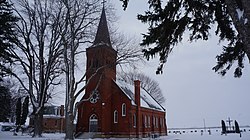 St. Peter's Church on the Thames River | |
 | |
| Coordinates: 42°20′48″N82°19′27″W / 42.34667°N 82.32417°W | |
| Country | Canada |
| Province | Ontario |
| Municipality | Chatham-Kent |
| Time zone | UTC-5 (EST) |
| • Summer (DST) | UTC-4 (EDT) |
| Forward sortation area | |
| Area codes | 519 and 226 |
| NTS Map | 040J08 |
| GNBC Code | FEMQN |
Prairie Siding is a small farming community located in Southwestern Ontario. It lies north of the shores of Lake Erie. It supports one of the bridges across the Thames River for Southwestern Ontario.