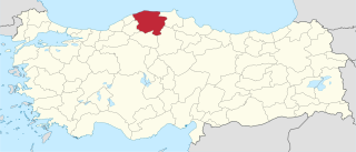
Pranjci | |
---|---|
Village | |
Coordinates: 43°19′N19°39′E / 43.317°N 19.650°E | |
Country | |
District | Zlatibor District |
Municipality | Prijepolje |
Population (2002) | |
• Total | 360 |
Time zone | CET (UTC+1) |
• Summer (DST) | CEST (UTC+2) |
Pranjci is a village in the municipality of Prijepolje, Serbia. According to the 2002 census, the village has a population of 360 people. [1]
A village is a clustered human settlement or community, larger than a hamlet but smaller than a town, with a population ranging from a few hundred to a few thousand. Though villages are often located in rural areas, the term urban village is also applied to certain urban neighborhoods. Villages are normally permanent, with fixed dwellings; however, transient villages can occur. Further, the dwellings of a village are fairly close to one another, not scattered broadly over the landscape, as a dispersed settlement.
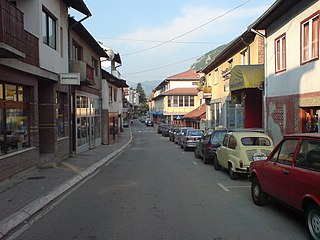
Prijepolje is a town and municipality located in the Zlatibor District of southwestern Serbia. As of 2011 census, the town has 13,330 inhabitants, while the municipality has 37,059 inhabitants.
Serbia, officially the Republic of Serbia, is a country situated at the crossroads of Central and Southeast Europe in the southern Pannonian Plain and the central Balkans. It borders Hungary to the north, Romania to the northeast, Bulgaria to the southeast, North Macedonia to the south, Croatia and Bosnia and Herzegovina to the west, and Montenegro to the southwest. The country claims a border with Albania through the disputed territory of Kosovo. Serbia's population numbers approximately seven million, most of whom are Orthodox Christians. Its capital, Belgrade, ranks among the oldest and largest citiеs in southeastern Europe.
Kokšov-Bakša is a village and municipality in Košice-okolie District in the Kosice Region of eastern Slovakia.
Piotroniowice is a village in the administrative district of Gmina Wołów, within Wołów County, Lower Silesian Voivodeship, in south-western Poland. The earliest mention concerning Piotroniowice dates from 13th century. It was burned by the Hussites in 1431. It was also damaged during the Thirty Years' War several times. Piotroniowice in 1939 had a population of 250. by Prior to 1945 it was in Germany.
Grozești is a commune in Mehedinți County, Romania. It is composed of four villages: Cârceni, Grozești, Păsărani and Șușița.
Verguleasa is a commune in Olt County, Romania. It is composed of seven villages: Căzănești, Cucueți, Dumitrești, Poganu, Valea Fetei, Vânești and Verguleasa.
Arcelin is a village in the administrative district of Gmina Płońsk, within Płońsk County, Masovian Voivodeship, in east-central Poland. It lies approximately 5 kilometres (3 mi) west of Płońsk and 67 km (42 mi) north-west of Warsaw.
Zezuty is a village in the administrative district of Gmina Olsztynek, within Olsztyn County, Warmian-Masurian Voivodeship, in northern Poland. It lies approximately 8 kilometres (5 mi) north of Olsztynek and 20 km (12 mi) south-west of the regional capital Olsztyn.
Rudziszki is a village in the administrative district of Gmina Węgorzewo, within Węgorzewo County, Warmian-Masurian Voivodeship, in northern Poland, close to the border with the Kaliningrad Oblast of Russia. It lies approximately 13 kilometres (8 mi) north-west of Węgorzewo and 96 km (60 mi) north-east of the regional capital Olsztyn.
Borčani is a village in the municipality of Tomislavgrad, Bosnia and Herzegovina.
Bistrica is a village in the municipality of Nova Varoš, western Serbia. According to the 2002 census, the village has a population of 791 people.
Vlasina Okruglica is a village in the municipality of Surdulica, Serbia. According to the 2002 census, the village has a population of 163 people.
Vahtraste is a village in Muhu Parish, Saare County in western Estonia.
Kraviće is a village in the municipality of Raška, Serbia. According to the 2002 census, the village has a population of 187 people.
Pocesje is a village in the municipality of Raška, Serbia. According to the 2002 census, the village has a population of 54 people.
Varevo is a village in the municipality of Raška, Serbia. According to the 2002 census, the village has a population of 1497 people.
Žutice is a village in the municipality of Raška, Serbia. According to the 2002 census, the village has a population of 224 people.
Reo is a village in Saaremaa Parish, Saare County in western Estonia.
Mirlovići is a village in the municipality of Višegrad, Bosnia and Herzegovina.
Višegradska Banja is a village in the municipality of Višegrad, Bosnia and Herzegovina.
Kırışoğlu is a village in the District of Kastamonu, Kastamonu Province, Turkey.
Coordinates: 43°19′N19°39′E / 43.317°N 19.650°E
A geographic coordinate system is a coordinate system that enables every location on Earth to be specified by a set of numbers, letters or symbols. The coordinates are often chosen such that one of the numbers represents a vertical position and two or three of the numbers represent a horizontal position; alternatively, a geographic position may be expressed in a combined three-dimensional Cartesian vector. A common choice of coordinates is latitude, longitude and elevation. To specify a location on a plane requires a map projection.
This Zlatibor District, Serbia location article is a stub. You can help Wikipedia by expanding it. |