Pratap Nagar, Jaipur

Last updated

Pratap Nagar
Suburban
Jaipur City Map (Wider).svg
Red pog.svg
Pratap Nagar
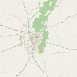
Location in Jaipur, India
Coordinates: 26°48′26″N75°49′19″E / 26.8072°N 75.8219°E / 26.8072; 75.8219 Coordinates: 26°48′26″N75°49′19″E / 26.8072°N 75.8219°E / 26.8072; 75.8219
CountryFlag of India.svg  India
State Rajasthan
District Jaipur
MetroPratap Nagar
Languages
  Official Hindi
Time zone UTC+5:30 (IST)
PIN
Planning agency Jaipur Development Authority

Pratap Nagar is one of the largest residential areas in Jaipur, India. It is located on NH 12 (locally known as Tonk Road). It is one of the fastest-growing areas in Jaipur.

Contents

It is 8 km away from Jaipur International Airport and 9 km away from nearest railway station (Durgapura railway station). Pratap Nagar is an area of interest for Rajasthan Housing Board and JDA (Jaipur Development Authority) for constructions and development. [1]
Health

Education

Schools

Colleges

8 SEC.

Online News Portals

Related Research Articles

Jaipur Capital of Rajasthan, India

Jaipur is the capital and the largest city of the Indian state of Rajasthan. As of 2011, the city had a population of 3.1 million, making it the tenth most populous city in the country. Jaipur is also known as the Pink City, due to the dominant colour scheme of its buildings. It is located 268 km from the national capital New Delhi. On 6 July 2019, UNESCO World Heritage Committee inscribed Jaipur the "Pink City of India" among its World Heritage Sites. Jaipur was founded in 1727 by the Kacchawa Rajput ruler Jai Singh II, the ruler of Amer, after whom the city is named. It was one of the earliest planned cities of modern India, designed by Vidyadhar Bhattacharya. During the British Colonial period, the city served as the capital of Jaipur State. After independence in 1947, Jaipur was made the capital of the newly formed state of Rajasthan.

Rourkela City in Odisha, India

Rourkelapronunciation  is a planned city located in the northern part of Odisha, India. It is the third-largest Urban Agglomeration in Odisha. It is situated about 328 kilometres (204 mi) west of state capital Bhubaneswar and is surrounded by a range of hills and encircled by rivers Koel, Sankha, & Brahmani. The city also popularly known as Ispat Nagar and Steel City of Odisha as well. One of the largest integrated steel plant set up with German collaboration Known as Rourkela Steel Plant, of Steel Authority of India Limited (SAIL). It also has one of the premier national level technical institute known as National Institutes of Technology (NIT Rourkela). Every year, on 3 March Rourkela Day has been celebrated.

Chengalpattu Town in Tamil Nadu, India

Chengalpattu, previously known as Chinglepet, is a town and the headquarters of Chengalpattu district of the state Tamil Nadu, India. The town is located near to the industrial and IT hub. It is the headquarters of the district and is 56 kilometres (35 mi) away from the state capital, Chennai on the National Highway 45.

Sangareddy Town in Telangana, India

Sangareddy, formerly Sangareddy peta, is a town and district headquarters of Sangareddy district in the Indian state of Telangana. It was named after the ruler Sanga, who was the son of Rani Shankaramba, a ruler of Medak during the period of Nizams.

Mayur Vihar Neighborhood of Delhi in East Delhi, India

Mayur Vihar is an upmarket residential area in East Delhi close to the Noida-Delhi border, situated just across the Yamuna River, and is divided into three distinct phases. As the name suggests, it has been the dwelling (vihar) of peacocks (mayur). Even today, the area has a closed sanctuary dedicated to the conservation of peacocks.

Beawar City in Rajasthan, India

Beawar is a city in Ajmer district of Rajasthan, India. Beawar was the financial capital of Merwara state of Rajputana. As of 2011, the population of Beawar is 342,935. It is located 70 kilometres from Ajmer the district headquarter, 184 kilometres (114 mi) southwest of the state capital Jaipur, amidst Aravali hills. The city used to be a major center for trade, especially in raw cotton, and used to have cotton presses and the Krishna cotton mills. Currently, major industries include mineral-based units, machine-based units, machine tools and accessories, pre-stressed concrete pipes, plastic products, textiles, wooden furniture and asbestos cement pipes. Beawar is the largest producer of cement in northern India and home to Shree Cement. It is situated in a mineral-rich region having reserves of feldspar, quartz, asbestos, soapstone, magnesite, calcite, limestone, mica, emerald, granite, and masonry stone. Reserves of barytes, fluorite, wollastonite and vermiculite have also been found. Nearest airports are Jodhpur (145 km) and Jaipur (190 km). It is also connected by RSRTC operated buses to all parts of Rajasthan, and neighboring Delhi NCR, Ahmedabad (Gujarat), Gwalior. It also has railway connectivity with Delhi, Mumbai, Ahmadabad, Bangalore (bi-weekly), Haridwar, Dehradun (weekly), Bareilly and Muzzafarpur.

Gandhidham City in Gujarat, India

Gandhidham is the developed, largest and most populous city in Kutch District, Gujarat, India. It was created in the early 1950s for the resettlement of Sindhi Hindu refugees from Sindh in the aftermath of the partition of India. It was named after Mahatma Gandhi, the father of the Indian nation. An economic capital of Kutch and a growing area for families and retirees, it is Gujarat's 8th most populous city. It is a popular destination for conventions, business and meetings.

Sohagpur Town in Madhya Pradesh, India

Sohagpur is a town and a nagar panchayat in Hoshangabad district in the Indian state of Madhya Pradesh. It is one of the subdivision and development block in Hoshangabad district. Sohagpur is also one of Legislative constituency of Madhya Pradesh. Sohagpur is famour for Betel culture, in huge quantity of betel is exported from here.

Nacharam Neighbourhood in Medchal–Malkajgiri, Telangana, India

Nacharam is a neighbourhood of Hyderabad in the Indian state of Telangana. It forms Ward No. 6 of Greater Hyderabad Municipal Corporation.

Shahdara district District of Delhi in India

ShahdaraDistrict is an administrative and revenue district of Delhi, India, situated near the banks of Yamuna river. The District Headquarter is Nand Nagari. It is one of the oldest inhabited areas of Delhi and integral to what is known as Purani Dilli. Shahdara district was formed in 2012 and has a collectorate office at Nand Nagri, Delhi. Delhi Metro started its operation in 2002 from Shahdara to Tis Hazari on the Red Line.

Kandivali Neighbourhood in Mumbai Suburban, Maharashtra, India

Kandivali formerly Khandolee is a neighbourhood in the north Mumbai, Maharashtra, India and has a large Gujarati population. It is the 20th railway station on the western line from Churchgate. It is an upmarket locality.

Santoshnagar neighborhood in Hyderabad, Telangana, India

Santosh Nagar Colony, or Santoshnagar Colony, is a residential and commercial area in Hyderabad, India. It is located near Saidabad in the Old City of Hyderabad and DRDO laboratories. Hyderabad International Airport is about 14 kilometres (8.7 mi) from here, spanning a 30 minute drive. It is divided into two areas, the Old Santoshnagar Colony and New Santoshnagar Colony. Santoshnagar falls under the Yakutpura assembly constituency, which is represented by All India Majlis-e-Ittehadul Muslimeen Legislator Syed Ahmed Pasha Quadri

Nizampet City in Telangana, India

Nizampet is a satellite city of Hyderabad and a municipal corporation situated in Bachupally mandal, Medchal-Malkajgiri district of Telangana, India. It is administered as Nizampet Municipal Corporation.

Indira Nagar, Lucknow Neighbourhood in Lucknow, Uttar Pradesh, India

Indira Nagar is a residential area in Lucknow in the Indian state of Uttar Pradesh. It was developed by the U.P. Housing Board and is one of the largest colonies in Asia.

Vasundhara Enclave Neighborhood of Delhi in East Delhi, India

Vasundhara Enclave is a residential area located in East Delhi, at Delhi-Noida border, one of the 11 zones of Delhi. The adjoining areas include Dallupura Village, Mayur Vihar Phase III, New Kondli, New Ashok Nagar, Noida Sector - 6 & 7. Vasundhara Enclave has about forty-four apartments, six markets, nine-ten schools, two colleges, one hospital & one dispensary.

Amb, India Town in Himachal Pradesh, India

Amb is a town situated in the district of Una in Himachal Pradesh state of India. It is situated in the Punjab region of Indian subcontinent. It is a sub-division and tehsil of Una district. The town was named Amb after the name of the goddess Amba, deity situated in nearby Chintpurni.

Nidamanuru, Krishna district Neighbourhood in Krishna district, Andhra Pradesh, India

Nidamanuru is a Town of Vijayawada in Krishna district of the Indian state of Andhra Pradesh. It is located in Vijayawada (rural) mandal of Vijayawada revenue division. As per the G.O. No. M.S.104 (dated:23-03-2017), Municipal Administration and Urban Development Department, it became a part of Vijayawada metropolitan area.

Ganapathy, Coimbatore Coimbatore, Tamil Nadu, India

Ganapathy is a residential neighbourhood in the city of Coimbatore in Tamil Nadu, India. It is located in the north-eastern part of the city. This is the most densely populated area within Coimbatore Corporation limits.

Nagar Untari Sub-Division in Jharkhand, India

Shree Banshidhar Nagar, also known as Nagar Unntari, is one of the administrative block in Garhwa district, Jharkhand state, India. It is located 40 km towards west from District headquarters Garhwa in Bhawanathpur Bidhansabha. Shree Banshidhar Nagar is surrounded by states Uttar Pradesh, Chhattisgarh and Bihar.

Vijay Nagar is a major residential, industrial and commercial area in Ghaziabad, Uttar Pradesh, India. It was developed with assistance of the Ghaziabad Development Authority. The suburb is located at the junction of Noida, Greater Noida, Crossings Republik, Pratap Vihar and Indirapuram. Vijay Nagar is known for its educational institutes, industrial areas, the Ghaziabad Junction Railway Station, the Meerut Expressway, NH-24 and the Vishwakarma Road. The area has witnessed rampant growth in infrastructure and civic development. Vijay Nagar is closely linked with the adjoining Pratap Vihar area having a residential area, upcoming real estate projects and the Santosh Medical & Dental College, a part of Santosh University.The adjoining Bhur Bharat Nagar is close to Ghaziabad Railway Station, the nearest railway station that serves this area.

References

  1. "Sector-11 Pratap Nagar Pin Code, Jaipur" . Retrieved 28 June 2014.