
Kingston upon Hull East is a borough constituency for the House of Commons of the Parliament of the United Kingdom. It elects one Member of Parliament (MP) at least once every five years by the first-past-the-post electoral system. The constituency has been represented by Karl Turner of the Labour Party since the 2010 general election.
Willerby is a village and civil parish located on the western outskirts of the city of Kingston upon Hull in the East Riding of Yorkshire, England.

The Kingston upon Hull tramway network was a network of 4 ft 8+1⁄2 instandard gauge tram lines following the five main roads radially out of the city centre of Kingston upon Hull, East Riding of Yorkshire, England. Two of these lines went west, and two east. The fifth went to the north, and branched to include extra lines serving suburban areas. Additionally a short line linked the city centre to the Corporation Pier where a ferry crossed the Humber Estuary to New Holland, Lincolnshire.
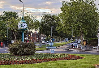
Anlaby Common is former common land, now an outer suburb of Kingston upon Hull. The area includes the residential areas which are located on the western urban fringe of Hull; the B1231 road passes through all of Anlaby Common's estates, east to west.

Drypool is an area within the city of Kingston upon Hull, England.

Orchard Park Estate is an area or housing estate situated on the north-western side of Kingston upon Hull, England.
Wisewood is a suburb of the city of Sheffield in South Yorkshire, England and situated 2+3⁄4 miles (4.4 km) north-west of the city centre. It is a residential suburb consisting almost exclusively of council housing, some of which has been bought by tenants under the right to buy scheme. It is bordered by the adjacent suburbs of Loxley, Wadsley, Malin Bridge and Hillsborough.
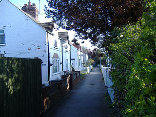
Stoneferry is a suburb of Kingston upon Hull, East Riding of Yorkshire, England. It was formerly a small hamlet on the east bank of the River Hull, the site of a ferry, and, after 1905, a bridge. The area is primarily industrial, and is situated on the east bank of the river, as well as close by areas on the west bank.
Gipsyville is a western suburb of Kingston upon Hull, in the East Riding of Yorkshire, England.

Newland is a suburb of Kingston upon Hull, East Riding of Yorkshire, England, in the north-west of the city, a former village on the Hull to Beverley turnpike.
Summergangs is a suburb of Kingston upon Hull, near the A165 road, in the East Riding of Yorkshire, England. The area contains the model village development known as The Garden Village and East Park.
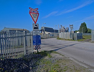
Marfleet is an area of Kingston upon Hull, East Riding of Yorkshire, England, in the east of the city, near King George Dock.

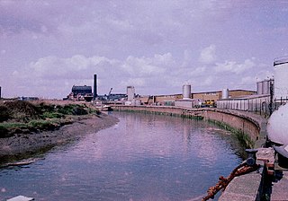
Holderness Drain is the main feature of a Land Drainage scheme for the area of Holderness to the east of the River Hull in the East Riding of Yorkshire, England. Construction began in 1764, and several notable civil engineers were involved with the scheme over the years. Despite the high costs of the initial scheme, it was not particularly successful, because of the refusal of the ship owners of Hull to allow an outlet at Marfleet. They insisted that the water be discharged into the River Hull to keep the channel free of silt. Following a period of agricultural depression and the building of new docks in the early 1800s, an outlet at Marfleet was finally authorised in 1832. A high level system still fed upland water to the Hull, but the low level system discharged into the Humber, where levels were considerably lower. Following the success of steam pumping on the Beverley and Barmston Drain, the trustees looked at such a possibility for the Holderness Drain, but the development of the Alexandra Dock in the 1880s and then the King George V Dock in 1913 provided a solution, as the docks were topped up with water pumped from the drain, to lessen the ingress of silt-laden water.

Southcoates is an urban area in the eastern part of Kingston upon Hull, England.

The North Hull Estate is a residential area in the north of Kingston upon Hull, west of the River Hull, built by Hull Corporation in the interwar period.
Dairycoates is an area of Kingston upon Hull, East Riding of Yorkshire, England, a former hamlet.

Greatfield Estate is a housing estate in the east of Kingston upon Hull, East Riding of Yorkshire. England, built in the late 1950s.

Kingswood, occasionally referred to as Kingswood Parks, is a modern housing estate on the northern fringe of Kingston upon Hull, England.

Bransholme water works is a surface water storage and pumping station serving the Bransholme and Kingswood estates in Kingston upon Hull, England. The facility was originally built in the late 1960s for both surface and waste water, and included a storage lagoon and sewage works – the sewage works was replaced c. 2000 by a large waste water treatment facility near Saltend near the banks of the Humber Estuary.


 St George's church, Marfleet Lane (dem. c. 2011) (2008)
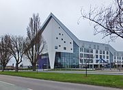 Archbishop Sentamu Academy (2015)
 Typical Preston Road Estate housing. Boarded and unoccupied prior to demolition for redevelopment (2007)
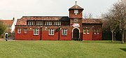
 Eastern Cemetery chapel, central building on a symmetrical trapezoidal plan, flanked by two rectangular plan chapels. built 1931 (2014)


