Related Research Articles

Crumpsall is an outer suburb and electoral ward of Manchester, England, 3 miles (5 km) north of Manchester city centre, bordered by Cheetham Hill, Blackley, Harpurhey, Broughton, and Prestwich. The population at the 2011 census was 15,959. Historically part of Lancashire, Crumpsall was a township within the parish of Manchester, Salford Hundred. North Manchester General Hospital is in Crumpsall.

The Metropolitan Borough of Bury is a metropolitan borough of Greater Manchester in England. It is north of Manchester, to the east of Bolton and west of Rochdale. The borough is centred around the town of Bury but also includes other towns such as Ramsbottom, Tottington, Radcliffe, Whitefield and Prestwich. Bury bounds the Lancashire districts of Rossendale and Blackburn with Darwen to the north. It is the 10th most populous borough in Greater Manchester.

Whitefield is a town in the Metropolitan Borough of Bury, Greater Manchester, England. It lies on undulating ground above the Irwell Valley, along the south bank of the River Irwell, 3 miles (4.8 km) southeast of Bury, and 5 miles (8.0 km) northwest of Manchester. Prestwich and the M60 motorway lie just to the south.

Churchdown is a large village in Gloucestershire, England, situated between Gloucester and Cheltenham in the south of the Tewkesbury Borough.

Little Aston is a village in the Lichfield District of Staffordshire, England. It is 5 miles (8 km) south of the city of Lichfield. It is contiguous with Sutton Coldfield and Streetly.At the 2011 United Kingdom census the population of Little Aston ward was 2,920 people living in 1,104 households. Little Aston is also in the parish of Shenstone.

Blackley is a suburban area of Manchester, England. Historically in Lancashire, it is approximately 4.5 miles (7.2 km) north of Manchester city centre, on the River Irk.

Prestwich is a town in the Metropolitan Borough of Bury, Greater Manchester, England, 3.3 miles (5.3 km) north of Manchester city centre, 3.1 miles (5 km) north of Salford and 4.7 miles (7.6 km) south of Bury.

Pendlebury is a town in the City of Salford, Greater Manchester, England. The population at the 2011 Census was 13,069. It lies 4 miles (6.4 km) north-west of Manchester city centre, 3 miles (4.8 km) north-west of Salford and 6 miles (9.7 km) south-east of Bolton.

Bury South is a borough constituency represented in the House of Commons of the Parliament of the United Kingdom. At the 2019 General Election it was the 10th most marginal seat in the country, with a majority of 402 for the Conservative Party candidate Christian Wakeford. Wakeford defected to the Labour Party on 19 January 2022.

Wychwood or Wychwood Forest is a 501.7-hectare (1,240-acre) biological Site of Special Scientific Interest north of Witney in Oxfordshire. It is also a Nature Conservation Review site, Grade 1, and an area of 263.4 hectares is a national nature reserve The site contains a long barrow dating to the Neolithic period, which is a scheduled monument.
Unsworth is a village and residential area of the Metropolitan Borough of Bury, in Greater Manchester, England. The population of Unsworth Ward, as of the 2011 census is 9,492. The village sits approximately 7 miles (11 km) north of the city of Manchester and 4 miles (6.4 km) south of the town of Bury, and contains the area of Hollins, and part of Sunny Bank.
Kersal is a suburb and district of Salford in Greater Manchester, England, 3 miles (4.8 km) northwest of Manchester and is part of the historic county of Lancashire.

Simister is a small suburb in the Metropolitan Borough of Bury, Greater Manchester, England. Historically part of Lancashire, it is located between the districts of Prestwich, Rhodes and Langley. Although the village's proximity to Manchester means the residential population is mainly made up of commuters, the village has a rural feel with much agricultural activity.

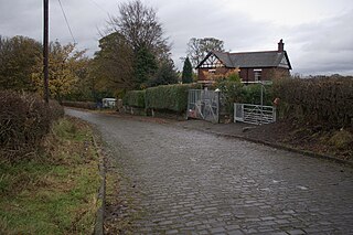
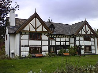
Drinkwater Park is situated in the Irwell Valley on the western border of Prestwich, near Manchester, bounded by the River Irwell to the west, Agecroft Road and Rainsough Brow (A6044) to the south, Butterstile Lane and Carr Clough estate to the east and Bunkers Hill to the north. The park is administered by Forestry England and is part of Prestwich Forest Park, which also incorporates Philips Park, Mere Clough, Prestwich Clough, Forest Bank Park in Pendlebury and Waterdale Meadow.
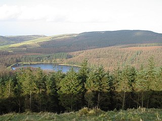
Macclesfield Forest is an area of woodland, predominantly conifer plantation, located around 3 mi (5 km) south east of Macclesfield in the civil parish of Macclesfield Forest and Wildboarclough, in Cheshire, England.

Hapton is a village and civil parish in the Borough of Burnley in Lancashire, England, 3 miles (4.8 km) west of Burnley, with a railway station on the East Lancashire Line. At the United Kingdom Census 2011, it had a population of 1,979.
Philips Park is an area of parkland situated within the Metropolitan Borough of Bury on the boundary of Whitefield and Prestwich, in Greater Manchester. The park consists of rich woodland and grassland habitat and is home to an assortment of wildlife. Two thirds of the site was once the Philips family estate, and the remainder, known as Waterdale, is Irwell Valley land reclaimed following the demolition of two bleach and dye works. The park is a local nature reserve.

Sheet Hedges Wood is in the parish of Newtown Linford, and lies some 1-mile (1.6 km) north of Groby, in Leicestershire, UK. The site is made up of two areas of woodland and a meadow field, all with public access, extending 29 acres (120,000 m2). The woodland block is adjacent to the road includes a car park and access trails.

Stanmore Common is a 49.2-hectare public park, Local Nature Reserve and Site of Metropolitan Importance for Nature Conservation in Stanmore in the London Borough of Harrow in England. It is owned by Harrow Council and managed by the council with a local group. It was a biological Site of Special Scientific Interest, but was de-notified in the early 1990s.
References
- ↑ Trust, Woodland. "Prestwich Clough". Woodland Trust. Retrieved 2020-09-17.
- ↑ "Prestwich Clough Leaflet" (PDF). Prestwich Clough. April 2012. Retrieved 17 September 2020.
- ↑ "Forest Park" (PDF). Prestwich.org.uk. Retrieved 17 September 2020.
- ↑ "Prestwich Clough Day – Prestwich Clough Day is a FREE Annual Event" . Retrieved 2020-09-17.