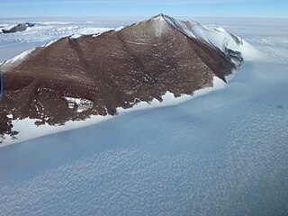
The Pensacola Mountains are a large group of mountain ranges of the Transantarctic Mountains System, located in the Queen Elizabeth Land region of Antarctica.
The Patuxent Range is a major range of the Pensacola Mountains, Antarctica. It comprises the Thomas Hills, Anderson Hills, Mackin Table and various nunataks and ridges bounded by the Foundation Ice Stream, Academy Glacier and the Patuxent Ice Stream.

The Leverett Glacier is about 50 nautical miles (90 km) long and 3 to 4 nautical miles wide, flowing from the Antarctic Plateau to the south end of the Ross Ice Shelf through the Queen Maud Mountains. It is an important part of the South Pole Traverse from McMurdo Station to the Admundson–Scott South Pole Station, providing a route for tractors to climb from the ice shelf through the Transantarctic Mountains to the polar plateau.

The Prince Charles Mountains are a major group of mountains in Mac. Robertson Land in Antarctica, including the Athos Range, the Porthos Range, and the Aramis Range. The highest peak is Mount Menzies, with a height of 3,228 m (10,591 ft). Other prominent peaks are Mount Izabelle and Mount Stinear. These mountains, together with other scattered peaks, form an arc about 420 km (260 mi) long, extending from the vicinity of Mount Starlight in the north to Goodspeed Nunataks in the south.
Cape Darnley is the ice-covered cape forming the northern extremity of Bjerkø Peninsula at the west side of MacKenzie Bay. On December 26, 1929, Sir Douglas Mawson, from the masthead of the RRS Discovery while at 66°57′S71°57′E, saw land miraged up on the southwest horizon. On February 10, 1931, he returned in the Discovery and was able to approach close enough to see the headland, naming it for E.R. Darnley, Chairman of the Discovery Committee of the Colonial Office, London, 1923 to 1933.
The Scott Mountains are a large number of isolated peaks lying south of Amundsen Bay in Enderby Land of East Antarctica, Antarctica. Discovered on 13 January 1930 by the British Australian New Zealand Antarctic Research Expedition (BANZARE) under Sir Douglas Mawson. He named the feature Scott Range after Captain Robert Falcon Scott, Royal Navy. The term mountains is considered more appropriate because of the isolation of its individual features.
Athos Range is the northernmost range in the Prince Charles Mountains of Mac. Robertson Land, Antarctica. The range consists of many individual mountains and nunataks that trend east–west for 40 miles (64 km) along the north side of Scylla Glacier.
Wilson Hills is a group of scattered hills, nunataks and ridges that extend northwest–southeast about 70 nautical miles between Matusevich Glacier and Pryor Glacier in Antarctica.

The David Glacier is a glacier over 60 nautical miles long, flowing east from the polar plateau through the Prince Albert Mountains to the coast of Victoria Land, Antarctica. It enters Ross Sea between Cape Philippi and Cape Reynolds to form the floating Drygalski Ice Tongue. It is the most imposing outlet glacier in Victoria Land. It is fed by two main flows which drain an area larger than 200,000 square kilometres, with an estimated ice discharge rate of 7.8 +/- 0.7 km³/year. The David Glacier was discovered by Ernest Shackleton's "Northern Party," in November 1908, under the leadership of Prof. T.W. Edgeworth David, of Sydney University, for whom the feature was named.
On the continent of Antarctica, the Aramis Range is the third range south in the Prince Charles Mountains, situated 11 miles southeast of the Porthos Range and extending for about 30 miles in a southwest–northeast direction. It was first visited in January 1957 by Australian National Antarctic Research Expeditions (ANARE) southern party led by W.G. Bewsher, who named it for a character in Alexandre Dumas' novel The Three Musketeers, the most popular book read on the southern journey.
Trilling Peaks is a group of linear nunataks, comprising three main peaks standing three miles south of South Masson Range in the Framnes Mountains, Mac. Robertson Land.
Casey Range is a jagged, razor-backed ridge and a few nunataks in a line extending north–south, standing 8 miles (13 km) west of David Range, in the Framnes Mountains. It was discovered by the British Australian and New Zealand Antarctic Research Expedition (BANZARE), 1929–31, under Douglas Mawson, who named it for Rt. Hon. Richard G. Casey.
Wyers Nunataks is a group of nunataks at the base of Sakellari Peninsula, just west of Wyers Ice Shelf in Enderby Land. Plotted from air photos taken from ANARE aircraft in 1956 and 1957. Named by Antarctic Names Committee of Australia (ANCA) for R.W.L. Wyers, glaciologist at Mawson Station in 1961.
Watson Nunatak is a nunatak standing between Price and Van Hulssen Nunataks in the Trilling Peaks, Framnes Mountains, in Mac. Robertson Land. It was mapped by Norwegian cartographers from air photos taken by the Lars Christensen Expedition, 1936–37. I was named by the Antarctic Names Committee of Australia (ANCA) for K.D. Watson, a diesel mechanic at Mawson Station who assisted in the Framnes Mountains--Depot Peak survey by ANARE in 1965.

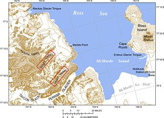
Mackay Glacier is a large glacier in Victoria Land, descending eastward from the Antarctic Plateau, between the Convoy Range and Clare Range, into the southern part of Granite Harbour. It was discovered by the South magnetic pole party of the British Antarctic Expedition, 1907–09, and named for Alistair Mackay, a member of the party. The glacier's tongue is called Mackay Glacier Tongue. First mapped by the British Antarctic Expedition, 1910–13 and named for Alistair F. Mackay, a member of the party. Its mouth is south of the Evans Piedmont Glacier and the Mawson Glacier. It is north of the Wilson Piedmont Glacier and the Ferrar Glacier.
The Mackin Table is an ice-topped, wedge-shaped plateau, about 20 nautical miles long, standing just north of Patuxent Ice Stream in the Patuxent Range of the Pensacola Mountains, Antarctica.
The South Masson Range is the southernmost of the three parts into which the Masson Range of the Framnes Mountains, Anatarctica is divided. It rises to 1,070 metres (3,510 ft) and extending 2 miles (3.2 km) in a northeast-southwest arc.
Lamplugh Island is an ice-capped island, 10 nautical miles long, lying 4 nautical miles north of Whitmer Peninsula, along the coast of Victoria Land, Antarctica.
Lincoln Nunatak is a snow-capped nunatak with a rocky west face, at the end of a ridge running westward from Mount Mangin on Adelaide Island, Antarctica. It was named by the UK Antarctic Place-Names Committee for Flight Lieutenant Warren D. Lincoln, Royal Air Force, a pilot with the British Antarctic Survey Aviation Unit based at Adelaide Station in 1962–63.
![]() This article incorporates public domain material from "Price Nunatak". Geographic Names Information System . United States Geological Survey.
This article incorporates public domain material from "Price Nunatak". Geographic Names Information System . United States Geological Survey. 


