Related Research Articles
Rockcliffe Park is a neighbourhood in Rideau-Rockcliffe Ward, close to the centre of Ottawa, Ontario, Canada. Established in 1864, organized as a Police village in 1908, and an independent village from 1926, and ultimately amalgamated with the rest of Ottawa on January 1, 2001. As of 2011, it had a population of 2,021. In 1977 the entire village of Rockcliffe Park was designated a Heritage Conservation District. Rockcliffe Park is one of only a handful of surviving nineteenth-century communities of its kind in North America.

Orléans is a federal electoral district in Ottawa, Ontario, Canada, that has been represented in the House of Commons of Canada since 1988.

The Senate of Canada Building is a building located at 2 Rideau Street in downtown Ottawa, Ontario, Canada that serves as the temporary seat of the Senate of Canada. The building includes the temporary Senate chamber, as well as some Senate offices and committee rooms. The building served as Ottawa's central railway station until 1966, and from 1966 to 2018 it was operated by the federal government as the Government Conference Centre.

Barrhaven is a rapidly growing suburban neighbourhood in the southwest of the urban area of the city of Ottawa, Ontario, Canada, about 17 km (11 mi) southwest of downtown Ottawa. Prior to amalgamation with Ottawa in 2001, Barrhaven was part of the City of Nepean. Its population as of the Canada 2016 Census was 87,234.

Carleton is a federal electoral district in Ontario, Canada, represented in the House of Commons of Canada from 1867 to 1968 and since 2015. It was represented in the Legislative Assembly of Upper Canada from 1821 to 1840 and in the Legislative Assembly of the Province of Canada from 1841 until 1866.
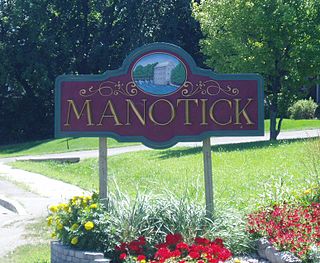
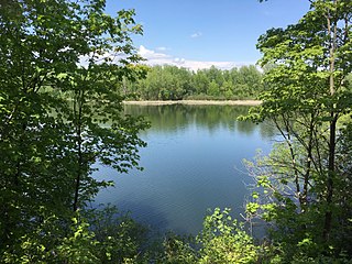
Manotick is a community in Rideau-Goulbourn Ward in the rural south part of the City of Ottawa, Ontario, Canada. It is a suburb of the city, located on the Rideau River, immediately south of the suburbs Barrhaven and Riverside South, about 25 km (16 mi) from downtown Ottawa. It was founded by Moss Kent Dickinson in 1864. He named the village 'Manotick', after the Algonquin word for 'island'. It has been part of the City of Ottawa since amalgamation in 2001. Prior to that, it was located in Rideau Township. According to the Canada 2016 Census, Manotick had a population of 4,486.

LeBreton Flats is a neighbourhood in Somerset Ward in central Ottawa, Ontario, Canada. It lies to the west of Centretown neighbourhood, and to the north of Centretown West. The Ottawa River forms the western and northern limit, with the western side being a wider area of the river known as Nepean Bay.

Alta Vista is a neighbourhood in Alta Vista Ward in Ottawa, Ontario, Canada. Its boundaries according to the Alta Vista Community Association are that part of Alta Vista Ward south of Smyth Road in the north, north of Walkley Road and east of the Rideau River, and west of the "greenspace underneath Haig Drive". However, the name is ambiguous, as there are several sub-neighbourhoods in this area,, as the neighbourhood could refer to the ward as a whole, down to thecore Alta Vista area,, centred on Alta Vista Drive.

Rideau View is a sub-neighbourhood of Carleton Heights in River Ward, in the west-end of Ottawa, Ontario, Canada, located near the Rideau River. It is bordered by Meadowlands Drive to the south, Claymor Avenue to the west and Dynes Road to the north. Debra Avenue is the main road that runs through the neighbourhood and there is some residential housing on Eiffel Avenue. Some of parts of the neighbourhoods are east of Prince of Wales Drive and runs parallel along the Rideau River. The area is also located close to the former city of Nepean. A major feature of the neighbourhood is a low-income housing project designed and built by the Ottawa Housing corporation. There are four high-rise condominiums on Prince of Wales at the corner of Dynes and Meadowlands.

Ottawa—Vanier is a provincial electoral district in Ottawa, Ontario, Canada, that has been represented in the Legislative Assembly of Ontario since 1908. It is located in the east end of Ottawa.

Hunt Club is a community in River Ward, in the south end of Ottawa, Ontario, Canada. The area is named after the prestigious Ottawa Hunt and Golf Club, which has been part of the area since 1876. Hunt Club Road and many local businesses were also named after the golf course.
Craig Henry is a residential neighbourhood in Knoxdale-Merivale Ward in the west end of Ottawa, Canada. It is located in the former city of Nepean. It is a residential subdivision that was developed from 1971 onwards. The neighbourhood is bordered by Woodroffe Avenue to the east, Greenbank Road to the west, Knoxdale Road to the south and the CN railroad separating it from Centrepointe and Briargreen to the north. The land previously belonged to the Craig Henry farm, and was developed by Jack Aaron.
Qualicum-Graham Park or Qualicum is a suburban neighbourhood in College Ward in the City of Ottawa, Ontario, Canada. It is located in the former City of Nepean in the west end of the city. Many of the residences in the area are executive homes situated on large lots (100x100) being built in the 1960s. Qualicum Street boasts large custom houses built by Bill Teron. The neighbourhood is bounded to the north by the Queensway, to the west by Richmond Road, to the south by Baseline Road, and to the east by Morrison Drive at the former Ottawa-Nepean border towards Redwood. Named after Qualicum Beach in British Columbia.

Carleton Heights is a neighbourhood in River Ward in Ottawa, Ontario, Canada. According to the Carleton Heights and Area Community Association, the neighbourhood is bounded on the north by the Central Experimental Farm, on the east by the Rideau River, on the south by the junction of Prince of Wales Drive and Fisher Avenue and on the west by Fisher Avenue. The neighbourhood is sometimes referred to as Hog's Back after the nearby falls. The total population of the neighbourhood is 7,586 according to the Canada 2016 Census.

Riverside Park is a neighbourhood in the south end of Ottawa, Canada.
Guildwood Estates is a sub neighbourhood within the Alta Vista area of Ottawa, Ontario, Canada. It can be broadly described as south of Kilborn Ave., west of the Walkley-Kilborn greenspace, east of Parkland and north of Heron Road. The population of this area according to the Canada 2011 Census was 3,179. However, maps usually show Guildwood Estates as the western section of this area, while the eastern half is the neighbourhood of Urbandale Acres. Guildwood Estates is newer, having mostly been built in the early 1970s, while Urbandale Acres was built in the 1960s.

The Capital Pathway, also known informally as the Bike Path, is a 220-kilometre (140 mi) recreational pathway interlinking many parks, waterways and sites in Ottawa, Ontario and Gatineau, Quebec. Most of the pathway is paved, and allows an almost continuous route through the National Capital Region.
Carleton Square is a sub-neighbourhood of Carleton Heights in the River Ward of Ottawa, Ontario, Canada. It is bounded on the west by Fisher Avenue, to the south Meadowlands Drive, Dynes Road to the north and Claymor Avenue to the east. According to the Canada 2011 Census the population for this area was 719.
Rideauview Terrace is a sub-neighbourhood of Carleton Heights in River Ward in the west-end of Ottawa, Ontario, Canada. It is located just west of the Rideau Canal. It is bordered by Prince of Wales Drive to the west, Heron Drive to the south, Rideau Canal to the east and the Central Experimental Farm to the north. It is across the Rideau Canal from Carleton University.
Country Place is a residential neighbourhood near the geographical centre of Ottawa, Canada and part of the former city of Nepean. It is a mature residential subdivision with about 400 houses located just inside the Ottawa greenbelt near the Rideau River, and about 11 km from downtown Ottawa. It is bordered by the Black Rapids Creek and the greenbelt to the south, Prince of Wales Drive to the east, Merivale Road to the west, and the Pineglen community to the north. Amberwood Crescent meanders through the community, exiting onto Prince of Wales and Merivale. Tennyson Drive links Country Place to Pineglen.
References
Coordinates: 45°21′37″N75°41′49″W / 45.3603°N 75.6970°W
| | This article relating to Ottawa and to Canada's National Capital Region is a stub. You can help Wikipedia by expanding it. |