Prines, Rethymno

Last updated

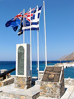
Prines (Greek : Πρινές) is a local community of the municipality of Rethymno within Rethymno regional unit, Crete, Greece. Before the "Kallikratis Project" it belonged to the municipality of Nikiforos Fokas (Νικηφόρος Φωκάς).

Greek language language spoken in Greece, Cyprus and Southern Albania

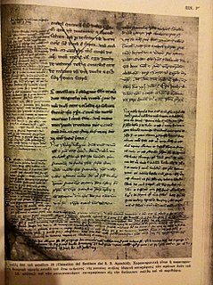
Greek is an independent branch of the Indo-European family of languages, native to Greece, Cyprus and other parts of the Eastern Mediterranean and the Black Sea. It has the longest documented history of any living Indo-European language, spanning more than 3000 years of written records. Its writing system has been the Greek alphabet for the major part of its history; other systems, such as Linear B and the Cypriot syllabary, were used previously. The alphabet arose from the Phoenician script and was in turn the basis of the Latin, Cyrillic, Armenian, Coptic, Gothic, and many other writing systems.

Rethymno (regional unit) Regional unit in Crete, Greece

Rethymno is one of the four regional units of Crete, Greece. Its capital is the city of Rethymno. Today its main income is tourism. The countryside is also based economically on agriculture and herding.

Crete The largest and most populous of the Greek islands

Crete is the largest and most populous of the Greek islands, the 88th largest island in the world and the fifth largest island in the Mediterranean Sea, after Sicily, Sardinia, Cyprus, and Corsica. Crete and a number of surrounding islands and islets constitute the region of Crete, one of the 13 top-level administrative units of Greece. The capital and the largest city is Heraklion. As of 2011, the region had a population of 623,065.

It lies 5 km W-SW of the town of Rethymno and consists of the village Prines, with 851 inhabitants and the settlement Vederoi with 33 inhabitants (2011 census). [1] Together, the two settlements have been classified as "preservable traditional settlements" thus retaining their traditional style and character.

Before World War II, Prines, was the capital of a commune consisting of the nearby villages Prines, Vederi and Gerani.

World War II 1939–1945 global war

World War II, also known as the Second World War, was a global war that lasted from 1939 to 1945. The vast majority of the world's countries—including all the great powers—eventually formed two opposing military alliances: the Allies and the Axis. A state of total war emerged, directly involving more than 100 million people from over 30 countries. The major participants threw their entire economic, industrial, and scientific capabilities behind the war effort, blurring the distinction between civilian and military resources. World War II was the deadliest conflict in human history, marked by 50 to 85 million fatalities, most of whom were civilians in the Soviet Union and China. It included massacres, the genocide of the Holocaust, strategic bombing, premeditated death from starvation and disease, and the only use of nuclear weapons in war.

Gerani, Rethymno Place in Greece

Gerani is a local community of the Rethymno Municipality in the Rethymno of the region of Crete established by Kallikratis reform. Previously, it was part of municipality of Nikiforos Fokas. Capital of the new municipality is Rethymno.

Prines used to be an important place during the Venetian occupation of Crete (1204-1669 AD). According to local traditions, its name derives either from a Venetian lord (that the locals used to call "Prince") who lived there or after a very common bush called "Prinos" or "Prinari" that flourishes in the area. The village church, dedicated to St. Nikolaos, dates from the 13th century.

Republic of Venice Former state in Northeastern Italy

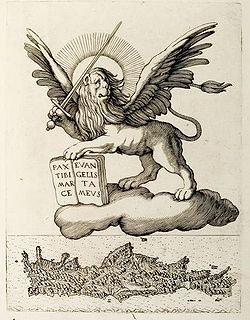
The Republic of Venice or Venetian Republic, traditionally known as La Serenissima was a sovereign state and maritime republic in northeastern Italy, which existed for over a millennium between the 7th century and the 18th century from 697 AD until 1797 AD. It was based in the lagoon communities of the historically prosperous city of Venice, and was a leading European economic and trading power during the Middle Ages and the Renaissance.

The majority of the local products are related to agriculture (mainly olives and olive-oil) and stock-breeding but there are also some small factories which employ a number of the inhabitants.

Related Research Articles

Heraklion Place in Greece

Heraklion or Heraclion is the largest city and the administrative capital of the island of Crete and capital of Heraklion regional unit. It is the fourth largest city in Greece. According to the results of the 2011 census, the municipality's population was 173,993 and according to the results of 2011 census, the metropolitan area has a population of 225,574 and it extends over an area of 684.3 km2 (264.2 sq mi).

Hora Sfakion town in Crete, Greece

Hóra Sfakíon or Sfakia is a town on the south coast of Crete, Greece. It is the capital of the remote and mountainous region of Sfakiá, and is a small town of just 265 inhabitants. It lies on the south coast near the end of the Imbros Gorge, 74 km south of Chania. It has two small harbours, where the ferry boats from Agia Roumeli dock, which in the summer bring the hikers from the Samaria Gorge to take buses back to the northern coast. From Hóra Sfakíon ferries also go to the nearby coastal town of Loutro and the island Gavdos.

Xiro Chorio is a hamlet of approximately 170 residents, which is part of the city of Rethymno, capital of Rethymno regional unit in the island of Crete, Greece.

Gavalochori is a village of the Chania regional unit on the northwest coast of the island of Crete, in Greece. It is located on Cape Drapan in the Vamos municipality of the Apokoronas region. It is named after the Gavalas family who lived here during the reign of the Venetians. Gavalochori is four kilometers from the coast at Almirida. It is a very old village with an interesting history explained in the local Folklore Museum. The population is around 350 but this number swells in the summer months as tourists, relatives and visitors arrive. The village has many shops including two taverns, two cafes, a pastry shop with cafe bar, the village pre-school, a graphic design Studio, bakery, three grocery stores and a handicrafts shop. There are 14 Greek Orthodox churches in and around the village as well as Venetian arches and wells, Roman tombs and an ancient olive oil factory. Many interesting walks exist around the village.

Mourtzana human settlement in Greece

Mourtzana is a village in Greece situated on the Old National Road Rethymno - Heraklion. It belongs to the community of Garazo in the municipal unit of Kouloukonas in Crete.

Loutra, Rethymno village in Greece

Loutra is a medieval village of central Crete, Rethymno regional unit, Arkadi municipal unit. It is situated 2 km from the Bay of Rethymno and 8 km from the town of Rethymno.

Kingdom of Candia

The Realm or Kingdom of Candia or Duchy of Candia was the official name of Crete during the island's period as an overseas colony of the Republic of Venice, from the initial Venetian conquest in 1205–1212 to its fall to the Ottoman Empire during the Cretan War (1645–1669). The island was at the time and up to the early modern era commonly known as Candia after its capital, Candia or Chandax. In modern Greek historiography, the period is known as the Venetocracy.

Agios Stefanos is a village within the Lasithi prefecture in eastern Crete. It belonged to the former province of Siteia until that was abolished in 2006. Between 1997 and 2010, it was part of the former Makry Gialos municipality. Today, it is part of Ierapetra municipality. It is located 30 kilometers north-east of Ierapetra, 40 kilometers southwest of Sitia, and six kilometers east of Stavrohori. It can be approached through the famous forest of Pefkoseli. Its patron is Saint Stephen. Saint Stephen church, at the entrance of the village, is an ecclesiastical and historical monument of Crete. Since the last decade, the majority of the population has been moved to the village's seaside settlement of Makry Gialos, some six kilometers to the south. Makry Gialos is one of Crete's most important tourist resorts.

Amari (municipality) Place in Greece

Amari is a village and a municipality in Rethymno regional unit, Crete, Greece. The seat of the municipality is the village Agia Foteini. The municipal unit has an area of 277.285 km2 (107.060 sq mi). One of the major geographic features of Amari is the Amari Valley, a landform of high elevation known for olive cultivation. It is thought that Monastiraki was developed by Phaistos inhabitants founding a satellite center as they pushed out into the Amari Valley.

Argoules, Chania village in Greece

Argoules is a semi-mountainous hamlet in Sfakia municipality on the island of Crete, Greece. It is the easternmost settlement of the Chania regional unit, located at a distance of about 85 km from the city of Chania. The time of its establishment is unknown, however Argoules is mentioned in Venetian registers as early as the sixteenth century (1577), belonging to the Territorio di Rettimo.

Rethymno (municipality) Place in Greece

The Municipality of Rethymno is a municipality in the Rethymno of the region of Crete established by Kallikratis reform. It consists of the unification of the pre-existing municipalities Arkadi, Lappa, Rethymno and Nikiforos Fokas of Rethymno Prefecture. The extent of the new municipality is 396.256 km2 (152.995 sq mi), and it had a population of 55,525 inhabitants at the 2011 census. The seat of the new municipality is the town Rethymno.

Chromonastiri Place in Greece

Chromonastiri is a local community of the Rethymno Municipality in the Rethymno of the region of Crete established by Kallikratis reform. Previously, it was part of the former municipality of Rethymno. Chromonastiri is a traditional settlement and is classified in Class II, that is of average cultural value. Buildings with Venetian architectural elements are scattered throughout the village. In the years 2005, 2007, 2008 and 2009 Chromonastiri received an award of the '"cleaner and organized traditional community"'

Roustika Place in Greece

Roustika is a local community of the Rethymno Municipality in the Rethymno of the region of Crete established by Kallikratis reform. Previously, it was part of municipality of Nikiforos Fokas. Capital of the new municipality is Rethymnon. It is traditional settlement and is classified in Class II, that is of average cultural value. In 2005 Roustika was awarded as a "'clean and organized traditional community"'

Maroulas Place in Greece

Maroulas is a local community of the Rethymno Municipality in the Rethymno of the region of Crete established by Kallikratis reform. It is traditional settlement and is classified in Class II, that is of average cultural value.

Roussospiti Place in Greece

Roussospiti is a local community of the Rethymno Municipality in the Rethymno of the region of Crete established by Kallikratis reform. Previously, it was part of the former municipality of Rethymno. It is a traditional settlement and is classified in Class II, that is of average cultural value.

Amnatos Place in Greece

Amnatos is a local community of the Rethymno Municipality in the Rethymno of the region of Crete established by Kallikratis reform. Previously, it was part of the municipal district of Municipality of Arkadi. Amnatos is a traditional settlement and is classified in Class II, that is of "average cultural value". Buildings with Venetian architectural elements are scattered throughout the village. In 2005 Amnatos received an award of the "cleaner and organized traditional community".

Pigi, Rethymno Place in Greece

Pigi is a local community of the Rethymno Municipality in the Rethymno of the region of Crete established by Kallikratis reform. Previously, it was part of the municipal district of Municipality of Arkadi. Capital of the new municipality is Rethymno.

Myriokefala Place in Greece

Myriokefala is a local community of the Rethymno Municipality in the Rethymno of the region of Crete established by Kallikratis reform. Previously, it was part of municipality of Lappa. Capital of the new municipality is Rethymno.

Myli, Rethymno Place in Greece

Μyli is a part of the local community of Chromonastiri of the Rethymno Municipality in the Rethymno of the region of Crete established by Kallikratis reform. Capital of the new municipality is Rethymno.

References

Coordinates: 35°20′42″N24°25′30″E / 35.345°N 24.425°E / 35.345; 24.425

Geographic coordinate system Coordinate system

A geographic coordinate system is a coordinate system that enables every location on Earth to be specified by a set of numbers, letters or symbols. The coordinates are often chosen such that one of the numbers represents a vertical position and two or three of the numbers represent a horizontal position; alternatively, a geographic position may be expressed in a combined three-dimensional Cartesian vector. A common choice of coordinates is latitude, longitude and elevation. To specify a location on a plane requires a map projection.