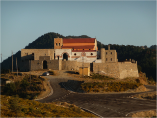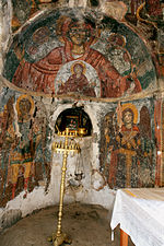
Agiasos is a small town and a former municipality on the island of Lesbos, North Aegean, Greece. Since the 2019 local government reform, it became a municipality unit that is part of the municipality Mytilene. The municipal unit has an area of 79.924 km2. It is located at the slopes of mount Olympos, at a height of 475 meters (1,558 ft), 26 kilometers (16 mi) from Mytilene. It is known for its special bright green landscape, its narrow cobbled streets lined by ranks of tiled-roof houses, the traditional architecture and its restless and religious inhabitants. Agiasos, the artistic and religious centre of the island, is a preserved settlement that has many to offer to visitors. The reading society of Anaptixi, a local cultural institution, was established in 1894, when the village was still under Turkish rule. Today it has a great library, a theatre hall, a folklore museum and an active organization which tries to continue the traditions that were passed by the old inhabitants.

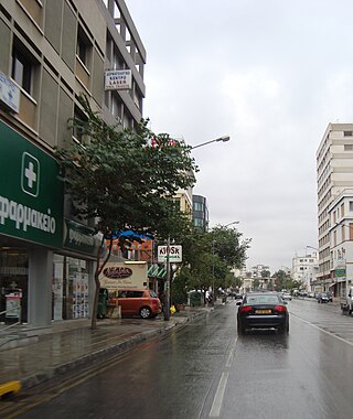
Engomi is a suburb and municipality of the Cypriot capital Nicosia. In 2011, it had a population of 18,010. Of these, 14,254 were citizens of Cyprus.

The Fortezza is the citadel of the city of Rethymno in Crete, Greece. It was built by the Venetians in the 16th century, and was captured by the Ottomans in 1646. By the early 20th century, many houses were built within the citadel. These were demolished after World War II, leaving only a few historic buildings within the Fortezza. Today, the citadel is in good condition and is open to the public.
Prines is a local community of the municipality of Rethymno within Rethymno regional unit, Crete, Greece. Before the "Kallikratis Project" it belonged to the municipality of Nikiforos Fokas.

Pallouriotissa is an area of Nicosia, Cyprus, formerly an independent village, which was annexed to the municipality in 1968. It was subsequently divided into the quarters of Panayia (Panagia) and Saints Constantine and Helen. As of 2011, their combined population was 15,607. Pallouriotissa is immediately south of Kaimakli.

Loutra is a medieval village of central Crete, Rethymno regional unit, Rethymno municipality, Arkadi municipal unit. It is situated 2 km from the Bay of Rethymno and 8 km from the town of Rethymno.

Rethymno is a city in Greece on the island of Crete. It is the capital of Rethymno regional unit, and has a population of more than 34,000 inhabitants.

The Municipality of Rethymno is a municipality in the Rethymno of the region of Crete established by Kallikratis reform. It consists of the unification of the pre-existing municipalities Arkadi, Lappa, Rethymno and Nikiforos Fokas of Rethymno Prefecture. The extent of the new municipality is 396.256 km2 (152.995 sq mi), and it had a population of 57,216 inhabitants at the 2021 census. The seat of the new municipality is the town Rethymno.
Roustika is a local community of the Rethymno Municipality in the Rethymno of the region of Crete established by Kallikratis reform. Previously, it was part of municipality of Nikiforos Fokas. Capital of the new municipality is Rethymnon. It is traditional settlement and is classified in Class II, that is of average cultural value. In 2005 Roustika was awarded as a "'clean and organized traditional community"'
Maroulas is a local community of the Rethymno Municipality in the Rethymno of the region of Crete established by Kallikratis reform. It is traditional settlement and is classified in Class II, that is of average cultural value.
Roussospiti is a local community of the Rethymno Municipality in the Rethymno of the region of Crete established by Kallikratis reform. Previously, it was part of the former municipality of Rethymno. It is a traditional settlement and is classified in Class II, that is of average cultural value.
Amnatos is a local community of the Rethymno Municipality in the Rethymno of the region of Crete established by Kallikratis reform. Previously, it was part of the municipal district of Municipality of Arkadi. Amnatos is a traditional settlement and is classified in Class II, that is of "average cultural value". Buildings with Venetian architectural elements are scattered throughout the village. In 2005 Amnatos received an award of the "cleaner and organized traditional community".

Atsipopoulo is a local community of the Rethymno Municipality in the Rethymno of the region of Crete established by Kallikratis reform. Previously, it was part of municipality of Nikiforos Fokas. Capital of the new municipality is Rethymno.
Pigi is a local community of the Rethymno Municipality in the Rethymno regional unit of the region of Crete established by Kallikratis reform. Previously, it was part of the municipal district of Municipality of Arkadi. Capital of the new municipality is Rethymno.
Gerani is a local community of the Rethymno Municipality in the Rethymno of the region of Crete established by Kallikratis reform. Previously, it was part of municipality of Nikiforos Fokas. Capital of the new municipality is Rethymno.
Myriokefala is a local community of the Rethymno Municipality in the Rethymno of the region of Crete established by Kallikratis reform. Previously, it was part of municipality of Lappa. Capital of the new municipality is Rethymno.
Μyloi is a part of the local community of Chromonastiri of the Rethymno Municipality in the Rethymno of the region of Crete established by Kallikratis reform. Capital of the new municipality is Rethymno.
Agia Galini is a village in Rethymno regional unit, Crete, Greece.

The Monastery of Panayia Yiatrissa is an Orthodox Christian monastery located in the southern Peloponnese of Greece. The monastery was erected on the site of the ruins of an ancient temple of Athena. The conversion of the temple from pagan to Christian took place possibly as early as 382 AD.

The Halevi Monastery, also spelled as Chalevi, is an abandoned 16th-century monastery located near the village of Chromonastiri, Rethymno regional unit in north-central Crete. The monastery stands on a hill, about 5 km south of the city of Rethymno. It ceased to function as a monastery near the end of the Ottoman occupation of Crete and currently only its principal church remains.


